Download
1 / 19
200 likes | 348 Vues
Mattole Basin Sediment Modeling Project Development. By Joel Monschke Good Roads Clear Creeks Program Director. Rapid Evaluation of Sediment Budgets (Reid and Dunne 1996) Defines a Seven Step Process for Sediment Budget Construction:. Define the problem Acquire background information

E N D
Mattole Basin Sediment Modeling Project Development By Joel Monschke Good Roads Clear Creeks Program Director
Rapid Evaluation of Sediment Budgets (Reid and Dunne 1996) Defines a Seven Step Process for Sediment Budget Construction: • Define the problem • Acquire background information • Subdivide the area • Interpret aerial photography • Conduct fieldwork • Analyze data • Check results
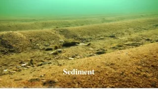
Step 1: Define the Problem • Excessive sedimentation in the Mattole River and tributaries is impairing salmonid populations • Development of a prioritization system to guide future sediment reduction projects • Monitor/model the longterm benefits of restoration work • Further understanding the hydrologic and geomorphologic processes
Step 2: Acquire Background Data • Significant field data has been collected • GRCC sub-shed sediment assessments identifies potential sediment delivery from point sources with STAR Worksheet Methodology • Volume of site (Length*Width*Depth)/(DFactor) • DFactor ranges from (3 to 6) • DFactor = 3 (slab type debris slide) • DFactor = 6 (typical fill crossing) • Erosion Potential • Sediment delivery increases exponentially with rainfall • Erosion Rate • Sediment delivery increases linearly with rainfall • The exact application of this data is yet to be determined for this modeling project
SWRCB TMDL Data Very useful data sets basin-wide benchmarks After completing work in the southern sub-basin, this data is too general to use for specific sub-shed or site specific prioritization Additional Background Data
Other Sources of Data • Humboldt Redwood Company data (pending availability) • Watershed analysis • Sedimentation from roads • Slope stability analysis • Lidar • Some modeling data
Step 3: Subdivide the Area • Choosing modeling software will be critical in this determination • Target will be subdivisions as small as possible to improve accuracy and usefulness the model • In the beginning subdivisions may be larger with more refinement as the project progresses • Some modeling software options: • BASINS (EPA hydrologic modeling software) • Very broad model • Netmap (GIS based channel network model) • Lee Benda and Dan Miller
Step 4: Interpret Arial Photography • Extensive air photo analysis was already done for the Mattole Watershed TMDL • Further work should be done updating the analysis with the most recent data • Arial photo analysis must be combined with field data to insure consistency and accuracy for sediment delivery rates
Step 5: Conduct Field Work • Significant field work has been done during sediment inventories • Further work needs to be done in two main areas: • Surveys of erosion rates in areas where minimal data is available • Channel surveys/monitoring to determine channel conditions including sediment storage, grain size, slope, width, etc. and yearly fluxes
Step 6: Analyze Data • Again, choosing a modeling software will be critical in this determination • Sediment Inputs • Input from previous stream segment • Input from tributaries • Input from streambank/hillslope • Input from channel storage • Sediment Transport Equation will be a function of: • Rainfall, stream slope, width, grain size
Step 7: Check results • This will be an iterative process where the model is calibrated to match on-the-ground conditions
First Step for Mattole Watershed Sediment Modeling Project • Finding a model that has flexibility and necessary output functions • Integrated with hydrologic model • Can the model run at a storm by storm scale rather than an average winter? • Integrated with GIS • Easy and flexible data entry for continued calibration • Ability to input point sources while also using GIS generated slope stability analysis • Ability to vary input data by area • More detail for some sub-sheds than others yet the model still functions at a watershed wide scale
Where do we go from here? • Contact ESI regarding Netmap program • It appears that they have already done significant work in the Mattole through PALCO • Discuss potential relationship with MRC • Cost, availability, data sharing, training • Discuss model input and output capabilities • If everything looks good, begin fundraising..... • If not, look for another model
Further Questions…. • Is there a way for this project to incorporate a hydrologic modeling and help predict summer low flows and possible solutions? • Low flows are often a partial function of excessive sedimentation in channels • Property ownership by sub-basin is easy to track in GIS and could be modeled
Specific Outcomes • Further define TMDL volumes and future management goals at a sub-shed scale • Specifically prioritizes locations for future sediment reduction projects and other restoration efforts • Give a long term vision of sedimentation and erosion through the entire watershed • Build on the MRC’s GIS/database with modeling data from the past and future with results displayed in a visually pleasing fashion
Final Thoughts… • Independent of the outcome, the process of developing a sediment model will greatly improve our understanding of the geomorphologic process. • Questions and Comments from the TAC