Download
1 / 40
410 likes | 646 Vues
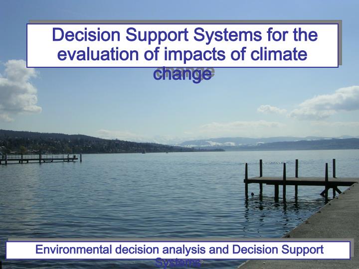
Decision Support Systems for the evaluation of impacts of climate change. Environmental decision analysis and Decision Support Systems. MAIN ISSUES TO DISCUSS. What is a spatial decision support system? Which are some current DSSs for evaluation of climate change impacts?

E N D
Decision Support Systems for the evaluation of impacts of climate change Environmental decision analysis and Decision Support Systems
MAIN ISSUES TO DISCUSS • What is a spatial decision support system? • Which are some current DSSs for evaluation of climate change impacts? • Which are their main features? • Comparison
SPATIAL DECISION SUPPORT SYSTEMS Spatial Decision Support Systems (SDSS) are decision support systems where the spatial properties of the data to be analyzed play a major role in the decision making. Usually, these properties refer to the data’s location on the Earth’s surface – the so-called georeferenced data (Woods et al, 1999) SDSS were created to support the analysis of complex spatial problems SDSS are explicitly designed to provide the user with a decision-making environment that enables the analysis of geographical information to be carried out in a flexible manner (Densham, 1991)
SPATIAL DECISION SUPPORT SYSTEMS • Spatial decision support relies heavily on maps, which form the backbone upon which plans and policies are defined. Problems can roughly be classified into: • Siting, i.e. WHERE to place some given object (e.g. a dam, a house, a park) • Spatial allocation, i.e. for a predefined location, WHAT is the best object among a class of objects to place there (e.g. a crop or a building type) • In the first case, the main issue is determining the location, whereas in the spatial allocation the unknown is the object itself • Some problems may require combination of both characteristics (e.g. urban planning) • (Woods et al, 1999)
SPATIAL DECISION SUPPORT SYSTEMS Environmental planning involves studies of risk impact assessment, and contingency planning, which combine WHAT and WHERE to WHEN and HOW The dependency of problems on the geographical scale, and the fact that the decision making process straddles many different approaches, reflecting planner’s varying views of natural phenomena, is a key aspect of environmental decision processes (Woods et al, 1999)
SPATIAL DECISION SUPPORT SYSTEMS Environmental decision making through a GIS corresponds to defining and calibrating a model by using the GIS’ functions to construct a set of maps. Map generation is a partially ordered sequence of activities, which are related by data and control links. (Woods et al, 1999)
SPATIAL DECISION SUPPORT SYSTEMS • A GIS is a software that provides mechanisms to store, analyze, manipulate and visualize georeferenced data. • GIS is used to help decision makers in: • Identifying geographic regions that satisfy one or more criteria, • Exploring spatial and temporal relations among georeferenced data • Providing data for analysis and simulation models
SPATIAL DECISION SUPPORT SYSTEMS SPATIAL DECISION SUPPORT SYSTEM SPATIAL DATA MANAGEMENT GEOGRAPHIC INFORMATION SYSTEM Management of geographically referenced data Building databases Spatial data analysis Generating maps Multi criteria evaluation Urban planning and industrial siting Multi-objective land allocation Land-cover prediction Erosion forecast
SPATIAL DECISION SUPPORT SYSTEMS • Advantages in using SDSS: • Better information management • Higher quality analysis • Ability to carry out “what if” scenarios • Scenario generation, visualization and analysis • Problematic issues: • Data availability • Calibration • Validation • Scale
DSSs PRESENTATION BASINS Availability: free, it can be run at any computer connected to the internet to access the CLIME database on the server. CLIME DSS To study the climate change and its effects on lakes and the impacts of the changes in the lakes to the society in Europe; To illustrate the predicted changes in the European climate; To illustrate the main effects of the predicted changes on lake water quality (socio-economic evaluation). http://geoinformatics.tkk.fi/twiki/bin/view/Main/CLIMEDSS
DSSs PRESENTATION BASINS CLIME DSS Functionalities: • Socio-economic valuation of water quality. • Evaluation of effects of climate change on lakes water quality. • Bayesian probabilistic networks. • Cost/benefit analysis. Methodologies: Structure: Climate change scenarios: • Use of Green-house gases emission scenarios (IPCC). • European climate dataset (CLIMEdatabase). Flexibility: To select the analysis area.
DSSs PRESENTATION BASINS Availability: with fee. DSS San Juan Basin To learn, evaluate, select and negotiate a management alternative of the effects of climate change on water supply in the San Juan Basin, USA.
DSSs PRESENTATION BASINS DSS San Juan Basin Functionalities: • Analysis of impacts by drought and temperature changes on water resources • Participatory decision making process • Planning of water resources, with definition of management plans • Evaluation of quality and quantity standards • Scenario analysis. • Risk analysis. • Cost/benefit analysis. Methodologies: Structure: Climate change scenarios: Construction of scenarios of global warming and drought Flexibility: To select the scenario
DSSs PRESENTATION BASINS Availability: free. RCC DSS Information-based DSS to perform an integrated assessment of the impacts produced by predicted changes of climate on socio-economic and bio-physical sectors on the river Mackinaw, USA. http://www.imlab.psu.edu/rcc/index.html
DSSs PRESENTATION • Repository of information and experts interviews. • Web based BASINS RCC DSS Functionalities: Access to several information on impacts produced by climate change in different economic and bio-physical sectors and definition of guidelines Structure: Flexibility: • To interview experts. • To select sectors on which having information
DSSs PRESENTATION LAND USE Availability: With fee (available only for New Zealand). CLIMPACTS To examine the sensitivity of New Zealand’s climate, agricultural and horticultural sectors to climate change and variability. http://www.waikato.ac.nz/igci/climpacts/index.html
DSSs PRESENTATION LAND USE CLIMPACTS Functionalities: • Climate variability and climate change valuation. • Simulation of daily site-specific changes. • Estimation of periods of extreme events in different sites and their changes on the basis of future climate. • Analysis of sensitivity of different crops to climate change. • Evaluation (spatial and/or temporal) of effects of climate change on agriculture. • Policy and plan formulation valuation. Methodologies: • Scenario analysis. • Sensitivity analysis. • Uncertainly analysis. • Extreme events analysis.
DSSs PRESENTATION • Climate data (climatology data, national and regional data for daily time series). • MAGICC (Model for the Assessment of Greenhouse-gas Induced Climate Change), impact models, SCENGEN (SCENario GENerator). • GIS. LAND USE CLIMPACTS Structure: Climate change scenarios: • Use of Green-house gases emission scenarios (IPCC). • Construction of scenarios of climate change (Global Circulation Models, GCMs). • Global and regional climate dataset. Flexibility: To partially modify scenarios, parameters or the period in which to visualize the results.
DSSs PRESENTATION LAND USE Availability: Free download with registration number (the user must to have the version 4) or complete package with fee. DSSAT To determine the potential impacts of climate change (temperature and precipitation) on crop production and provide a management alternative (new crops, products and practices) for adapting to climate variability. www.icasa.net/dssat
DSSs PRESENTATION LAND USE DSSAT Functionalities: • Analysis of potential impacts of climate change on crops production by “what-if” questions. • Simulation of production in function of climate variables. • Evaluation of management scenarios for adaptation measures to climate change. • Land planning in consideration of changes in temperature and precipitation. Methodologies: • Scenario analysis. • System analysis.
DSSs PRESENTATION • Climate data (climatology data, national and regional data for daily time series). • MAGICC (Model for the Assessment of Greenhouse-gas Induced Climate Change), impact models, SCENGEN (SCENario GENerator). • GIS. LAND USE DSSAT Structure: Climate change scenarios: Construction of climate change scenarios. Flexibility: To select the scenario.
DSSs PRESENTATION LAND USE Availability: The complete software is not available. LADSS To explore options and provide the decision-maker with a better understanding of the consequences of changes in land use and management; to answer the questions “How climate change may affect crops, livestock and other farming systems?” and “How farming may adapt to change?”. www.macaulay.ac.uk/LADSS/
DSSs PRESENTATION LAND USE LADSS Functionalities: • Analysis of impacts (economic, social and environmental) of climate change on farming systems. • Simulation of farm production and of environmental variables for different types of crops under different management regimes. • Evaluation of mitigation and adaptation measures in farming systems. • Land planning. Methodologies: • Scenario analysis. • Integrated impact analysis. • Cost/benefit analysis.
DSSs PRESENTATION LAND USE LADSS Structure: Climate change scenarios: • Use of Green-house gas emission scenarios (IPCC). • Variables of temperature and precipitation (Global Circulation Models, GCMs).
DSSs PRESENTATION COASTS&ISLANDS Availability: With fee. DIVA To perform an integrated assessment of coastal zones, specifically designed to explore the vulnerability of coastal areas to sea level rise. http://www.pik-potsdam.de/DINAS-COAST/Info/info_index
DSSs PRESENTATION COASTS&ISLANDS DIVA Functionalities: • Evaluation of coastal environment vulnerability. • Evaluation of the effects of climate change on coastal environments and societies. • Evaluation of costs and benefits of coastal adaptation options. • Setting of priorities for international cooperation with respect to climate change and development. • Use of the results for further scientific and policy analysis. Methodologies: Scenario analysis.
DSSs PRESENTATION COASTS&ISLANDS DIVA Structure: Climate change scenarios: • Use of Green-house gases emission scenarios (IPCC). • Use of sea-level rise scenarios (DINAS-COAST scenarios). Flexibility: To select the scenario.
DSSs PRESENTATION COASTS&ISLANDS Availability: With fee. SimLucia To develop a methodology and an operational procedure applicable on the level of the individual coastal country or island, to explore impacts on territory, ecosystems and socio-economic systems. www.riks.nl/projects/SimLucia
DSSs PRESENTATION COASTS&ISLANDS SimLucia Functionalities: • Evaluation of the vulnerability to climate change. • Analysis of the impacts of climate change on the territory, the ecosystems, the socio-economic sector. • Evaluation of policy measures and policy interventions to prevent or alleviate undesirable impacts. • Land planning. Methodologies: • Scenario analysis. • Bayesian probabilistic networks. Structure:
DSSs PRESENTATION COASTS&ISLANDS SimLucia Climate change scenarios: • Models and scenarios of climate change. • Models and scenarios of Green-house gases emission. Flexibility: To select the scenario.
DSSs PRESENTATION GENERAL (land use, coast and water resources) Availability: With fee. SimCLIM To support decision-making with its capacity to assess baseline climates and current variability and extreme. It can examine the impacts of present climate variability and future change on land use, coastal zones or water resources (with different models). http://www.climsystems.com/site/products/?id=9
DSSs PRESENTATION GENERAL (land use, coast and water resources) SimCLIM Functionalities: • Evaluation of risks related to climate change assessed both currently and in the future. • Analysis of sectoral impacts of climate change. • Economic evaluation (cost/benefit). • Evaluation of adaptation measures for present day conditions and under future scenarios of climate change and variability. Methodologies: • Scenario analysis. • Spatial and statistical analysis. • Integrated impact analysis. • Cost/benefit analysis.
DSSs PRESENTATION GENERAL (land use, coast and water resources) SimCLIM Structure: Climate change scenarios: Construction of national climate change scenarios. Flexibility: • To select the scenario. • To omit the climate change from the evaluation.
DSSs COMPARISON BASINS
DSSs COMPARISON BASINS
DSSs COMPARISON LAND USE
DSSs COMPARISON LAND USE
DSSs COMPARISON COASTS&ISLANDS
DSSs COMPARISON COASTS&ISLANDS
DSSs COMPARISON GENERAL