Download
1 / 17
170 likes | 308 Vues
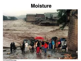
Moisture observation by a dense GPS receiver network and its assimilation to JMA Meso‑Scale Model. Koichi Yoshimoto 1 , Yoshihiro Ishikawa 1 , Yoshinori Shoji 2 , Takuya Kawabata 2 and Ko Koizumi 1 1 Numerical Prediction Division 2 Meteorological Research Institute

E N D
Moisture observation by a dense GPS receiver network and its assimilation to JMA Meso‑Scale Model Koichi Yoshimoto1, Yoshihiro Ishikawa1, Yoshinori Shoji2, Takuya Kawabata2 and Ko Koizumi1 1 Numerical Prediction Division 2 Meteorological Research Institute Japan Meteorological Agency
Moisture observation by fixed GPS receivers GPS satellites GPS signal is delayed by moisture en route Inhomogeneous moisture distribution Water vapor amount can be retrieved from the “movement” of a fixed GPS receiver GPS receiver
GPS observation network in Japan GEONET (GPS Earth Observation NETwork) is a GPS network operated by the Geographical Survey Institute, the Ministry of Land, infrastructure and transportation, Japan. Approximately 1,200 GPS receivers are located throughout Japan with a separation of 20 km in order to monitor crustal deformation of the earth. GEONET JMA-AWS(AMeDAS)
GPS PW accuracy of real time processing Real Time (IGS Ultra Rapid) Bias -0.10mm RMS 2.69mm Cor 0.96 PW(GPS) Jul – Aug 2007 PW(Sonde) The near-real time processing provides enough accuracy of GPS PW
Moisture monitoring with GPS PW ① Time series Blue line: hourly GPS PW Green line: GPS PW of 15-day running mean Red line: typical PW estimated from temperature Orange dashed line: Temperature ② Monitoring web page is updated hourly
Moisture monitoring with GPS PW GPS PW and surface wind Analyzed precipitation amount Flux divergence 6-hour trend PW deviation from typical value Departure from 15-day running average SSI Column Humidity = GPS PW / saturate PW
GPS PW FLUX 地上風 地上風 Water vapor convergence can be a precursor of local (heavy-) rainfall phenomena. GPS PW FLUX calculated from surface wind vector and GPS PW is an indicator of the water vapor convergence. Surface wind Surface wind After several hours GPS PW FLUX = div(u×PW ,v×PW) = {∂(u×PW) /∂x + ∂(v×PW) /∂y } (unit:m/s×kg/m2×1/m=(kg/m2) / s) surface wind : the AWS network AMeDAS
Some parameters can be used as precursor of heavy rain 14:00 JST 14:30 JST 15:00 JST 15:30 JST 16:00 JST Aug 8 , 2008
Meso-scale model • Resolution • Horizontal : 5km • Vertical : 50 layers up to 21800 m • Forecast frequency : eight times a day • 15-hour forecast from 00, 06, 12 and 18 UTC initials • 33-hour forecast from 03, 09, 15 and 21 UTC initial • Purpose • Severe weather warning • Input to Very Short Range Forecast for precipitation amount • Aviation use (TAF etc.)
Obsevation MSM forecast (init: 21UTC July 20) GPS data assimilated GPS data not used Impacts on MesoScale Model Heavy rain during 20 July 21UTC to 21 July 00UTC 2009
Equitable Threat Score for precipitation forecast(17-25 July 2006) (10mm/3hr) (1mm/3hr) Forecast time (hour) Forecast time (hour) Red line: with GPS Green line: w/o GPS
Currently used – Zenith Total Delay Homogeneity assumption Zenith Total Delay Mapping Signal delay is measured for each satellite
Next challenge – slant delay Dry Wet (a) Observation operator of refractivity K1,K2,K3:const. Pd:pressure of dry air Pv:vapor pressure T: temperature (b) Integration along signal path G : distance between receiver and satellite S : signal path length Assuming S=G Homogeneity assumption becomes unnecessary Inhomogeneous water-vapor distribution can be retrieved
Preliminary impact test(2km model) 1136 JST 1201 JST 1231 JST 50km PWV SLT Radar observation
Summary • GEONET GPS receiver network works also as a moisture observation system • Moisture nowcasting can provide precursor information for heavy rain • GPS PW data have a positive impacts on MSM precipitation forecast • Preliminary test of slant delay data shows some potential for further improvement with high-resolution NWP