Download
1 / 17
170 likes | 306 Vues
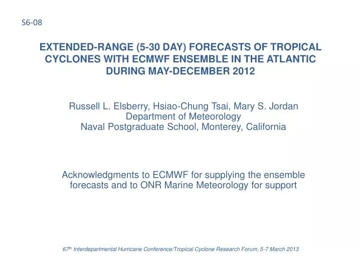
S6-08. EXTENDED-RANGE (5-30 DAY) FORECASTS OF TROPICAL CYCLONES WITH ECMWF ENSEMBLE IN THE ATLANTIC DURING MAY-DECEMBER 2012. Russell L. Elsberry, Hsiao-Chung Tsai, Mary S. Jordan Department of Meteorology Naval Postgraduate School, Monterey, California

E N D
S6-08 EXTENDED-RANGE (5-30 DAY) FORECASTS OF TROPICAL CYCLONES WITH ECMWF ENSEMBLE IN THE ATLANTIC DURING MAY-DECEMBER 2012 Russell L. Elsberry, Hsiao-Chung Tsai, Mary S. JordanDepartment of MeteorologyNaval Postgraduate School, Monterey, California Acknowledgments to ECMWF for supplying the ensemble forecasts and to ONR Marine Meteorology for support 67th Interdepartmental Hurricane Conference/Tropical Cyclone Research Forum, 5-7 March 2013
BACKGROUND Elsberry et al. (2010, APJAS) documented that the ECMWF 32-day ensemble predictions provided guidance up to four weeks in advance of the formations and tracks of the three most intense typhoons and two other typhoons during the 2008 western North Pacific season. Elsberry et al. (2011, APJAS) documented even more successful predictions out to four weeks for 12 typhoons during the 2009 season, and a surprisingly good performance in predicting the formation location and early track segments of eight minimal tropical storms or tropical depressions. Tsai et al. (2013 APJAS) developed an objective track analog verification technique and demonstrated that the ECMWF 32-day ensemble was able to predict out to four weeks nearly all of the tropical cyclones in the 2009 and 2010 seasons, with only a small number of misses that were short-lived tropical depressions. Defining false alarms to be all ensemble storms that could not be matched with JTWC storms, Tsai et al (2013) found seasonal and geographic biases and that about 50% of the false alarms originate from the initial conditions. 67th Interdepartmental Hurricane Conference/Tropical Cyclone Research Forum, 5-7 March 2013 2
OBJECTIVES Evaluate performance of ECMWF 32-day track forecasts for the Atlantic made twice-weekly during 31 May – 17 December 2012 Describe characteristics of successes and limited successes in four- week predictions, and complete failures in Weeks 1-4 Describe some characteristics of false alarms in the Atlantic region 67th Interdepartmental Hurricane Conference/Tropical Cyclone Research Forum, 5-7 March 2013 3
Beginning at time t = 12 h, ensemble vortices within time-dependent separation distance e(t) are grouped into an “Ensemble Storm” and a number is assigned. Once assigned to an ensemble storm, the vortex stays as a storm member for its entire lifetime. Example: At 29/00 UTC, four vortices are within 180 n mi and form Storm 1. FORMING AN ENSEMBLE STORM Tracks of four member vortices Location of Storm 1 at 29/00 UTC 67th Interdepartmental Hurricane Conference/Tropical Cyclone Research Forum, 5-7 March 2013
When an ensemble storm initially forms (time t0), the mean latitude and longitude of all contributing vortices is defined as the ensemble storm center. Location12 hours later (t1) is the Weighted-Mean Vector Motion of the ensemble, with weighting highest for the smallest distance to the mean position. New vortices may join at the next time step. If the new vortex is within a distance (e) of the ensemble storm location, the vortex is added to the ensemble storm. The new and existing members are used to compute the next 12 h storm position using Weighted-Mean Vector Motion. If a new vortex is not close to any existing ensemble storms, the vortex is designated as an new ensemble storm. Allowable separation distance, e(t), linearly increases with time from 180 n mi during forecast Day 1 to 420 n mi at Day 14 and is constant for Days 15-32 (420 n mi). WEIGHTED-MEAN VECTOR MOTION AND VORTEX ADDITIONS t1 V3 V1 V2 d3 t0 d1 e d2 67th Interdepartmental Hurricane Conference/Tropical Cyclone Research Forum, 5-7 March 2013
ENSEMBLE VERIFICATION AS A TRACK ANALOG Basic criteria to select an ensemble storm as an analog to a JTWC track: • Time diff. at matched points: ± 3 days for WK 1, ± 4 days for WK 2, and ± 5 days for WKs 3 and 4 • Total matched points:at least 2 days or 1/3×LifespanJTWC • To avoid just matching the latter part of NHC storms, if “Time at Matched Point” is after midpoint of NHC track (1/2×LifespanJTWC): HoursENS ≥ 1/3×HoursJTWC NHC Storm 1/2×LifespanJTWC HoursJTWC Ensemble Storm Matched Points (shortest dist.) HoursENS 67th Interdepartmental Hurricane Conference/Tropical Cyclone Research Forum, 5-7 March 2013
2012 ATLANTIC SEASON CONTINGENCY TABLE • Forecastability of Atlantic TC events is limited compared to the NW Pacific • The ECMWF 32-day ensemble forecast [Hits/ (Hits + Misses)] by week: • Week 1: 70.3% • Week 2: 52.9% • Week 3: 48.5% • Week 4: 35.5% • False Alarms (FAs) will be discussed later 67th Interdepartmental Hurricane Conference/Tropical Cyclone Research Forum, 5-7 March 2013
OVERALL 2012 ATLANTIC SEASON PERFORMANCE EXAMPLEHURRICANE LESLIE EXAMPLE* Objectively-determined quality measure is maximum LikeliHoodValue (LHV), which measures the overall similarity of the best ensemble storm track to the NHC working best-track in terms of four metrics: (1) shortest distance; (2) average distance; (3) distance at formation time; and (4) distance at ending time. Hit LESLIE A Week 1 storm starts in the forecast on the Monday (or Thursday) before the NHC declares the system to be a Tropical Depression. A storm starting in the Week 2 (3 or 4) forecast is two (three or four) weeks before the corresponding NHC Tropical Depression existed. *Hurricane Leslie (AL 12) is an example of Above Average quality (0.6 < LHV < 0.8) in Weeks 2-4 forecast (although Week 1 quality is only in Good category with 0.4 < LHV < 0.6). 67th Interdepartmental Hurricane Conference/Tropical Cyclone Research Forum, 5-7 March 2013
Working Best Track of Hurricane Leslie (AL 12) (ATL 12, red), ensemble storm with largest LHV (black dots) and individual ensemble member vortices (gray dots) for Week 1 (LHV = 0.54), Week 2 (LHV = 0.74), Week 3 (LHV = 0.74), and Week 4 (LHV = 0.78) 67th Interdepartmental Hurricane Conference/Tropical Cyclone Research Forum, 5-7 March 2013
OVERALL 2012 ATLANTIC SEASON PERFORMANCEHURRICANE SANDY EXAMPLE Sandy prediction is only somewhat satisfactory with Weeks 1 and 2 forecasts of Good quality, and although the Week 3 forecast is Above Average, Sandy is missed in the Week 4 forecast (LHV=0) Hit SANDY 67th Interdepartmental Hurricane Conference/Tropical Cyclone Research Forum, 5-7 March 2013
Working Best Track of Hurricane Sandy (ATL 18, red), Ensemble storm (black dots), Member vortices (gray dots) (1) Late season storms with poleward tracks from beginning were also not well forecast in NWPAC (2) Critical interaction with midlatitude trough in later stages is not predictable (3) Poor initial position is due to Sandy starting near an area with frequent false alarms Not a “hit”: too short 11 67th Interdepartmental Hurricane Conference/Tropical Cyclone Research Forum, 5-7 March 2013
OVERALL 2012 ATLANTIC SEASON PERFORMANCEEXAMPLES OF MISSES IN ALL FOUR WEEKS Hurricane Chris (AL03) was a baroclinic system that first became a tropical storm at 37°N on 18 June Hurricane Michael (AL13) was a non-tropical system that became a tropical storm at 25°N Hit CHRIS TONY MICHAEL PATTY Tropical Storm Patty (AL16) was a small, short-lived system that formed at 25°N at southern end of north-south oriented cloud band Tropical Storm Tony (AL19) was a short-lived system that formed at 27°N and moved northeastward 67th Interdepartmental Hurricane Conference/Tropical Cyclone Research Forum, 5-7 March 2013
Ensemble storm tracks starting in Week 1 that were HITS, i.e., could be matched with a NHC (working best track) storm. (1) For the 30 African wave-type 1 tracks, three quality measures of the HITS are indicated by colors (see inset). (2) Note that only four Week 1 HITS were not of the African wave-type. 67th Interdepartmental Hurricane Conference/Tropical Cyclone Research Forum, 5-7 March 2013
Ensemble storm tracks starting in Week 1 that were False Alarms (FAs), i.e., could not be matched with a NHC storm with a LikeliHoodValue (LHV >0.20). Four types of tracks based on geographical considerations are indicated by colors (see inset) and the numbers of FAs in each type is indicated. (1) Note similarity of Type 1 FAs (red) with Type 1 HITS tracks in PPT 13, except many FA tracks are short(2) For Type 2 FA tracks (blue) and Type 4 FA tracks (black) no corresponding HITS tracks existed for AL 3 – AL 19.(3) For Type 3 FA tracks (green), only two (three) corresponding HITS tracks originated near Central (South) America. 67th Interdepartmental Hurricane Conference/Tropical Cyclone Research Forum, 5-7 March 2013
SUMMARY I Overall forecastability by the ECMWF 32-day ensemble of Atlantic tropical cyclones during Weeks 1-4 for 2012 season is less than in previous evaluations in the western North Pacific Only two hurricanes (AL 11 & AL 15) and two tropical storms (AL 10 & AL 12) were forecast in all four weeks with quality measures > 0.4 Four hurricanes (AL 05, AL 09, AL 14, and AL 18) and one tropical storm (AL 06) were only forecast in three of the four weeks Two hurricanes (AL 08 & AL 17) and two tropical storms (AL 04 & AL 07) were only forecast in the first two weeks No forecastability by the ECMWF 32-day ensemble in any of the four weeks was found for two hurricanes (AL 03 & AL 13) and two tropical storms (AL 16 & AL 19) Chris (AL 03), Michael (AL 13), and Tony (AL 19) formed in North Central Atlantic from baroclinic processes Patty (AL 16) formed at 25ºN, 74ºW from mesoscale processes 67th Interdepartmental Hurricane Conference/Tropical Cyclone Research Forum, 5-7 March 2013 15
SUMMARY II ECMWF 32-day ensemble forecasts had large numbers of false alarm-type tracks during 2012 Atlantic season with some distinct geographic and seasonal characteristics Most frequent FAs originate in coastal regions of southeast U.S., Central America, and northern South America African-type FA tracks tended to be shorter and had a distinct maximum in September (not shown) Studies are in progress to diagnose the characteristics for the HITS, MISSES, and FALSE ALARMS 67th Interdepartmental Hurricane Conference/Tropical Cyclone Research Forum, 5-7 March 2013 16
67th Interdepartmental Hurricane Conference/Tropical Cyclone Research Forum, 5-7 March 2013