Download
1 / 31
310 likes | 319 Vues
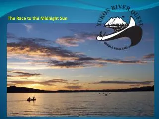
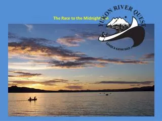
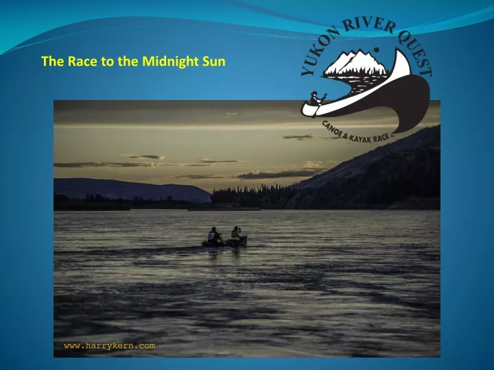
The Race to the Midnight Sun. YRQ 2017 Support Crew Briefing. Preparation Pre Race The Start The Race Day 1 Viewpoints Carmacks Day 2 Viewpoints 5 Finger Rapids Minto Landing Dawson City. Welcome & Introductions. Introduction of Race Officials

E N D
YRQ 2017 Support Crew Briefing • Preparation • Pre Race • The Start • The Race • Day 1 Viewpoints • Carmacks • Day 2 Viewpoints • 5 Finger Rapids • Minto Landing • Dawson City
Welcome & Introductions • Introduction of Race Officials • Harry Kern, YRMPA President & Safety Coordinator • Roger Hanberg, YRMPA Vice President & Race Marshal • Stan Fordyce, Safety Coordinator • Don Hanberg, Assistant RM • Hank Moorlag & Jules Lebland, Communications Coordinators • Peter Coates, SPOT & Results Coordinator • Alison Schreiber & Al Foster, Carmacks Coordinators • Valerie Ross, YRMPA Secretary • Jeff Brady, Media Coordinator There will be media covering the race, and they may interview you, but please direct any questions about the race itself to the President or Race Marshal for official YRQ statements.
Preparation • Assumptions • You and your racer(s) have worked out a plan for what they will need. • You will be in Carmacks and Dawson ready to help them BEFORE they arrive. • You will make sure your paddler(s) have enough food and water for each leg of the race (Whse-Carm. & Carm.-Dawson) • You have made arrangements for where you and your paddlers will be staying in Carmacks and Dawson. • There is a camping fee you will need to pay at Coal Mine Campground in Carmacks if you stay there. If your paddler is camping there, the race covers that fee.
Weather & Moon Phase • Whitehorse weather: http://www.weatheroffice.gc.ca/city/pages/yk-16_metric_e.html • Carmacks weather: http://www.weatheroffice.gc.ca/city/pages/yk-17_metric_e.html • Dawson weather: http://www.weatheroffice.gc.ca/city/pages/yk-6_metric_e.html MOON PHASE June 28-July 1, 2017: First quarter moon (Briefing on Wildland Fires if needed) IMPORTANT: Make sure your paddlers leave with extra clothing for any kind of weather
Pre-Race Tuesday atYukon Visitor Information Centre • Boats will be measured; mandatory gear will be checked. • Make sure your paddlers Pay their evacuation deposit, have their Health Insurance card/information and pick up their Registration Packet. • Paddlers are given bibs WHICH MUST BE SIGNED at Registration. One bib will be given to the paddler to wear and keep, while another will will be held by race officials for his/her Bib Sponsor. • Your paddlers will attend the racer presentation that follows this one. Voyageur/C4 teams at 4, solo and tandem teams at 5 p. m. • There is a 2-HOUR PENALTY for missing the Racer briefing.
Race Day • You Are Here (race briefing at Visitor Centre) • Boats must be offloaded at the Rotary Park staging area and moved to the launch to be positioned for the start where final inspections will be done. • All Voyageurs should be taken directly to the launch area at 7:30 a.m. and placed by number. • All other boats should be dropped off according to this schedule: #1-25 8:30-9 am #26-50 9-9:30 am #51-75 9:30-10 am #76-100 10-10:30 am • Boat checks will take place from 8 am - 10:30 am. Teams will be photographed with bibs and boats. • Racers/support crew must stay with their boat till the gear check is completed and the boat is moved to the start line. • Race marshal will be available for any last minute issues. • Teams must be at the start line by 11:30 a.m. for introductions. • Start is at noon. Teams run to boats. Only 1 support person may push off your team. • Launch Unloading area RotaryPeace Park Start Line
The Line-up • Voyageurs downstream along shore, others upstream of them by boat number - in normal flow years. • If river is low, some teams will be lined up on outer gravel bar and paddlers must run through water to get to their boats.
Start • Rotary Peace Park, 1200 (noon) The Launch The Run Great Views All along Shore and on new Wharf The Start
The Run from Rotary Peace Park • Spread out on grass under banner for introductions, go at the horn. • Funnel on grass toward narrow paved walkway that leads down to the river. At riverbank, fan out toward your boats. • No pushing or shoving. Your run/walk is 400m of 715 km!
Hitting the River • One member of you support team may push you off. • Angle out into the current. • Give other teams plenty of space to avoid collisions.
The Race • It is a RACE, not a trip down the river. • Paddlers have 14 hours to reach the end of the Lake, 35 hours to get to Carmacks, and 84 to get to Dawson. • Encourage your paddlers to finish, even if they are tired and having ‘second thoughts’ in Carmacks. You can stay a little longer than your departure time if you want. Once they are back on the water, they will feel better. If they don’t, they can always get out at Minto. • If injuries, illness or extreme fatique force them to scratch, support their decision. They can always come back and finish in another year. • Safety boats will evacuate teams that cannot carry on and are forced to scratch on the river. They will be taken to the nearest road access point: Deep Creek (Lake Laberge Campground), Little Salmon, Carmacks, Minto Landing, and Dawson. We will attempt to notify you of this so you can meet them.
Communications • Satellite phones are used by safety boats and remote checkpoints to report team positions to our Race Communications Centre (RCC). • RCC posts times often on the RESULTS link on our website. • Spot™ devices are now required on all boats for helping us track teams, and should already be registered and activated. You can track your team by going on the RACE TRACKING link on our site: http://www.yukonriverquest.com/yrq/app/17yrq/results.php • If your team has a Satellite Phone, please give the number to the Race Marshal today. E-mail: yrqracemarshal@gmail.com
Lake Contingency Plans • If Lake Laberge is too rough before teams hit the lake and determined unsafe for passage by the Race Marshal, safety boats will hold up teams at Policeman’s Point and at a camping area just upriver (location on next slide) until it is safe to continue. There will be a restart on the hour or half hour. Times will be adjusted accordingly by the Race Marshal. • If the lake becomes too rough and unsafe for passage after teams are on the lake, an airplane will signal teams by waving its wings (weather permitting). Teams should pull off at the safest spot possible, and then watch for a return of the plane waving and dipping its wings when it is safe to resume. If weather is too bad to launch a plane, teams must use good judgment and stay on shore until it is safe to proceed. Watch for updates in Carmacks.
Checkpoints & Monitor Points • There are 6 Official Race Checkpoints: CP1 Policeman’s Pt, CP2 Lower Laberge, CP3 Carmacks, CP4 Ft. Selkirk, CP5 Coffee Creek and CP6 Dawson City Finish Line. Times are recorded at these checkpoints. They are called into our Communications Centre via satellite phones and posted on the Results link on the website. • There are also 8 Safety Monitoring Points/ Camps: MP1 Early Lake Laberge, MP2 Cathers Mid-Lake, MP3 Lower 30 Mile, MP4 Big Salmon, MP5 Little Salmon, MP6 Five Finger Rapids, MP7 Minto Landing, and MP8 Sixty Mile. They are positioned for us to keep an eye on racers and for help if needed. • Racers must be self-sufficient!!! CP6 MP8• CP5 • CP4 • • MP7 MP6 • • CP3 • MP5 MP3 • • CP2 • MP4 • MP2 CP1 • • MP1
Viewing points(Whitehorse to Carmacks, Days 1 & 2) • Takhini Bridge (3.5 km/2.2 miles up N. Klondike Hwy). Pull off the roadside going up the hill just north of the bridge. Park off the highway and don’t stand on the bridge(the RCMP has called us on this). • Burma Road (approx. 12 km, 8 miles) - turn to right goes down to river, decent road, decent view. • Policeman’s Point CP1 (approx. 13 km, 9 miles) not the best road, but better view and last chance to see teams before they hit the lake. • Robert Campbell Highway (after Carmacks, turn right at junction just past Coal Mine Campground). For next 35.9 km / 22.3 miles (until Little Salmon) there are turnouts where you can spot teams from high bluffs. We recommend that you print this page and use a highway map for directions. Policeman’s Point View of river from Robert Campbell Highway, with 2 teams passing below
Little Salmon MP5 • Monitor Point 5 is at Little Salmon Village - currently closed to general public • DRIVING DIRECTIONS (if you have to pick up an evacuated team): Just past Coal Mine Campground, turn right onto the Robert Campbell Highway, drive 35.9 km / 22.3 miles to an unmarked turn to right which has a Stop Sign (if you pass the Frenchman Lake sign and turnoff on left, you’ve gone too far). There are several pull-offs along this stretch of road between Little Salmon and Carmacks for viewing teams on the river. • If you are supporting a fast team, it will arrive in Carmacks 3-4 hours after passing Little Salmon; middle of the pack teams will take around 4 hours; slower teams could take 5 hours. We recommend that you print this page for directions Monitor Point 5
Carmacks CP3 Information • Carmacks Checkpoint 3 at the Coal Mine Campground opens at 0600 Thursday morning. TIP – refer to Al Foster’s detailed notes on Carmacks on the website! • LOCATION:2-2.5 hours up N. Klondike Hwy. from Whitehorse. Carmacks is reached by highway first but is actually downriver from Little Salmon. Several river views along walkway in town. Cross large Yukon River bridge to Coal Mine Campground CP 4, about a mile further on the right just before junction with Robert Campbell Highway. • Required 7-hour Stop. Teams may stay longer if they need to. • Teams must reach CP 3 within 35 hours of the start (2300 Thurs) and leave within 42 hours of the start (0600 Fri - close of checkpoint). • Please advise ASAP in writing if a team decides to scratch ($100 penalty for not filling out withdraw form before checkpoint closes) • Support Crews need to be here ahead of time ready to support your paddlers. Watch Little Salmon times on race tracker/leaderboard to approximate your team’s arrival time. If you have a voyageur trailer, please take it to lot behind Sunrise Services. • If your team is not staying in the campground, let us know at registration. Make sure they are back in plenty of time (at least an hour) before their departure time. • The campground has water, restrooms, and showers that take $1 “loonies”. There also is a canteen that serves food all day. Limited internet access. • If you remove your boat from the staging area, please inform one of the Carmacks coordinators.
Coal Mine Campground Map HOT FOOD Gift Shop RV Parking Washrooms Washrooms Showers Laundry Shelter building (gear storage) Fresh Water spigot outside bldg. Racer Camping Tents Only Quiet Area!!! Status board Support Camping and Cooking Boat staging area Timing line ramp Voyageur berths Outbound dock Inbound dock Support crews must assist with moving boats from/to dock! Approx. 150 meters from Timing line to Docks Al Foster will explain Carmacks in more detail Yukon River
Checkpoint 3 Timeline & Docking Docks Timeline After passing the Timeline, your team will come into the inbound dock. You must assist in lifting your team’s boat out of the water – you must wear a life jacket on the dock; please bring a life jacket if you plan on helping at the dock or along the shoreline as we have a limited number of spare life jackets that we can provide you with. Make sure your paddler is safely ashore, then help carry the boat to its storage area with the gear in the boat. Voyageurs will be lined to designated berths upstream. Make sure the boat’s SPOT device is turned off, and then turn it on 1 hour before team departure time. We also recommend that your team eats before they rest.
Leaderboard & Results • The Leaderboard will be at Coal Mine Campground when the Carmacks Checkpoint opens at 0600 on Thursday morning. It will be updated as times are relayed to the checkpoint from the Communications Centre in Whitehorse or from our website. • Results from remote checkpoints usually will be on the website before they are recorded on the Leaderboard. There is limited web access in Carmacks, and pretty good service in Dawson. You can find the results and track teams on our website Saturday night when the race officially ends (or when the last team is in). • As you leave Carmacks, we recommend fueling up at Sunrise Services (supporters of the YRQ)
Viewing points (Carmacks to Dawson, Days 2 & 3) Shooting Five Finger Rapids We rcommend that you print this page for directions Five Finger Rapids Viewpoint (about 23 km/15 miles from Carmacks on left). See next slide for how to access viewing platform above the rapids. Yukon Crossing Viewpoint (about 39 km/24 miles from Carmacks on left), turnout on left affords view of wide bend in river. Teams will sneak around islands on down to old Yukon Crossing, where the old winter ice road crossed the river. Minto Landing (about 74 km/46 miles from Carmacks on left), 1 km road to river. See slide for map. Last chance to see teams before Dawson.
Five Finger Rapids Viewing Platform Viewing Platform is at end of the trail, about a 20 minute walk from the parking area. Go down the stairs and follow the main trail. Be very, very careful if you go off trail and onto the bluffs. Stay well back from the edge, which can have loose sand or mud. It’s a long way to fall and your team will never forgive you if they have to stop and fish you out! Teams go this way, down the right (near) channel
Minto Landing Ramp • Minto Landing MP7 - Last Road access before Dawson -on left about 74 km/46 miles from Carmacks, 1 km road to river. Look for Capstone Minto Mine signs; don’t take the road to the lodge. • There is a mining barge that crosses river. Watch for large ore trucks on road. • Teams may pull out by barge landing (watch eddy line). No assistance allowedfor teams staying in the race. • Last chance for teams to scratch without losing evacuation deposit. We recommend that you print this page for directions MINTO ROAD lodge
Dawson City • A 6-hour drive on the N. Klondike Highway from Whitehorse, 4 hours from Carmacks. Follow highway right into town, where it turns into Front Street. • Finish Line/Checkpoint is on the Front Street Dike - near the Gazebo, just before the old yellow CIBC bank building and the restored steamboat SS Keno. • Docking area is 100 metres or so downstream of the Finish Line..
Dawson View from River • Showing Moosehide slide Finish line before the old yellowish building Spot for teams from end of dike at confluence with Klondike River Takeout 100 metres or so downstream. Teams go around the tour boat Klondike Spirit and then turn right into the docking area (well before the ferry crossing). Watch for race officials on shore and assist your team. Photo by Monte Dodge
As Teams Finish • Teams are finished when they hear the horn as they cross the “line” marked by Orange Cones on the Riverbank below the checkpoint, then they need to paddle over to the docking area downstream. Cheer them on and then get down to the shore and make sure they get ashore! • Assist your paddlers when they get out. Have blankets ready if it’s in the early morning hours of Saturday before the sun comes up. Paddlers can get hypothermic very fast. • Checkers will do a final inspection of boats. • Boats will then will need to be tidied up and preferably taken away ASAP as there is limited space. YRQ rental boats should be hosed down and taken to the trailer. KP and UN will have their own trailers. • There are portable toilets by the docking area. • Leaderboard, information and YRQ merchandise by the finish line on the embankment. • Internet in hotel, internet cafés and other places.
Dawson City Information • Finish Line Checkpoint opens at 1200 (noon) Friday, closes 2359 Saturday. • If you are supporting a fast team, it could arrive in Dawson 3.5-4 hours after passing Sixtymile MP8; middle of the pack teams will take around 5 hours; slower teams could take 6-7 hours. • After the checkpoint closes, no one will be watching stored boats. • Unless you are planning on camping, you must pre-arrange accommodation in Dawson. Hotels may be full. • Government campground is across the river via ferry, commercial campgrounds in town and out the road south.
After the Finish • To be counted as an official finisher, teams must finish within 84 hours of starting (including the 10 hours of mandatory stops - 74 hours elapsed time on river) by 2359 Saturday evening. • Prize money is given to top finishers in their classes under 55 hours river time (by 0500 Saturday morning). DAWSON EVENTS • Saturday - Diamond Tooth Gerties Casino & Shows (4th & Queen)- Racers get a drink card/discount (see packet) • Sunday Finish Awards & BBQ 1100 – 1400 (Robert Service School – Gym entrance off Queen between 4th and 5th) • Do not forget your racer’s banquet tickets. Tickets are in their race packets. Purchase extras for support crews at pre-race or in Dawson. • As you leave Dawson, we recommend fueling up at The Gas Shack.
Be There for your Team! • Ho for the Klondike! • See you in Dawson! Photos by Harry Kern, Jeff Brady and Peter Coates