Download
1 / 91
910 likes | 915 Vues
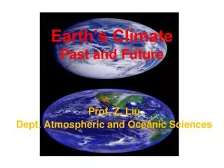
Explore the factors that determine Earth's climate, including solar energy, heat balance, and the role of greenhouse gases. Learn about the distribution of temperature, precipitation, ice, and vegetation, as well as variations in heat balance and the impact of ocean and atmospheric circulation.

E N D
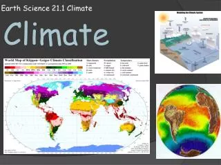
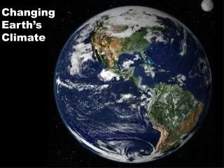
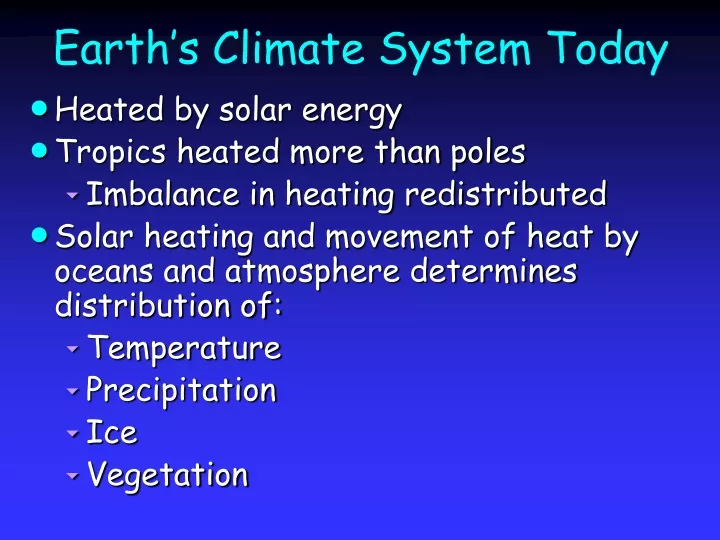
Earth’s Climate System Today • Heated by solar energy • Tropics heated more than poles • Imbalance in heating redistributed • Solar heating and movement of heat by oceans and atmosphere determines distribution of: • Temperature • Precipitation • Ice • Vegetation
Electromagnetic Spectrum • Electromagnetic energy travels through space • Energy heating Earth mostly short-wave radiation • Visible light • Some ultraviolet radiation
Incoming Solar Radiation • Radiation at top of Earth’s atmosphere = 1368 W m-2 • If Earth flat disk with no atmosphere, average radiation = 1368 W m-2 • Earth 3-dimensional rotating sphere, • Area = 4r2 • Average solar heating = 1368 4 = 342 W m-2
30% Solar Energy Reflected • Energy reflected by clouds, dust, surface • Ave. incoming radiation 0.7 x 342 = 240 W m-2
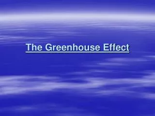
Energy Budget • Earth’s temperature constant ~15C • Energy loss must = incoming energy • Earth is constantly receiving heat from Sun, therefore must lose equal amount of heat back to space • Heat loss called back radiation • Wavelengths in the infrared (long-wave radiation) • Earth is a radiator of heat • If T > 1K, radiator of heat
Energy Budget • Average Earth’s surface temperature ~15C • Reasonable assumption • Surface of earth radiates heat with an average temperature of 15C • However, satellite data indicate Earth radiating heat average temperature ~-16C • Why the discrepancy? • What accounts for the 31C heating?
Energy Budget • Greenhouse gases absorb 95% of the long-wave, back radiation emitted from Earth’s surface • Trapped radiation reradiated down to Earth’s surface • Accounts for the 31C heating • Satellites don’t detect radiation • Muffling effect from greenhouse gases • Heat radiated back to space from elevation of about 5 km (top of clouds) average 240 W m-2 • Keeps Earth’s temperature in balance
Greenhouse Gases • Water vapor (H2O(v), 1 to 3%) • Carbon dioxide (CO2, 0.037%; 365 ppmv) • Methane (CH4, 0.00018%; 1.8 ppmv) • Nitrous oxide (N2O, 0.00000315%; 315 ppbv) • Clouds also trap outgoing radiation
Variations in Heat Balance • Incoming solar radiation • Stronger at low latitudes • Weaker at high latitudes • Tropics receive more solar radiation per unit area than Poles
Variations in Heat Balance • What else affects variation in heat balance? • Solar radiation arrives at a low angle • Snow and ice reflect more radiation at high latitudes • Albedo • Percentage of incoming solar radiation that is reflected rather than absorbed
Sun Angle Affects Albedo • All of Earth’s surfaces absorb more solar radiation from an overhead sun • Water reflects <5% radiation from an overhead Sun
Sun Angle Affects Albedo • Water reflects a high fraction of radiation from a low-lying Sun • Earth average albedo = 10%
Pole-to-Equator Heat Imbalance • Incoming solar radiation per unit area higher in Tropics than Poles • Sun angle higher in Poles than Tropics • Albedo higher at Poles than Tropics • Variations in cloud cover affect heat imbalance
Seasonal Change in Solar Radiation & Albedo • Tilt of Earth’s axis results in seasonal change in • Solar radiation in each hemisphere • Snow and ice cover (albedo)
Seasonal Change in Albedo • Increases in N. hemisphere winter due mainly to snow cover and to lesser degree Arctic sea ice • Increases in S. hemisphere winter due to sea ice
General Circulation of the Atmosphere • Tropical heating drives Hadley cell circulation • Warm wet air rises along the equator • Transfers water vapor from tropical oceans to higher latitudes • Transfers heat from low to high latitudes
The Hadley Cell • Along equator, strong solar heating causes air to expand upward and diverge to poles • Creates a zone of low pressure at the equator called • Equatorial low • Intertropical Convergence Zone (ITCZ) • The upward motions that dominate the region favor formation of heavy rainfall • ITCZ is rainiest latitude zone on Earth • Rains 200 days a year – aka. doldrums
General Circulation • Air parcels rise creating low pressure • Heat and expand • Become humid • Transfer heat to poles • Transfer of moisture towards poles • In mid latitudes • Dry air sinks creating high pressure • Air flows away from high pressure
General Circulation • Hadley cell circulation creates trade winds • Dry trade winds move from subtropics to tropics and pick up moisture • Trade winds from both hemispheres converge in the ITCZ • Trade winds warm and rise • Contribute to low pressure and high rainfall in the ITCZ
Ocean Circulation? • Circulation in the troposphere is caused by atmospheric pressure gradients • Result from vertical or horizontal temperature differences • Temperature variations caused by latitudinal differences in solar heating • Ocean surfaces are heated by incoming surface radiation • Do the oceans circulate for the same reason as the atmosphere?
No! • 90% of solar radiation that penetrates oceans absorbed in upper 100 m • Warm water at surface is less dense than the colder water below • Water column is inherently stable • Very little vertical mixing • Water has a high heat capacity • Lots of heat required for a small change in temperature • Lateral temperature and salinity differences are small over large areas
Ocean Circulation • Ultimately driven by solar energy • Distribution of solar energy drives global winds • Latitudinal wind belts produce ocean currents • Determine circulation patterns in upper ocean • Distribution of surface ocean temperatures strongly influence density structure • Density structure of oceans drives deep ocean circulation • Negative feedback • Surface temperature gradients drive circulation • Net effect is to move warm water to poles and cold water towards tropics
Heat Transfer in Oceans • Heating occurs in upper ocean • Vertical mixing is minimal • Average mixed layer depth ~100 m • Heat transfer from equator to pole by ocean currents • Oceans redistribute about half as much heat at the atmosphere
Surface Currents • Surface circulation driven by winds • As a result of friction, winds drag ocean surface • Water movement confined to upper ~100 m • Although well-developed currents ~1-2 km • Examples, Gulf Stream, Kuroshiro Current • Coriolis effect influences ocean currents • Water deflected to right in N. hemisphere • Water deflected to left in S. hemisphere
Eckman Spiral • Eckman theory predicts • 1) surface currents will flow at 45° to the surface wind path • 2) flow will be reversed at ~100 m below the surface • 3) flow at depth will be considerably reduced in speed • Few observations of true Eckman Spiral • Surface flow <45°, but still to an angle
Eckman Transport • Observations confirm net transport of surface water is at a right angle to wind direction • Net movement of water referred to as Eckman Transport
Deep Ocean Circulation • Driven by differences in density • Density of seawater is a function of • Water temperature • Salinity • Quantity of dissolved salts • Chlorine • Sodium • Magnesium • Calcium • Potassium
Thermohaline Circulation • Deep ocean circulation depends on temperature (thermo) & salinity (hals) • Controls seawater density • Density increases as: • Salinity increases • Temperature decreases • Horizontal density changes small • Vertical changes not quite as small • Water column is stable • Densest water on bottom • Flow of water in deep ocean is slow • However, still important in shaping Earth’s climate
Vertical Structure of Ocean • Surface mixed layer • Interacts with atmosphere • Exchanges kinetic energy (wind, friction) and heat • Typically well mixed (20-100 m)
Vertical Structure of Ocean • Pychnocline (~1 km) • Zone of transition between surface and deep water • Characterized by rapid increase in density • Some regions density change due to salinity changes – halocline • Most regions density change due to temperature change – thermocline • Steep density gradient stabilizes layer
Bottom Water Formation • Deep-ocean circulation begins with production of dense (cold and/or salty) water at high latitudes • Ice formation in Polar oceans excludes salt • Combination of cold water and high salinity produces very dense water • Dense water sinks and flows down the slopes of the basin towards equator
Antarctic Bottom Water (AABW) • Weddell Sea major site of AABW formation • AABW circles Antarctica and flow northward as deepest layer in Atlantic, Pacific and Indian Ocean basins • AABW flow extensive • 45°N in Atlantic • 50°N in Pacific • 10,000 km at 0.03-0.06 km h-1; 250 y
North Atlantic Deep Water (NADW) • Coastal Greenland (Labrador Sea) site of NADW formation • NADW comprises about 50% of the deep water to worlds oceans • NADW in the Labrador Sea sinks directly into the western Atlantic • NADW forms in Norwegian Basins • Sinks and is dammed behind sills • Between Greenland and Iceland and Iceland and the British Isles • NADW periodically spills over sills into the North Atlantic
Deep Atlantic Water Masses • Deep Atlantic water comes from high latitude N. Atlantic, Southern Ocean and at shallower depth, the Mediterranean Sea
AABW and NADW Interact • NADW flowing south in the Atlantic joins the Antarctic Circumpolar Current • NADW and AABW combine • Spin around Antarctica • Eventually branch off into the Pacific, Indian and Atlantic ocean basins
Ocean Circulation • Surface water at high latitudes forms deep water • Deep water sinks and flows at depth throughout the major ocean basins • Deep water upwells to replace the surface water that sinks in polar regions • Surface waters must flow to high latitudes to replace water sinking in polar regions • Idealized circulation – Thermohaline Conveyer Belt
Thermohaline Conveyor Belt • NADW sinks, flows south to ACC and branches into Indian and Pacific Basins • Upwelling brings cold water to surface where it eventually returns to N. Atlantic
Ocean Circulation and Climate • Warm surface waters move from equator to poles transferring heat pole-ward and into the deep oceans • Oceans vast reservoir of heat • Water heats and cools slowly • Pools of water warmer than normal heat the atmosphere • Pools of water colder than normal cool the atmosphere • Timescale of months to years • Time needed for heating/cooling of water
Ocean Circulation and Climate • On long timescales, average ocean temperature affects climate • Most water is in deep ocean • Average temperature of ocean is a function of • Process of bottom-water formation • Transport of water around ocean basins • Deep water recycle times is ~1000 y • Thermohaline circulation moderates climate over time periods of ~ 1000 y
Thermohaline Conveyor Belt • NADW sinks, flows south to ACC and branches into Indian and Pacific Basins • Upwelling brings cold water to surface where it eventually returns to N. Atlantic
Thermohaline Conveyor Belt • Effects of landmasses?