Download

1 / 29
290 likes | 406 Vues
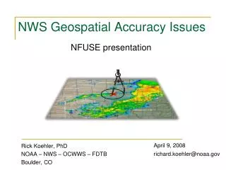
NWS OPS Committee September 19, 2007. NWS Geospatial Accuracy Issues. Richard Koehler, PhD Forecast Decision Training Branch Boulder, CO. richard.koehler@noaa.gov 303-497-8369. Quick bio. Current – OCWWS, Training Division

E N D
NWS OPS Committee September 19, 2007 NWS Geospatial Accuracy Issues Richard Koehler, PhD Forecast Decision Training Branch Boulder, CO richard.koehler@noaa.gov 303-497-8369
Quick bio • Current – OCWWS, Training Division • FDTB in Boulder, CO (co-located with COMET), hydrologist • Education • Univ. of Ariz., Tucson, AZ PhD Hydrology and remote sensing • NPS, Monterey, CA MS Mapping, charting, and geodesy • Univ. of Ariz., Tucson, AZ BS, MS Watershed management • Other NOAA positions (~ 20 years with NOAA) • Retired NOAA Corps – several NOS, NWS assignments • NWS - CBRFC and NWRFC • DOC Pioneer Grant recipient, “Integrating GIS into River Forecast Operations”, 1993 • NOS - Hydrographic survey ships RAINIER and WHITING • Lead NOS Hydrographic Sciences/Marine Charting instructor
Coming soon! Already here! 2 miles or is it really 2 miles, ± 2.5 mile?
Outline Some questions to consider Current example of an NWS geospatial product Quick geospatial lessons NWS data references and accuracy NWS elevation data WSR-88D database comparison Estimated location accuracy Summary situation Proposed solutions
Key issues and questions (June 2004 report) NWS Digital Services 1 - Very high temporal and spatial detail used to populate the NDFD 2 - Provide data with spatial and temporal consistency 3 - More detailed forecasts/warnings use higher spatial/temporal resolution data Increased access to, and use of this detailed, accurate, and consistent source of weather information will help decision makers in all sectors of society. Are NWS geospatial data…. Detailed? Standardized? Accurate? Reliable? Consistent? Defendable? If “No” or “I don’t know” to any of these, is someone’s life endangered?
The following caveats apply: 3) Accuracy of these data is not guaranteed. GIS Applications in Climate and Meteorology Shipley, Graffman, and Ingram 2000 16th Internat. Conf. on IIPS for Met., Oceano., and Hydro. Position errors of ~ 2 km between the NAD27 and NAD83 ellipsoids Significant errors (~ 20 km) when data from spherical Earth is placed the NAD83 ellipsoid. 1992 3rd Nat. Heavy Precip Workshop Some answers? OST/SEC GIS Map Group http://www.weather.gov/geodata/cat_descrip.html Purpose: Spatial geographic information issued by the National Weather Service (NWS) for use by the user community. Data consist of a variety of official NWS forecast zones and county designations used by be NWS. The Importance of Correctly Identifying Sensor Locations in the Modernized NWS Koehler and Tuell (Grady, not Jason)
NWS geospatial data – current example DE FireFox 4.1 km, 2.5 mi IE 7 3.9 km, 2.4 mi 1.6 mi PA MD
2 mi2 1000 m radius Foothills Lab FlagpoleNAD83 500 m radius Quick lesson 1 – Not all lat/long are the same Locations from different “map datums” Some GPS units provide 70 different datums
Quick lesson 1 – Not all lat/long are the same Why so many different datums? To match the Earth’s shape in different places. Earth shape is the gravity-based geoid Geoid is “bumpy” Reference ellipsoid is “smooth” A datum links an ellipsoid to the geoid
National Spatial Reference System (NSRS) Accurate, stable and consistent survey network, datums, map projections, GPS, detailed data - NAD83, NAVD88 Quick lesson 2 - NSRS Longitude Latitude Topography Shoreline Boundaries Urban zones Roads Streams Vegetation Fed govt standard What about NWS products? Entrusted to NOAA
Quick lesson 2 - NSRS NOAA's National Geodetic Survey (NGS) defines and manages a national coordinate system. National Spatial Reference System (NSRS), provides the foundation for transportation and communication; mapping and charting; and a multitude of scientific and engineering applications. geospatial information metadata “It is possible that the adoption of the term ‘NDFD Spatial Reference System’ may cause some serious confusion with the general public, considering it comes from the same NOAA that gives them the NSRS or National Spatial Reference System.” Dru A. Smith, Ph.D., Chief Geodesist , NGS
Lat/Long NAD83 Datum NAD83 Survey Observations (ground points) Geospatial parameters Accurate geospatial data Unknown geospatial accuracy, datum, or source,… Reference Ellipsoid GIS, AWIPS, etc GRS 80 Accurate, useful products Questionable products (Shape of Earth) Quick lesson 3 – Datum elements and GIS No GIS or software can make inaccurate geospatial data more accurate. Quality must begin at the start of a project.
NWS geospatial data – how accurate? *conversion equation available to address this
NWS geospatial data – how accurate? Implied NWS product geospatial accuracy 40 35 30 25 20 Number of products 15 10 5 0 0.001 0.03 1 2 4 5 10 100 unknown Estimated accuracy (distance in km)
NWS elevation data NWS Standards for SLOSH Basin Databases (Draft standards, 8/29/06) Depths and land elevations must all be referenced to the same common datum (traceable to NAVD-1988). All elevation and bathymetric data used will be made available to the NWS, allowing the NWS to do checks and comparisons. (i.e. verification) Source documentation will accompany these data, including a determination of the accuracy of these data. POC: Wilson A. Shaffer
NWS WSR-88D database comparison Recent item: One RFC found an 88-d site with a 680 meter position difference between Integrated Hydrologic Forecast System (IHFS) and NCDC lat/long.
Estimated location accuracy Weather “event”, “point” data, warning area vertex Datum uncertainty (100 m) Radar site uncertainty (100 to 700 m) Map background uncertainty (1 km) Radar plot (or model) uncertainty (1.5 km) Other possible uncertainty? (4 km) Gridded data basis Point location could have an uncertainty of ~ ± 2 km RSS Same as an area of 3,100 acres ~ 5 mi2
Metadata Document and create a “data pedigree” Reference datum for all products Projections used in all files Data source Data accuracy Ensure Proper display of NWS data in GIS software Consistent quality for any end users Both vertical and horizontal datums – i.e. where things are located
Current situation synopsis Future Goal - NWS Digital Services Requires accurate, consistent, and detailed geospatial data Reality check Web maps don’t match ground coordinates (4 km error), points = ± 2 km uncertainty WGS84, NAD27, NCEP Sphere, “NULL”, NGVD29, MSL, NAD83, NAVD88 Multiple datums = end user confusion Little documentation or metadata (one office = 99% locations “NULL” datum) Politically embarrassing to NWS, NOS/NGS, and especially NOAA Geospatial data with poor or unknown accuracy effects Will frustrate Digital Services efforts Will mean any high resolution product will have suspect quality (such as NDFD) Will cause questionable verification Will cause loss of confidence in NWS by emergency managers & partners Worst case – poor/misused products may endanger lives Little training provided Untrained staff are creating geospatial products Vertical Datum training unfunded for FY08 ($5K)
Proposed solutions Work with NOS/NGS NGS Director & chief geodesist willing to help NWS (building next door) NGS has world-class expertise in all things geospatial In best interest of NOAA, NWS, and NOS/NGS Establish an NWS geospatial policy which includes: NWS conforming to established national standards Assessing, adopting and put into practice geospatial QA/QC Ensuring complete metadata (data pedigree including location accuracy) A “Geospatial Information Officer” (GIO) under the CIO Similar to USGS, EPA, Homeland Security, multiple states, others agencies Single NWS ‘go to’ person to coordinate geospatial topics Provide adequate training for everyone (mgmt and field)
Proposed solutions Developing a white paper for management review “Proposed Steps to Address NWS Geospatial Issues” • What are the geospatial accuracy needs of NWS? • What level of accuracy are current NWS geospatial data and products? • What level of geospatial QA/QC is needed? • How much training will be required?
Proposed solutions Developing a white paper for management review “Proposed Steps to Address NWS Geospatial Issues” A. Background summary of geospatial fundamentals B. Major issue is broken down into the following subsection: Issue Actions required Support information Potential solution Estimated timeframe Estimated costs
Proposed solutions Existing white paper available for review Draft“Geospatial Policy for NOAA’s National Weather Service” The following four key points form the basis of a geospatial policy for NOAA/NWS: 1) Ensure all NWS geospatial data conform to the NSRS. 2) Partner with NOS/NGS on all geospatial related activities. 3) Ensure all geospatial and georeference data have a reference datum listed with the data. The preferred horizontal datum is NAD83 and the preferred vertical datum is NAVD88. If any other datum is used, that information shall be provided with the product. 4) Use the GRS80 reference ellipsoid as the shape of the Earth when geodetic calculations are needed. Define the geospatial accuracy needed to create NWS products List the geospatial accuracy for all NWS products
Proposed solutions Training material under development Preparing e-learning module for NOAA LMS Mapping datums and geospatial issues: The science of location and the keys to an accurate GIS Intra-NOAA cooperative project NWS/OCWWS: Rick Koehler, FDTB hydrologist NOS/NGS: David Zilkoski , NGS Director NESDIS/NGDC: Anna Milan, associate scientist Thanks to Jim Hoke, Leroy Spayd, and Tony Mostek