Download
1 / 24
240 likes | 369 Vues
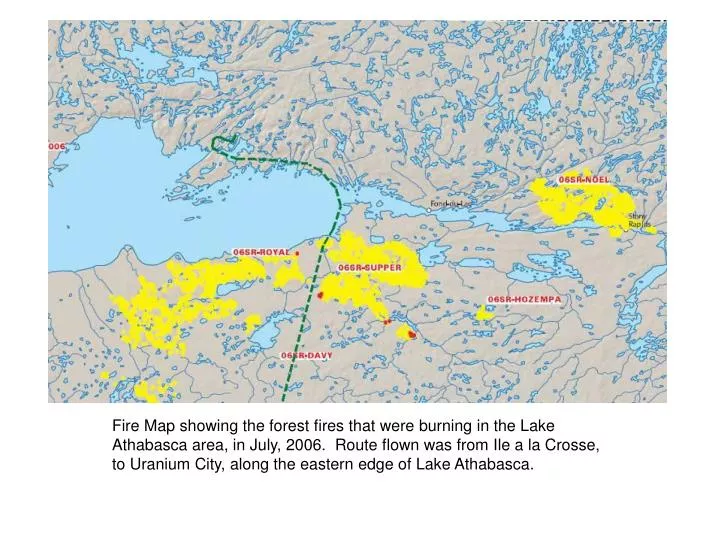
Fire Map showing the forest fires that were burning in the Lake Athabasca area, in July, 2006. Route flown was from Ile a la Crosse, to Uranium City, along the eastern edge of Lake Athabasca.

E N D
Fire Map showing the forest fires that were burning in the Lake Athabasca area, in July, 2006. Route flown was from Ile a la Crosse, to Uranium City, along the eastern edge of Lake Athabasca.
Approaching south shore of Lake Athabasca. Many forest fires were buring, but managed to steer between them.
View looking at Guts Lake, Cinch Lake, towards UC. Note burnt out forest close to town.
Picture of Uranium City, with Cinch Lake Beach in the foreground.
On the road to Jean Lake. Trying to get my mountain bike underneath the bent-over trees.
The hospital was still standing, but about to be demolished.
The sandpit where many parties were held, on the way to Saint Mike’s Mine.
The old townhouses on the west side of town, close to bypass road.
Jean Lake, showing the old mining area. Roads still snake their way through the bush, to town.
The larger sand dunes, with the forest fires in the background.