Download
1 / 42
420 likes | 548 Vues
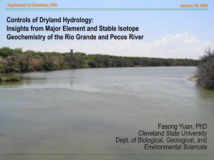
Controls of Dryland Hydrology: Insights from Major Element and Stable Isotope Geochemistry of the Rio Grande and Pecos River. Fasong Yuan, PhD Cleveland State University Dept. of Biological, Geological, and Environmental Sciences. OUTLINE. Introduction Long-term Changes in Stream Chemistry

E N D
Controls of Dryland Hydrology: Insights from Major Element and Stable Isotope Geochemistry of the Rio Grande and Pecos River Fasong Yuan, PhD Cleveland State University Dept. of Biological, Geological, and Environmental Sciences
OUTLINE • Introduction • Long-term Changes in Stream Chemistry • Upper/middle Rio Grande • Lower Rio Grande • Pecos River • Spatial Variations in TDS • Oxygen-18 and Deuterium
Introduction • Atmospheric Circulations • El Niño Southern Oscillation (ENSO) • Pacific Decadal Oscillation (PDO) • The Rio Grande Basin • Geomorphic Settings • Land Use Land Cover • Water Diversions and Water Quality • Problem Statements
Atmospheric Circulations El Niño Southern Oscillation (ENSO) Normal Conditions El Niño Conditions [source: noaa.gov]
Atmospheric Circulations Pacific Decadal Oscillation (PDO) warm phase cool phase [Mantua et al., 1997]
Rio Grande Basin Colorado PECOS RIVER Oklahoma Arizona New Mexico Texas RIO GRANDE Mexico
Land Use Land Cover [Source: rivers.txstate.edu]
Dams • Elephant B., 1916 • Amistad, 1968 • Falcon, 1953 • Red Bluff, 1936
Flood in 1942 [source: US Forest Service]
(1) Approach One • Long-term changes in stream chemistry • Data Used: • International Boundary and Water Commission (IBWC), United States and Mexico • United States Bureau of Reclamation (USBR) • United States Geological Survey (USGS)
Upper Rio Grande El Paso
Lower Rio Grande near Amistad Amistad
Upper Pecos River near Pecos, NM Pecos, NM
Seasonal Change Pecos, NM Langtry
Log-linear Relationship Girvin Langtry
Summary • Long-term stream hydrology and chemistry are largely determined by large scale atmospheric circulations (such as PDO). • The mixed features identified in the lower valley are ascribed to • contrasting climatic settings • poor hydrologic connectivity • lithologic heterogeneity
(2) Approach Two • Downstream changes in stream flow and TDS of the Pecos River • Data Used: • United States Geological Survey (USGS) • International Boundary and Water Commission (IBWC), United States and Mexico
Changes in Discharge and TDS Pecos River
Gibbs Model [Gibbs, 1970]
Model Development [Yuan and Miyamoto, 2005]
YM Model [Yuan and Miyamoto, 2005]
YM Model Application [Yuan and Miyamoto, 2005]
Summary • YM model is capable of identifying mechanisms that control stream TDS. • The Pecos River receives most of the dissolved solids from the upper valley. • Evaporation is an important process regulating water chemistry. • Dilution dominates in the lower Pecos.
(3) Approach Three • Characteristics of Oxygen-18 and Deuterium in the Pecos River • Data Collection • Stream Water- This Study and USGS • Precipitation- Global Network of Isotopes in Precipitation (GNIP) • Groundwater- Published Literatures
d-Notation (‰)
: March 7-8, 2005 : March7-8, 2005 Pecos River : July 12, 2005 : May 6-7, 2005
Flagstaff, AZ Precipitation Waco, TX Chihuahua, MX [original data from GNIP]
Global Meteoric Water Line (GMWL) Waco Chihuahua GW Flagstaff dD = 8d18O + 10 d = dD - 8d18O
d18O and d-excess Langtry Red Bluff Santa Rosa [original data from USGS]
Summary • The Pecos River contains a range of variations in d18O and dD • Although relatively large variations, the averaged values of d18O and dD of meteoric waters from the Gulf are relatively high. • d-excess (d= dD-8 d18O) appears to be a better index capable of differentiating stream waters affected by evaporative enrichments.
Future Research • Speciation analysis (e.g., sulfur) • Stable isotope studies on sulfate (d34S and d18O) • Microbial analysis
Acknowledgement • Martinez Ignacio and Seiichi Miyamoto of Texas A&M Research Center at El Paso • Anaya Gilbert of International Boundary and Water Commission, USA and Mexico • Alyson McDonald of Texas Cooperative Extension at Fort Stockton