Download
1 / 29
310 likes | 342 Vues
AS 1726:2017 Geotechnical Site Investigations. Michael Gawn – Principal ( Newcastle). New Standard. AS 1726:2017 Geotechnical Site Investigations. Contents of Presentation So What’s Different Changes to DP Logging Review of Universal Classification System Rock Logging

E N D
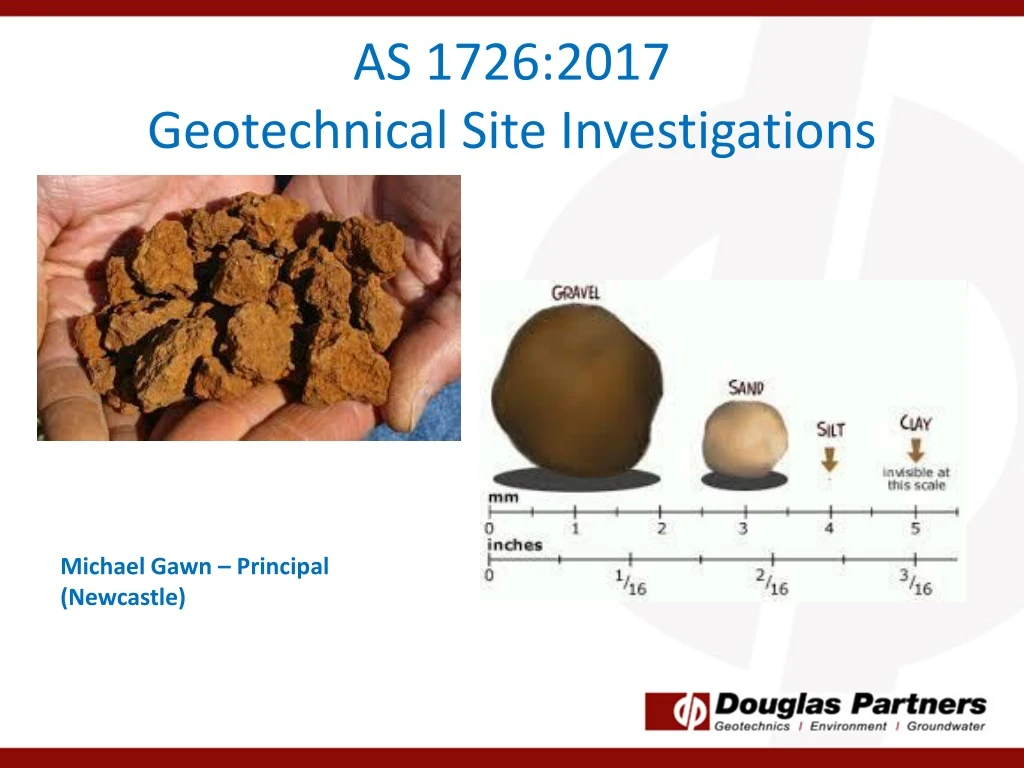
AS 1726:2017Geotechnical Site Investigations Michael Gawn – Principal (Newcastle)
AS 1726:2017 Geotechnical Site Investigations • Contents of Presentation • So What’s Different • Changes to DP Logging • Review of Universal Classification System • Rock Logging • Additional Logging Changes • Implications for Reporting • Other important changes to AS1726 • Useful Spreadsheets for Logging • Take Home Message
So what’s different? • Previous revision 1993 • Previously the delineation between a coarse material (sand,gravel) and a fine material (clay, silt) was based on the majority rule (ie. If more than 50% above 75 micron = coarse soil) • Now new boundaries, as follows • >65% above 75 micron Sand or gravel • >35% below 75 micron Clay or silt • Why? It only takes a relatively small amount of fines to alter the behaviour of the soil
How does this differ from DP Logging? No difference to boundaries from previously but slight difference to subdivision for sand DP Notes AS 1726:2017
Secondary Constituents and Naming AS 1726:2017 DP Notes Different thresholds for terminology DP notes being changed to reflect new code
Secondary Constituents and Naming • Previously a soil would become “clayey sand“ for instance with 20% to 35% clay. Now only 12% clay is required to be a “clayey sand” • Now if a soil has greater than 35% fines it is a fine soil • Therefore, a soil with 64% sand and 36% clay is a sandy CLAY not a clayey SAND. • This is to try to convey the behaviour of the soil (i.e that amount of clay is going to make it behave like a clay).
Secondary Constituents and Naming Note: Different thresholds for secondary constituents in coarse as opposed to fine soils. This reflects that it takes a lot more coarse material to change the behaviour of the soil (30% v 12%).
Minor Soil Components • Terms used is as follows: • Trace (<5% fines) or (<15% coarse) • With (>5% to 12% fines) or (>15% to 30% coarse) • Adjective modifier (eg sandy) (>12% fines) or (>30% coarse) No use of “slightly” or “some”
Examples of Soils • Examples of different soils • Sample 11 Sand with clay • Sample 12 Sandy CLAY • Sample 13 Sandy CLAY with silt • Sample 14 CLAY with sand 10% fines 35% fines 60% fines 80% fines Sandy CLAY Sandy CLAY CLAY with sand SAND with clay
Naming • Primary Component in BLOCK LETTERS • Secondary component included in name if over secondary threshold • Minor components added after name • Eg Clayey SAND with trace gravel
Determining Fine Content • If hydrometers done then use them • If Atterberg done use the following rule • Above A line clay • Below A line silt • If neither done then use tactile assessment for clay/silt – use water!
Plasticity • Terms • Non plastic • Low plasticity • Medium plasticity • High plasticity Note: Medium not Intermediate
Moisture Condition • Coarse Soils • Only three terms used, as follows: • Dry • Moist • Wet • No use of “humid” or “saturated” • Fine Soils • Moist, dry of plastic limit (w<PL) • Moist, near plastic limit (w≈PL) • Moist, wet of plastic limit (w>PL) • Wet, near liquid limit (w≈LL) • Wet, wet of liquid limit (w>LL) • Use textural test in the field (i.e roll a 7 mm long thread) DP will use description in brackets only
Group Symbol Classifications • Two characters system • Primary Classifier (i.e. first letter) • (G,S,M or C for Gravel, Sand, Silt or Clay) • Secondary Classifier (i.e. second letter) • (Coarse Soils) • Reflect grading (W or P for well or poorly graded) • Or Fine content (C, M or O for clay, silt or organic) • Secondary Classifier (i.e. second letter) • (Fine Soils) • Reflect plasticity (L, I or H for low, intermediate or high) • Note silt only uses L or H (no I)
Classifications Coarse Soils Gravel Dominated Soils GW – well graded gravel GP – poorly graded gravel GM – gravel-silt mixture GC – gravel-clay mixture Sand Dominated Soils SW – well graded sand SP – poorly graded sand SM – sand-silt mixture SC – sand-clay mixture Note: Fines contents between 5% and 12% to have dual classification – eg GP-GM
Classifications Fine Soils Silt Dominated Soils ML – low plasticity silt MH – high plasticity silt OH – organic silt Clay Dominated Soils CL – low plasticity clay CI – medium plasticity clay CH – high plasticity clay OH – organic clay of medium to high plasticity Pt – peat
Rock Classification • Changes in strength characterisation • Removal of extremely low strength • Material with a strength less than very low should be described as a soil but any rock structure noted. • UCS categories included (using a ratio of 20:1 with point load index) • Classification Symbols – same as used by DP (without EL)
Rock Weathering XW? • SW? REMEMBER: RMS (NSW) has its own weathering classification system
Rock Strength No longer Extremely low strength rock Now includes UCS ranges Material with strength less than “Very Low” shall be described using soil characteristics. The presence of the original rock structure, fabric or texture should be noted, if relevant
Additional Logging Changes • DP carried out extensive review of AS1726 (Grahame Wilson), with changes to DP procedures agreed to by Board • DP review of Field Procedures Manual (to be released soon) • Part A – Introduction and Fundamentals (principles of soil/rock behaviour) • Part B – Collection (how we record data) • Part C – Data Entry (gINT, DigiPen) • Part D – Presentation (how data is to be presented) • Log templates being amended (to suit new code and digipen usage) • No longer double up of strength graphic and description • Changes to descriptors (pale rather than light) • Main soil type in uppercase, not both (eg clayey SAND) • Soil origin is required to be interpreted. If in doubt use ‘possibly’ or ‘probably’ • Code gives examples of soil description • (SP Sand, trace silt, grey, medium grained, medium dense; dry; marine; Tomago Sand Beds)
Reporting Implications • Literature review required (ie. Previous projects, published mapping, etc) • Don’t forget historical aerial photos and 1974 Orthophotos – excellent resource • Code requires that a ‘geotechnical model shall be developed for every geotechnical site investigation’
Other Changes • New Code has a whole section of material alteration (extremely, highly, moderately and slightly) with abbreviations. This is based on visual assessment • It has good guidance on description of defects • Situation by situation. Some circumstances it is important to describe each joint/defect (ie. Unfavourable joints in excavation face) • Other circumstances generalisation of defects may be better to provide geotechnical model (eg foundation design) • Terms such as “joint spacing is typically 100 mm to 300mm and most joints traces less than 100 mm”
Other Changes • Has a more geological approach to jointing with good descriptions around dip, dip direction and strike • Roughness (with roughness counts, waviness, etc)
Soil Classification Spreadsheet Enter details and copy percentage passing from lab results Enter Atteberg results, if any
Soil Classification Spreadsheet Presents data with comments on lab testing Provides Soil portions Give soil description and Unified Soil Classification Grading proportions Plasticity Curve
Enter UCS/PL ratio and adopted multiplier (guidance in box) Input depth, Unit, Rock Type and PL values Provide range of estimated UCS based on common ratios Calculates estimated UCS and ultimate end bearing Colour codes rock class (based on Pells et al) and using strength only – must consider defects/seams
Take Home Message • It doesn’t take a lot of fines to make a soil “fine grained”. This reflects soil behaviour • Extremely low strength rock should be logged as soil or ‘extremely weathered (name of parent rock)’ • Pay attention to gradings and PIs (roll threads in field – take spray bottle) • DP logging sheets and DP Field Procedure Log section of Company Manual being changed (out soon) • New Code is a good recourse for Geo/Env Engineers
That’s all!Thanks to the following people who are driving and assisting in the innovations to our procedures:Grahame Wilson Will Wright Tim Swavley Heidi Sirianni