Download
1 / 62
640 likes | 824 Vues
Fluvial Processes, Patterns & Landforms. 5 th Year Geography Ms Cummins. Learning Outcome:. Understand how fluvial (river) processes transform the landscape. Examine the landforms created during the different river stages. FEED s for these landforms F eature E xplanation E xample

E N D
Fluvial Processes, Patterns & Landforms 5th Year Geography Ms Cummins
Learning Outcome: • Understand how fluvial (river) processes transform the landscape. • Examine the landforms created during the different river stages. • FEEDs for these landforms • Feature • Explanation • Example • Diagram
Today we will...... • Recall what we already know about fluvial processes. • Recap on some important river keyterms. • Examine what influences the speed/velocity of a river.
What do I already know about Fluvial Processes....(Rivers)....????
Rivers transform the landscape in three main ways • Erosion; wearing it away. • Transportation; moving its load downstream. • Deposition; dropping its load.
River Key Terms - A river transports its _____________ or eroded material. - The place where a river begins is its _______________. - The __________, is the route a river takes as it flows from an upland area down through its valley until it enters the sea - A stream/river which joins a larger river called a _______________. - The ____________ is the place where a river enters the sea or lake - Where a river mouth is tidal is the _________________. - A ________________ is the entire area which is drained by a river and its tributaries. - The high ground that separates two river basins is the ______________. - ____________________ is the amount or volume of water carried by a river at a given time.
Rate Of River Erosion Depends on: - Size (erodes faster when in flood) - Speed/Velocity (faster rivers have more power) - Hardness of rock (certain rocks erode more easily)
Velocity/Speed of a River • Velocity is influenced by; • Gradient(steeper slope-faster river) • Volume of water carried by river (greater volume/discharge- greater velocity) • Roughness of the channel (smooth channel, little friction- greater velocity) • Shape of river channel
Learning Outcome for Today.... • Examine four processes of erosion. • Identify three types of erosion. • Understand four processes of transportation. • Identify when a river may deposit it’s load.
Video Clip • http://postprimary.folensonline.ie/resources.aspx?programme=Horizons_1&chapter_group_index=10# • River Usk, Brecon Beacons Mountain Range, South Wales.
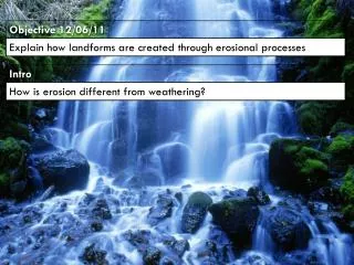
Processes of Fluvial Erosion Rivers erode through a number of processes: • Hydraulic Action • Abrasion/Corrasion • Solution/Corrosion • Attrition
Different Types of Erosion in a River Channel Vertical; the river erodes down into the riverbed. Lateral; the river erodes the sides of the river channel, which widens it. Headward; the erosion backwards (opposite direction of river flow), of material at the river source. Headward erosion lengthens a river valley.
River Transportation • Solution • Suspension • Saltation • Traction
River Deposition Deposition is the dropping of the river’s load. Rivers deposit their load when the following occurs: • The river loses speed • There is a reduction in waters in the river channel • The river flows into a lake or sea • The slope or gradient of the river is reduced • The river flows over a permeable rock layer, which allows the water to pass through easily • The river is carrying a larger load than it can actually transport
Pairwork- Quick Questions • List the three main ways rivers transform the landscape. • What is an estuary? • Explain the term ‘river discharge’. • List four factors affecting river velocity. • What are the four processes of fluvial erosion? • Explain the term ‘cavitation’. • What is lateral erosion? • Give another word for ‘traction’. • Identify four reasons why a river starts to deposit it’s load.
River profile Three stages can be identified: • Youthful or upper river valley • Mature or middle river valley • Old age stage or lower river valley
River Landforms / Features
Describing a Feature F.E.E.D F: Feature (Name, erosion or deposition, stage it is found) E: Explain with at least one or two processes explained E: Three examples, one Irish D: Clear 1/2/3 diagram/s to show how the feature is formed.
Features of the Youthful Stage • V – Shaped Valleys • Interlocking Spurs • Waterfalls
Feature: V-shaped valley (A narrow valley with steep sides and a narrow floor) 2 • Explanation: • A V-shaped valley is a landform formed at the youthful stage of the river by processes of river erosion. 2 • V-shaped valleys form in highland areas where streams are flowing down steep slopes. Such valleys are formed by the river cutting downwards into its bed. This is known as vertical erosion. 2 • The volume and speed of flow of a young river is often low due to the lack of tributaries feeding the river in its youthful stages. When the rivers velocity increases vertical erosion will occur, especially in areas of heavy rainfall or melting of winter snow. 2 • Hydraulic action, an erosion process caused by the physical force of flowing water, loosens and carries away the bedrock and soil of the river channel. 2 • Abrasion – erosion caused by the river’s load – will wear down bedrock as the load hits the sides and bed of the river channel. These 2 processes will deepen the level of the riverbed and form steeper sides to the channel. 2 • The valley sides will also be exposed to weathering and mass movement. Mechanical and chemical weathering weaken the rock and soil on the valley sides. Rainfall and snow melt may trigger landslides. 2 • The depth of the V is controlled by a combination of several factors: The speed of vertical erosion, the type of rock and weathering and Mass Movement . 2 • Example: River Moy, County Mayo. 2
Processes of transportation move material down river • Valley with steep sides and narrow floor remains • Interlocking spurs may form • Areas of high ground that jut out from each side of the valley where river meets resistant hard rock it is unable to erode • River flows around the hard rock while still eroding downwards • Creates a series of interlocking spurs
Interlocking spurs A typical upper course V-Shaped valley with interlocking spurs, steep valley sides and active slope processes. The diagram below shows the formation of interlocking spurs.
V-shaped valleys and Interlocking spurs are found in the upper courses of many rivers, including the River Slaney and River Liffey.
Waterfalls (a vertical fall of water) • Formed in the youthful stage of a river valley. Where the channel is narrow and deep • Created where a band of hard rock lies next to a layer of soft rock. Differential erosion occurs whereby soft rock is eroded and transported downstream and Leaves hard, more resistant rock elevated and standing out. • As the process continues the drop over the more resistant rock becomes steeper. Flow over the resistant rock forms a waterfall
A series of rapids are often formed above the area of resistant rock, Processes of hydraulic action and abrasion are occurring here. • A plunge pool forms at the base of the waterfall. The force of the falling water causes the water to swirl in the pool in a movement called eddying. It Deepens as a result of hydraulic action and abrasion • The back wall of the waterfall will be further eroded as a result of the water spray eroding the soft rock • Soft rock is eroded and the remaining hard rock is left exposed • Hard, resistant rock eventually falls into the bottom of the waterfall
Waterfall formation Look at the diagram, How is a waterfall formed?
Can you put the labels below into the correct place on he diagram?
Examples Angel Falls, Venezeula Victoria Falls, Zimbabwe Torc Waterfall, Killarney, Kerry
Angel falls is the highest waterfall in the world it has a height of 979 metres. It is located in Venezuela. It is 15 times higher than Niagara Falls
Niagara falls is one of the most famous falls in the world. Situated on the border of North America and Canada it is the most powerful waterfall in the world, with 35 million gallons of water rushing over the edge of the fall every minute.
Victoria Falls on the Zimbabwe/ Zambia Border is the widest waterfall in the world, with its mile-long breadth. It is Africa's biggest tourist attraction.
Homework • Examine, with the aid of a labelled diagram(s), the processes that have led to the formation of one Irish landform of erosion. (30m) • Use a FEED to answer this question.
Features of the Mature Stage • Meanders • Oxbow lakes • Flood plains
Meanders • Meanders are bends or curves along the course of the river • At the mature stage, the valley is less steep than that of a youthful river valley • River flows more slowly • Many tributaries join • More discharge • River erodes laterally • Volume of water and the river’s load increases • Meanders are a result of erosion and deposition • Water on the outer bend of a meander is deep; the river moves faster and erosion occurs (hydraulic action). Bank Caving may occur • Water on the inner bend of a meander is shallow; the river moves slowly and deposition takes place . This area is called a riffle
The meander resembles a snake. • Where erosion has occurred on the outside bend, the undercut riverbank collapses, this forms a river cliff. • Where deposition has occurred on the inside bend, this can build up to form a river beach or point bar.
Meanders 1 2 3
Examples of Meanders • Mature stage of the River Shannon, near Portumna, Co Galway. • River Moy, Co Mayo.
Ox-Bow Lake • Ox-bow lakes are horse-shoe shaped lakes • Formed when a meander is cut-off from the river • Lateral erosion takes place on the outer bend (hydraulic action) • Deposition occurs on the inside bend • After a long period of time meander neck becomes very narrow • Narrow neck is eventually cut through • River at the cut-off point has very little energy • Deposits its load leaving a meander loop isolated • Oxbow lake is eventually formed when deposit seals off both ends of the cut-off meander loop • Eventually oxbow lake dries up forming a mortlake
Examples of Ox-Bow Lakes • Lower Course of the River Shannon, near Limerick • Mortlake- River Liffey, near Ballymore Eustace, Co. Kildare.
Features of the Old-Age Stage • Levees • Deltas
Old Age Stage • River is moving very slowly • Level low-lying ground • River has very little energy to erode • The river deposits its load which has become too heavy to transport