Download
1 / 26
270 likes | 290 Vues
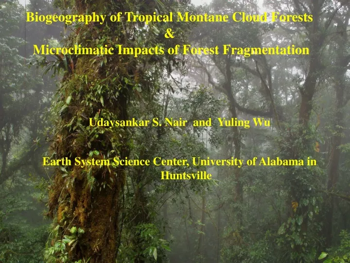
Udaysankar S. Nair and Yuling Wu Earth System Science Center, University of Alabama in Huntsville. Biogeography of Tropical Montane Cloud Forests & Microclimatic Impacts of Forest Fragmentation. Introduction cloud forests Methodology Results Applications Conclusions, future work.

E N D
Udaysankar S. Nair and Yuling Wu Earth System Science Center, University of Alabama in Huntsville Biogeography of Tropical Montane Cloud Forests & Microclimatic Impacts of Forest Fragmentation
Introduction cloud forests Methodology Results Applications Conclusions, future work Outline
Characterized by predictable, frequent and prolonged immersion in orographic clouds. Tropical montane cloud forests
Altitude range 1500 -3500m, coastal areas descends to 1000-300m Tropical montane cloud forests
TMCFs are located within biological hotspots that support about 20% and 16% of plants and vertebrates Retains less than 25% of their original primary vegetation cover Why map TMCFs? Myers et. al., 2000
Why map TMCFs? • TMCFs are water resources with potential to affect agriculture, water distribution and power generation • “Horizontal precipitation” can account for up to 14 – 18 % and 15% - 100% of total precipitation during wet and dry season respectively • Monteverde: Rainfall, 4310mm, Horizontal precip: 3560mm
Characterization of TMCFs are essential for understanding ecological processes in tropical mountains Upscaling of cloud forest hydrology and ecology Why map TMCFs?
UNEP, WCMC (Mark Mulligan) UK DFID Current state of cloud forest mapping International TMCF Symposium,1990
Cloud top height Cloud top pressure Optical depth Effective radius Temperature profile Assumptions Cloud Thickness Estimation of cloud base height from satellite imagery MODIS
Comparison to Celiometer observations over US Welch et al., 2008 Journal of Applied Meteorology
Comparison against photographic observations ~ 100m RMS error R. Lawton, Alan Pounds
MODIS derived cloud immersion frequency 12.00N 12.00N 11.50N 11.50N 11.00N 11.00N 10.50N 10.50N 10.00N 10.00N 9.50N 9.50N 9.00N 860W 860W 850W 850W 840W 840W 830W 830W
Combination of mesoscale model and satellite observations 10.40N 10.30N 10.20N 10.10N 10.40N 10.30N 10.20N 10.10N 84.90W 84.70W 84.50W 84.90W 84.70W 84.50W 100% 0 10 15 20 25 35 45 55 65 75 85 95 100 300 500 700 900 1100 1300 1500 1700m 0
Comparison to photographic observations Photo Obs MODIS RAMS & GOES
Comparisons to species ranges Jason Arnold, Dan Irwin, SERVIR
Comparisons to species range Jason Arnold, Dan Irwin, SERVIR
Conservation management Jason Arnold, Dan Irwin, SERVIR
Goal of the IDS project, proof of concept It is possible to determine cloud base height with sufficient accuracy, cloud immersion product accurately identifies cloud forests and quantifies cloud immersion SERVIR developing Central American cloud forests distribution Conclusions • Publications (Peer reviewed) • Lawton et al. (2007), Book chapter, Mountains in the Mist • Ray et al. (2006), Global and Planetary Change • Welch et al. (2008), JAM • Pielke Sr et al. (2007), Tellus • Nair et al. (2008), In Press, JAM • Nair et al. (2008), under preparation
Forest fragmentation causes abrupt exposure of a forest interior to an environment significantly different from the optimum conditions for which it is adapted Microclimatic changes is one of the important link in the chain of events that lead to potential erosion and collapse of forest fragments Need to understand the physical processes that drive the changes and to formulate strategies to minimize the variations Microclimatic impacts of Forest Fragmentation
Forest fragmentation causes abrupt exposure of a forest interior to an environment significantly different from the optimum conditions for which it is adapted Microclimatic changes is one of the important link in the chain of events that lead to potential erosion and collapse of forest fragments Need to understand the physical processes that drive the changes and to formulate strategies to minimize the variations Microclimatic impacts of Forest Fragmentation
Field studies such as the Biological Dynamics of Forest Fragments Project (BDFFP)yielded valuable information, but instrumentation expensive, results site specific Numerical models, calibrated against field observations provides a viable alternate option Edge Effects
T NDVI LES Modeling Results: Canopy temperature
LES modeling is a viable approach to study microclimatic impacts of forest fragmentation Need to compare against observations collected from BDFFP LES modeling is a valuable tool for exploring mitigation strategies Conclusion