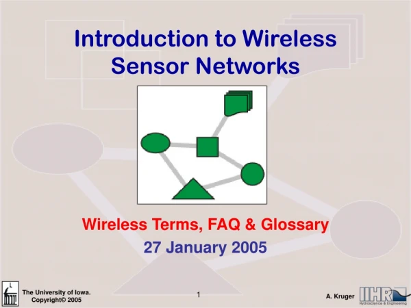
Download
1 / 32
320 likes | 407 Vues
Introduction to Sensor Networks. Rabie A. Ramadan, PhD Cairo University http://rabieramadan.org rabie@rabieramadan.org 3. Virtual grid architecture routing. Utilizes data aggregation and in-network processing to maximize the network lifetime

E N D
Introduction to Sensor Networks Rabie A. Ramadan, PhD Cairo University http://rabieramadan.org rabie@rabieramadan.org 3
Virtual grid architecture routing • Utilizes data aggregation and in-network processing to maximize the network lifetime • Inside each zone, a node is optimally selected to act as CH. • Data aggregation is performed at two levels: • Local: the set of CHs performing local aggregation • Global: the selection of global aggregation points is NP-hard • Strategies for the selection of MAs: • Exact alg: ILP • Approximate algs: genetics-based, k-means, greedy-based
Why do I need localization ? • In sensor networks, nodes are deployed without priori knowledge about their locations. • Estimating spatial-coordinates of the node is referred to as localization.
LocalizationGPS • Global Positioning System (GPS) is an immediate solution. • There some factors against the usage of GPS: • GPS can work only outdoors. • GPS receivers are too expensive to unsuitable for wide-range deployment. • It cannot work in the presence of obstructions.
Classifications of Localization Methods • Centralized vs Distributed • Anchor-free vs Anchor-based • Range-free vs Range-based • Mobile vs Stationary
Centralized versus Distributed Localization Algorithms • In centralized algorithms, • nodes send data to a central location where computation is performed and the location of each node is determined and sent back to the nodes. • Drawbacks • high communication costs • intrinsic delay
Centralized versus Distributed Localization Algorithms • In distributed algorithms, • each node determines its location by communication with its neighboring nodes • robust and energy efficient • Drawback • Can be more complex to implement • At times may not be possible due to the limited computational capabilities of sensor nodes
Anchor-Free vs Anchor-Based • Anchor Nodes: • Nodes that know their coordinates a priori • By use of GPS or manual placement • For 2D three and 3D four anchor nodes are needed • Anchor-free • Relative coordinates • Anchor-based • Use anchor nodes to calculate global coordinates
Range-Free vs Range-Based • Range-Free • Range-free techniques use connectivity information between neighboring nodes to estimate the nodes‟ position • Local Techniques • Hop-Counting Techniques • Range-Based • Received Signal Strength Indicator (RSSI) • Attenuation • RF signal • Time of Arrival (ToA) • time of flight • Time Difference of Arrival (TDoA) • requires time synchronization • electromagnetic (light, RF, microwave) • sound (acoustic, ultrasound) • Angle of Arrival (AoA) • RF signal
Range-Based Techniques • Time of Arrival • All sensors transmit a signal with a predefined velocity to their neighbors. • Then, the nodes each send a signal back to their neighbors • by using the transmission and received times each node estimates its distance to its neighbor
Range-Based Techniques • Received Signal Strength Indicator (RSSI) • The amount of power present in a received radio signal. • Due to radio-propagation pathloss, received signal strength (RSS) decreases as the distance of the radio propagation increases. • The distance between two sensor nodes can be compared using the RSS value at the receiver, assuming that the transmission power at the sender is either fixed or known
Range-Based Techniques • TDOA (Time Difference of Arrival) • Transmit both radio and ultrasonic signals at the same time to observe the arrival time difference. • Extra hardware, i.e., ultrasonic channel, is required • Not only radio but also sound signals have multipath effects affected by humidity, temperature, …
Range-Based Techniques • Angle of Arrival (AoA) • Gather data using either radio or microphone arrays. • Allow a receiving node determines the direction of a transmitting node. • A single transmitted signal is heard by several spatially separated microphones. • The phase or time difference between the signal‟s arrival at different microphones is calculated and thus the AoA of the signal is found. • Requires directional antennae
Anchor‐Based versus Anchor‐Free Localization Techniques • Anchor-based methods • Anchor nodes have GPS; • Other nodes derive their locations by trilateration. • Anchor-free methods. • Connectivity only; • Distance estimation for all communication links. • Node locations that reflect the position of the sensor nodes relative to each other
Proximity base localization • Trilateration / Multilateration technique • Proximity based localization: • Some nodes which can know their position through some technique (ex. GPS) broadcast their position information. • Other nodes listen to these broadcast messages and calculate their own position. • A simple method would be to calculate its position as the centroid of all the positions it has obtained. • This method leads to accumulation of localization error.
A 5.LocalizationTrilateration Example • Trilateration • A is 5m from B • A is 10m from C • A is 8m from D C B D
Range-Free Localization • DV-HOP • Similar to classical distance vector routing. • An anchor broadcasts a beacon to be flooded in the area.
DV-Hop propagation method • Each node maintains a table {Xi ,Yi ,hi} • Updates only with its neighbors. • Each landmark {Xi ,Yi} • Computes a correction • And floods it into the network • Each node • Uses the correction from the closest landmark • Multiply its hop distance by the correction
L1L2: 2 hopL1L3: 6 hopL2L3: 5 hop 2 Hop 3 Hop 3 Hop • Corrections computed by the landmarksc1 c2 c3 • Assume A gets its correction from L2 • Its estimate distances to the three landmarks • To L1: 3×16.42 • To L2: 2×16.42 • To L3: 3×16.42
Range-Free Localization • DV-hop • Advantages • Simplicity • Dose not depend on measurement error • Disadvantage • Only work for isotropic networks
APIT Overview • Anchors • Nodes equipped with high-powered transmitter • Location information obtained from GPS or other mechanism • Location estimation by isolating the environment into triangular regions between anchors
Location verification – SerLoc (Secure Range-independent localization)
What is location verification? • Different assumptions from general localization • What if some malicious nodes lie about their location? • Sample attack scenario • Claim to be very close to the sink • Attract many packets • Drop some or all of them • Very easy DoS attack especially for geographic routing protocols
Secure Location Services • Secure Verification of Location Claims • [Sastry et al. WISE 2002]. • Location Privacy • Privacy-aware Location Sensor Networks [Gruteser et al. USENIX 2003]. • Secure Localization: Ensurerobust location estimationevenin the presence ofadversaries. • SeRLoc: [Lazos and Poovendran, WISE 2004]. • S-GPS: [Kuhn 2004]. • SPINE: [Capkun & Hubeaux, Infocom 2005].
SeRLoc • SeRLoc:SEcureRange-independent LOCalization. • SeRLoc features • Passive Localization. • No ranging hardware required. • Decentralized Implementation, Scalable. • Robust against attacks - Lightweight security.
Sensors: Randomly deployed, unknown location Omnidirectional Antennas Sensor range r Locators: Randomly deployed Directional Antennas r Known Location, Orientation R θ Beamwidth θ Locator range R Locator Sensor Two-tier network architecture (X2, Y2) (X4, Y4) (X3, Y3) (X1, Y1) (X5, Y5)
The Idea of SeRLoc ROI Locator Sensor L4 • Each locator Li transmits information that defines the sector Si, covered by each transmission. • Sensor defines the region of intersection (ROI) from all locators it hears. L1 L3 s L3 (0, 0)
How SerLoc works • Node i claims its location is (x, y) • Node i needs to send (x, y) a location verification request msg to a nearby verifier • A verifier can be a normal sensor node • The verifier sends a random nonce to node i and start the clock • Node i has to immediately return the challenge through both radio and ultrasonic channels • The verifier measures the time for node i returning the challenge and take the difference between the radio & ultrasonic signal propagation. Based on this observation, verify the claimed location
Weakness of SerLoc • Requires extra hardware, i.e., ultrasonic channel • Innocent victims may respond late due to backlog • Not location verification but range verification sink M’s claimed Location Verifier Oops... Verifier cannot tell the difference! Big trouble... M’s Real Location
Possible Research Issues • Most localization work is mathematical and evaluated via (high level) simulations • More realistic work is needed • Indoor localization is harder • Look at CodeBlue project at Harvard • Location verification • Can’t trust sensors • Secure localization • Can’t trust anchors