Download
1 / 43
440 likes | 550 Vues
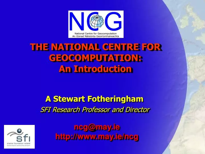
THE NATIONAL CENTRE FOR GEOCOMPUTATION: An Introduction. A Stewart Fotheringham SFI Research Professor and Director. ncg@may.ie http://www.may.ie/ncg. Why has SFI created a National Centre for Geocomputation?. Why hasn’t SFI created 5 such centres?. Who are we?. Core-funded group.

E N D
THE NATIONAL CENTRE FOR GEOCOMPUTATION: An Introduction A Stewart Fotheringham SFI Research Professor and Director ncg@may.ie http://www.may.ie/ncg
Why has SFI created a National Centre for Geocomputation? Why hasn’t SFI created 5 such centres?
Who are we? Core-funded group NUIM affiliates Affiliates from rest of Ireland Visiting Fellows
Core Funded Group Ann-Marie Burke, Senior Executive Assistant Matthew Sammon, PhD Student Stewart Fotheringham, Director Martin Charlton, Senior Research Associate Seamus Coveney, PhD Student Orla Dunne, Executive Assistant Stamatis Kalogirou, Postdoctoral Fellow Susanne Tschirner, Intern Camille King, STAR Awardee Mary O’Brien, Spatial Information Officer Melanie Tomintz, Intern John Sims, STAR Awardee
What is Geocomputation? Geocomputation involves any aspect of the capture, storage, integration, management, retrieval, display, analysis and modelling of spatial data Spatial data contain locational info as well as attribute info. Most data sets are spatial.
Computer Science NCG Statistics Geography
Why is it important? “Geotechnology isone of the three most important emerging and evolving research fields, along with biotechnology and nanotechnology” US Dept. of Labor, cited in Nature Jan 2004
Information Revolution Industrial Revolution Information is Power and a great deal of information is spatial
Geocomputation promotes: • Profitability – private sector • optimal location of facilities • shortest path algorithms • Equity – social sector • resource allocation • impact analysis • Efficiency – public sector • sharing information (e.g. road building and archaeological sites – M50 at Carrickmines Castle and N3 around Hill of Tara) • avoiding duplication of data collection
The Prevalence of Spatial Data • Census of Population • every 5 years in Ireland • Customer databases • Companies in the UK hold records on over 30 million individuals • Traffic Flows • Volumes of roads by time of day and day of the week • LiDAR • Low pass fly overs by plane: rapid collection of detailed data on terrain features - local • DEMs • US space shuttle mission - global
The Prevalence of Spatial Data • Health Records • Patient records • Incidence of disease • Satellite remotely-sensed images • Land use cover • Tracking changes over time • Military • Satellite GPS • ESA launching Galileo starting next year (30 satellites) to begin in 2008. Cost € 3.2 billion and annual running costs of € 140 million. Accuracy of 1m for civilians • US GPS launched in 1978 • Russia’s Glonass 1982 • European Commission estimates 3 billion receivers by 2010 and market worth € 250 billion
The Growing Prevalence of GPS-Derived Data • General data capture • In-car navigation systems • Vehicle tracking – cars, buses etc • Congestion charging • Criminal tagging • Animal tagging and tracking • Newmarket Oct 16th, 2004 • The GPS watch • Children • Alzheimer patients
www.wherifywireless.com GPS LocatorFOR CHILDRENPeace of Mind for Parents.Cool for Kids.Children have a natural urge to explore. Parents have a natural desire to know their children are safe. That's why Wherify created the world's first Personal Locator to help you determine your child's location in minutes. Wherify's GPS Locator helps keep loved ones safe by combining Wherify's patented technology with the U.S. Department of Defense's multi-billion dollar Global Positioning System (GPS) satellites plus the largest 100% digital, nationwide PCS wireless network. So relax. Now you can have peace of mind 24 hours a day while your child is the high tech envy of the neighborhood!
The Potential Use of GPS-Derived Data • Link to mobile phones - LBS • The movement of individuals – lapel badges • Sports applications – runners, football • Covert surveillance • GPS ‘dust’ Raises all kinds of ethical and legal issues that we need to think about now
Types of Spatial Data • GEODETIC • Coordinate reference system • ELEVATION • Heights above sea-level • BATHYMETRIC • Depth of water bodies • ORTHOIMAGERY • Georeferenced images of the earth’s surface • HYDROGRAPHY • Rivers and streams, coastline
Types of Spatial Data • 6. TRANSPORTATION NETWORKS • Roads, railways, canals • 7. CADASTRAL • Property boundaries • 8. UTILITIES • Locations of pipes, lines • 9. BOUNDARIES • Electoral, school and health districts • 10. FEATURES / ATTRIBUTES • Disease, toxic sites, census info. agriculture, ind. loc. environmental
The Value of Spatial Data Spatial data have enormous value and underpin large elements of the economy “In the UK, for example, it has been estimated that the value of the information provided by OS underpins some €160 billion of the national economy” www.eurogeographics.org
What’s special about spatial? • Spatial data sets can be LARGE • They have special statistical properties • They lend themselves to many innovative ways of visualisation
The Size of Spatial Data Sets • Census of Ireland • 3.9 million records • Satellite land use images • Terabytes of info • Global data sets • a dataset on a single attribute on each sq m of the earth transmitted over a 256Kb/s modem would take how long to transmit? • 1 minute? • 10 minutes? • 1 hr? Answer = 62 years Take 714,285 CDs to store (7kms long)
Special Statistical Properties • Spatial dependence • statistical inference • spatial interpolation • Modifiable Areal Unit Problem • scale and reporting units • Spatial nonstationarity • global versus local modelling of processes
GWR software sales Korolinska Medical Institute, Sweden Division of Marine Biology, University of the Algarve USGS Dept. of Transportation, Univ of N. Carolina Royal Veterinary College, UK Office of National Statistics, UK Entomology Dept, Oregon St. University CDC, Atlanta Buenos Airies Police Dept Institute of Behavioral Sciences, University of Coloado Ministry of the Environment, Singapore Dept of Applied Economics, Univ. of Minnesota Health Canada Dept. of Zoology, Univ of Vermont EWL Sciences, Australia Eli Lilley Pharmaceuticals, US
Geocomputation is fundamental to a great variety of application areas
Special ways of visualising spatial data • 3-D mapping • Animations • Spatial querying • Buffering • Data Mixing • Views at different scales
Goals for the NCG • To establish itself as a world-class research centre for geocomputation • Research and Development • Visiting scholars • Conferences/Workshops • Seminar series (sign up) • Expansion • Equipment – High-end, GIS-based Visualisation and Graphics Lab
Goals for the NCG • 2. To help promote the use of GIS and spatial data analysis throughout Ireland • Government offices (national and local) • Schools • Universities • Irish Spatial Data Initiative • Undertake research on Irish spatial data issues – spatial equity and efficiency
Cost of Irish spatial data … is expensive and prohibits academic research and training on Irish problems Cost of full set of 1:1000 vector data + 1:2,500 vector data to academics UK€8,300 (registration fee for Digimap) US Free Ire. €1,360,000
Goals for the NCG • 3. To train the next generation of geocomputational experts for Ireland • PhD Fellowships • MSc in GIS (industry-relevant) • Work with GIS software industry (cf UK’s CASE awards)
Goals for the NCG • 4. To work with Ireland’s GIS software industry • Train students • Joint research • Use and test products • ESRI Ireland • eSpatial Solutions Ltd
ESRI-Ireland • Provision of a substantial amount of ESRI software • Sponsorship of PhD students • Undertaking joint research projects
eSpatial Solutions Ltd Donation of €2.36 million to the NCG The NCG is now a Centre for Excellence in Enterprise Spatial Solutions cf CAST in US
Hopes for the NCG • Become a Portal for academics and government agencies within Ireland providing a one-stop spatial data service • Needs cooperation between OSI / SFI / HEA / Census Office • cf DIGIMAP and MIMAS in UK • Needs hardware
Hopes for the NCG • 2. Become a focal point for a Geogrid network linking the various academic groups across Ireland involved in geocomputation • Spatial data sharing • Workshops/visitors/seminars • Hardware linkage cf Cosmogrid • Becoming affiliated with the NCG
Hopes for the NCG • 3. Become a catalyst for the development and use of GIS and spatial data analysis within Ireland. For this we need: • Long-term commitment and support by SFI. Urgent equipment needs. • Support from NUIM • The support of the GIS software ind. • The support of government depts and agencies – contracts, spatial data, sponsorship of students etc. • The support of the rest of the Irish GIS community. Please get in touch.
“The NCG is the most significant thing that has happened to the GIS industry in Ireland”Peter Lyon, Director ESRI-Ireland