Download
1 / 22
220 likes | 354 Vues
Watershed Boundary Delineation Project (WBD) Status Report September, 2003. EPA GIS Workgroup – 09/03. What is the WBD Project?. EPA GIS Workgroup – 09/03. What is the WBD Project?. Delineation of 5 th and 6 th order watersheds. EPA GIS Workgroup – 09/03. What is the WBD Project?.

E N D
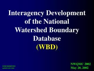
Watershed Boundary Delineation Project(WBD)Status ReportSeptember, 2003 EPA GIS Workgroup – 09/03
What is the WBD Project? EPA GIS Workgroup – 09/03
What is the WBD Project? • Delineation of 5th and 6th order watersheds EPA GIS Workgroup – 09/03
What is the WBD Project? • Delineation of 5th and 6th order watersheds • 1:24,000 scale based EPA GIS Workgroup – 09/03
What is the WBD Project? • Delineation of 5th and 6th order watersheds • 1:24,000 scale based • Seamless, nationally consistent EPA GIS Workgroup – 09/03
What is the WBD Project? • Delineation of 5th and 6th order watersheds • 1:24,000 scale based • Seamless, nationally consistent • 5th order: 40,000 – 250,000 acres EPA GIS Workgroup – 09/03
What is the WBD Project? • Delineation of 5th and 6th order watersheds • 1:24,000 scale based • Seamless, nationally consistent • 5th order: 40,000 – 250,000 acres • 6th order: 10,000 – 40,000 acres EPA GIS Workgroup – 09/03
What’s Changing? EPA GIS Workgroup – 09/03
What’s Changing? • 1st order: was REGION, will stay REGION EPA GIS Workgroup – 09/03
What’s Changing? • 1st order: was REGION, will stay REGION • 2nd order: was SUBREGION, will stay SUBREGION EPA GIS Workgroup – 09/03
What’s Changing? • 1st order: was REGION, will stay REGION • 2nd order: was SUBREGION, will stay SUBREGION • 3rd order: was ACCOUNTING UNIT, will be BASIN EPA GIS Workgroup – 09/03
What’s Changing? • 1st order: was REGION, will stay REGION • 2nd order: was SUBREGION, will stay SUBREGION • 3rd order: was ACCOUNTING UNIT, will be BASIN • 4th order: was CATALOGING UNIT, will be SUBBASIN EPA GIS Workgroup – 09/03
What’s Changing? • 1st order: was REGION, will stay REGION • 2nd order: was SUBREGION, will stay SUBREGION • 3rd order: was ACCOUNTING UNIT, will be BASIN • 4th order: was CATALOGING UNIT, will be SUBBASIN • 5th order: will be WATERSHED EPA GIS Workgroup – 09/03
What’s Changing? • 1st order: was REGION, will stay REGION • 2nd order: was SUBREGION, will stay SUBREGION • 3rd order: was ACCOUNTING UNIT, will be BASIN • 4th order: was CATALOGING UNIT, will be SUBBASIN • 5th order: will be WATERSHED • 6th order: will be SUBWATERSHED EPA GIS Workgroup – 09/03
What Needs To Be Done? EPA GIS Workgroup – 09/03
What Needs To be Done? Intrastate and Scale Issues EPA GIS Workgroup – 09/03
What Needs To be Done? Interstate Boundary Issues EPA GIS Workgroup – 09/03
What Needs To be Done? Attribute Compilation & Entry EPA GIS Workgroup – 09/03
R3 Priority Work Areas EPA GIS Workgroup – 09/03
Will this hurt ? EPA GIS Workgroup – 09/03
Will there be any surprises ? EPA GIS Workgroup – 09/03
Who To Contact • Ken Legleiter (NRCS Ft. Worth)klegleit@ftw.nrcs.usda.gov • Mike Laitta (USGS WRD Atlanta)mtlaitta@usgs.gov EPA GIS Workgroup – 09/03