Download
1 / 19
190 likes | 463 Vues
Earth’s Structure. Part III. Sea Floor Spreading. Continental Drift. Perceived Problem with Continental Drift. Alfred Wegener presented all his research to other professionals in 1915. However, most geologists of the day did not accept the idea of moving continents.

E N D
Earth’sStructure Part III Sea Floor Spreading
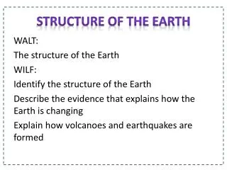
Continental Drift Perceived Problem with Continental Drift • Alfred Wegener presented all his research to other professionals in 1915. However, most geologists of the day did not accept the idea of moving continents. • There was no suitable mechanism to explain how continents could move over Earth’s surface. • Interest in continental drift only revived when new evidence from studies of Earth’s magnetic field and oceanographic research showed that the ocean basins were geologically young features.
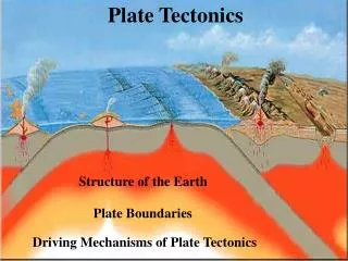
Sea Floor Spreading • Continental drift reexamined in 1960’s with new information • New theory developed – Seafloor spreading • Supporting evidence for seafloor spreading • Paleomagnetism • Age of seafloor • World seismicity • Volcanism • Heat flow • Theory combining continental drift and seafloor spreading termed “Plate Tectonics”
Earth’s Magnetic Field • Earth behaves as a giant dipole magnet. Magnetic poles essentially coincide with the geographic poles and may result from different rotation speeds of outer core and mantle • Strength and orientation of the magnetic field varies with latitude. It’s weak and horizontal at the equator and strong and vertical at the poles.
Paleomagnetism • Paleomagnetism is a remanent magnetism in ancient rocks recording the direction and the strength of Earth’s magnetic field at the time of the rock’s formation. • When magma cools below the Curie point temperature of iron (500 0C) magnetic iron-bearing minerals align with Earth’s magnetic field N Temperature higher than 500 0C Temperature b`elow 500 0C external magnetic field present) S Temperature lower than 500 0C (with no external magnetic field present)
Polar Wandering • In 1950s, research revealed that paleomagnetismof ancient rocks showed orientations different from the present magnetic field. • Magnetic poles apparently moved. • This apparent movement was called polar wandering. Different continents had different paths. • The best explanation • is stationary poles • and moving continents
Magnetic Reversals South Magnetic Pole North Magnetic Pole Geographic North Pole • Earth’s present magnetic field is called normal • with magnetic north near the north geographic pole • and magnetic south near the south geographic pole At various times in the past, • Earth’s magnetic field has completely reversed • with magnetic south near the north geographic pole • and magnetic north near the south geographic pole • This is referred to as a magnetic reversal Geographic South Pole South Magnetic Pole North Magnetic Pole
Sea Floor Spreading • Measuring paleomagnetism and dating continental lava flows led to • the realization that magnetic reversals existed • the establishment of a magnetic reversal time scale
Sea Floor Spreading Cryogenic Magnatometer aboard JOIDES Resolution collects data on orientation of magnetic sediment samples in core samples. Scientist aboard JOIDES Resolution on Leg 190 examining core samples Picture depicts how magnetic particles in ocean sediments can align with the magnetic north. Core samples collected years later aide in the determination of the magnetic north pole during the time of deposition.
Sea Floor Spreading Sonar • Harry Hess was a geologist and United States Navy officer in World War II. • Hess joined the United States Navy during World War II, becoming captain of the USS Cape Johnson, an attack transport ship equipped with a new technology: sonar. • Hess carefully tracked his travel routes across the Pacific Ocean using his ship's echo sounder. This unplanned wartime scientific surveying enabled Hess to collect ocean floor profiles across the North Pacific Ocean. • A device that bounces sound waves off underwater objects and then records the echoes of these sound waves. Sonar mapped mid-ocean ridges.
Sea Floor Spreading • Ocean mapping revealed a ridge system more than 65,000 km long, the most extensive mountain range in the world Mid-Atlantic Ridge • The Mid-Atlantic Ridge is the best known part of the system and divides the Atlantic Ocean basin in two nearly equal parts.
Sea Floor Spreading • Harry Hess, in 1962, proposed the theory of seafloor spreading. • It stated that continental and oceanic crust move together and that seafloor separates at oceanic ridges where new crust forms from upwelling and cooling magma, and that the new crust moves laterally away from the ridge. • The mechanism that drives seafloor spreading was thermal convection cells in the mantle. Hot magma rises from mantle to form new crust and cold crust subducts into the mantle at oceanic trenches, where it is heated and recycled. • Seafloor spreading theory indicates that oceanic crust is geologically young because it forms during spreading and is destroyed during subduction.
Sea Floor Spreading • The Glomar Challenger was a research ship administrated by Scripps Institution of Oceanography. It collected drill samples from the ocean floor and found that the farther away from the ridge it collected samples, the older the rocks were. The youngest samples were collected in the center of the ridge. • Radiometric dating confirms the oldest oceanic crust is less than 180 million years old whereas oldest continental crust is approximately 3.96 billion yeas old.
Sea Floor Spreading Age of Seafloor • Youngest sea floor is at mid-ocean ridge (red) • Oldest sea floor away from mid-ocean ridge (blue)
Sea Floor Spreading Confirmation of Hess’s Hypothesis • In addition to mapping mid-ocean ridges, ocean research also revealed magnetic anomalies on the sea floor. • A magnetic anomaly is a deviation from the average strength of Earth’s Magnetic field
Sea Floor Spreading Confirmation of Hess’s Hypothesis The magnetic anomalies were discovered to be parallel and symmetrical with the oceanic ridges The record of these alternating reverse and normal polarity helps support the idea of seafloor spreading.
Sea Floor Spreading World Seismicity • Earthquake distribution matches plate boundaries
Sea Floor SpreadingVolcanism • Volcanoes match some plate boundaries; some are hot spots
Sea Floor SpreadingHeat Flow • Heat flow at ocean basins are located along the rifting zones.