Download
1 / 35
380 likes | 891 Vues
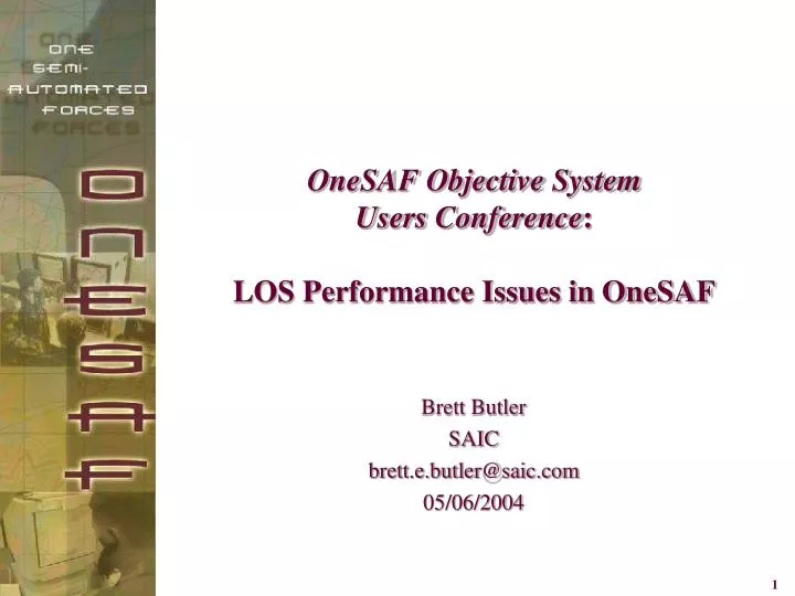
OneSAF Objective System Users Conference : LOS Performance Issues in OneSAF. Brett Butler SAIC brett.e.butler@saic.com 05/06/2004. Outline – LOS Performance Issues in OneSAF. OneSAF Environment Overview Primary LOS Algorithm LOS Variants and Use Cases Timing Results in OOS

E N D
OneSAF Objective System Users Conference:LOS Performance Issues in OneSAF Brett Butler SAIC brett.e.butler@saic.com 05/06/2004
Outline – LOS Performance Issues in OneSAF • OneSAF Environment Overview • Primary LOS Algorithm • LOS Variants and Use Cases • Timing Results in OOS • Optimization Strategies in Current Implementation • Integration Landscape for GPU into OOS • Collision Detection in OOS • (Backup) Terrain Database Organization
What is One Semi-Automated Forces (OneSAF) Objective System (OOS)? A composable, next generation CGF that can represent a full range of operations, systems, and control processes (TTP) from entity up to brigade level, with variable level of fidelity that supports multiple Army M&S domain (ACR, RDA, TEMO) applications. Software only Automated Composable Extensible Interoperable Platform Independent Field to: RDECs / Battle Labs National Guard Armories Reserve Training Centers All Active Duty Brigades and Battalions Constructive simulation capable of stimulating Virtual and Live simulations to complete the L-V-C triangle
Scope of the OneSAF Environment Representation • Terrain • Cultural and Natural Features • Atmosphere • Ocean • Weather • Smoke, • Obscurants • Aerosols • NBC Agents • Urban Environments • Buildings • Building Interiors
OOS’ Enhanced Synthetic Natural Environment • Increased number of trafficability categories • Increased number of attributes and features • Enhancement of mixed-fidelity terrain modeling
OOS’ Enhanced MOUT Capabilities • Enhanced DI SAF level behaviors • Validated, physics-based modeling • Ultra High Resolution Building (UHRB) models • Integration of MOUT FACT developments JRTC Screen shot Of UHRB Editor
Environmental Model Military System Models Effects (e.g.) - Propagation (e.g. geometric intervis /TL) - Trafficability (e.g. corridor) Passive Sensors Data (e.g.) - Terrain (e.g. surface, hydro, veg, ..) - Atmosphere (e.g. aerosols, clouds, ..) - Ocean (e.g. sea state, SVP, ..) - Space (e.g. particle flux, fields, ..) - Civilian (e.g. roads, structures, ..) - Military (e.g. engineering works, ..) Behaviors (e.g.) - Scout - March - Occupy - Target - Fire - Search / Find - Localize - Track - .. Active Sensors Internal Dynamics Weapons & Countermeasures Impacts (e.g.) - Obscurants/Energy (e.g. smoke, chaff, noise, ..) - Damage (e.g. structural, combat engineering, craters, ..) Units / Platforms SNE Conceptual Reference Model
Primary LOS Algorithm not_done = true los_exists = true get_first_triangle(segment, triangle) while (los_exists and not_done) if (areal_feature or linear_feature) then raise_triangle_vertices if (elevations of triangle vertices < elevations of segment endpoints) // bounds check for efficient pruning los_exists = true else los_exists = not intersects(ray, triangle) while (triangle_point_feature_list not empty and los_exists) los_exists = not intersects (ray, point_feature_bounding_volume) not_done = get_next_triangle(segment, triangle) return los_exists
LOS Variants and Use Cases • Low-Resolution Sampling vs. High-Resolution Ray-Trace • Geometric LOS vs. Attenuated LOS • Atmospheric • Foliage • Use Cases: • Primary • Rasterized • LOS Fan • Outdoors Terrain vs. Inside Ultra-High Resolution Buildings
Sampled LOS as used in WARSIM Multi-Resolution WARSIM reuse legacy gives us the sampled LOS model for use by OOS (picture Courtesy of WARSIM) OneSAF enhancements include exact ray-trace LOS model Ray-Trace LOS includes strict segment-polygon intersection tests
LOS Attenuation Compute path loss through canopy – individual trees or forest areal Compute path loss through atmosphere 35% LOS 10% LOS Sensor Model accounts for attenuation path loss. Usually by a thresholding combined with a random draw of LOS result
Use Cases Rasterized LOS Fan
Timing Results • JRTC Database • 4000m range • Elevations set at 300m to guarantee no LOS blockage • Computer: Intel-based workstation containing a Pentium III 1GHz processor and 512M RAM Measured from Java, through the JNI, to the C++. Windows 2K and Debian linux • Results Minimum Time = 2549.68 usec Maximum Time = 2771.53 usec Statistical average = 2576.10 usec • Historical Context (CCTT) 950 usec for unblocked 4000m call Regular triangular terrain vs. OneSAF TINs Flat-earth terrain vs. ellipsoidal/geoidal earth model
Optimization Strategies in Current Implementation • Motion coherence for Observer Save triangle reference for my location to pass back to LOS for next call • Spatial Coherence for Geometric pair Save my triangle reference and feature reference of blocking object and perform subsequent test against that object
AAR Management& ControlTool(SSDE) Sim. Config. & Asset Mgmt. Tool Management & ControlTool Monitor & Control Services Data ManagementTool S/W Eng. Environment Annotator Tool CM Tool Federation Mgmt. Tool Translation Services Information Meta-Data Tool Federation Develop. Tool ModelVerif. Tool Data Collection Specification Tool DefectTool Connect Services Stealth Tool S/W Verif.Tool Performance Modeling Tool System Acct. Tool Network Loader Tool S/W InstallTool Benchmark Tool SystemDist. Tool SNE Components of PLAF Architectural Applications (OneSAF System Compositions) Leader andStaff Training System Composition SeamlessTraining System Composition Force and Organizations Analysis Tool System Composition Test and Evaluation System Composition Other System Compositions … OneSAF Product Layer Repository Manager Maintenance Environment SystemComposer Knowledge Eng. Env. Event Planner Model Composer Simulation Generator Technical Manager Simulation Core Simulation Controller C4I Adapter Analysis & Review OneSAF Component Layer SystemComposerTool KA/KETools Military Scenario Development Environment Unit Composer UnitModels EntityComposer EntityModels Environment Database Generation Environment Behavior Composer Behavior Models EnvironmentComposer Physical Models IconTool Environment Models BattlefieldEnum. Tool OneSAF Component Support Layer CompositionServices EnvironmentRuntimeServices EnvironmentReasoningServices GUIServices Plan ViewDisplay DataCollectionServices SimulationServices Simulation Object RuntimeDatabase Modeling Services System RepositoryServices OneSAF Repository Component Layer KA/KERepository EnvironmentRepository SoftwareRepository System Composition Repository Military Scenario Repository Local ExerciseEnvironmentRepository Parametric & Initialization Repository Simulation Output Repository OneSAF Common Services Layer Middleware Services Monitor Services Time Services Name Directory Services Messaging Services Interchange Services Coordinate Services RTI DIS COEServices WWW JDBC/ ODBC ORB Live Range Adapter OneSAF Platform Layer Hardware Operating System Network
Environment Runtime Services Context Client Product Client Component QueriesModification Requests Results Environment RuntimeServices StaticEnvironment Data Environment Simulation Objects Environment Events LEER SORD
Collision Detection in OOS • Basic Architecture of Collision • Two types of collision • Entity collides with entity • Entity collides with environment feature • Collision Detection is responsibility of each maneuvering entity • Penetration of bounding planes • Assessment of damage received is the responsibility of all colliding parties • Force of collision • Penetration depth • Entity composition • OneSAF Environment provides a service (get_features_in_area) to assist in detection of collisions with environmental objects • Rectangular search area specified by geodetic coordinates • Returned feature list w/ bounding planes • Collision detection functionality is new and not yet mature • Complicating issues: • “dead reckoning” • Variable integration time step • Features not wholly contained in rectangular search area
Geotile Reference System A hierarchical, geodetic tiling system proposed as a common tiling scheme across M&S applications and programs Being adopted by STOW World Wide Terrain Database (WWTDB), JSIMS SNE, JWARS and Terrain Scenario Generation and Archiving (TSGA) Paul Birkel, Kent Cauble, Dale Miller, Eric Root
Geographic Referencing Scheme Requirements • Tile earth’s surface into manageable tiles for modularity, production & referencing • Provide a human intelligible means of referencing tiles • “Reasonable” width of tiles (nominally between 66 and 112 km) • Indexing for rapid access and retrieval • Provides a natural, hierarchical decomposition of the earth into simply defined megatiles, each comprised of a number of tiles
GeoTileRef Definition • Geotiles are 1 degree in latitude and 1 to 30 degrees in longitude • Megatiles are 15 X 15 degrees between +-60 degrees latitude, 30 X 15 degrees elsewhere (polar regions)
Megatile identifier scheme based on GEOREF lettering system Geotiles within megatiles are referenced via longitude/latitude offset of SW corner from megatile SW corner
C L 10 02 North offset in degrees of latitude from southwest corner of Megatile East offset in degrees of longitude from southwest corner of Megatile Megatile northing designator letter Megatile easting designator letter Human Readable Geotile Referencing
Terrain Skin Representation Triangular Irregular Network (TIN) Grided
Coverage Holds all GeoTiles for a given database. (Can have missing GeoTiles) GeoTile Holds all pages for a given area, aggregate features (those that overlap pages) and dynamic terrain features. Page Used as a paging unit from disk. Stores features and Terrain Elements (e.g. Polygons - that can overlap pages). Pages broken up along geodetic boundaries. Geotiles decompose into regions. Region Used to access sub-regions. Pages decompose into regions. Sub-Region Used to speed up access to terrain polygons. Regions decompose into sub-regions. Runtime Database Structure
Runtime Database Structure REGION PAGE Polygon selected because it contains the center of the sub-region. SUB-REGION