Download
1 / 113
1.14k likes | 1.47k Vues
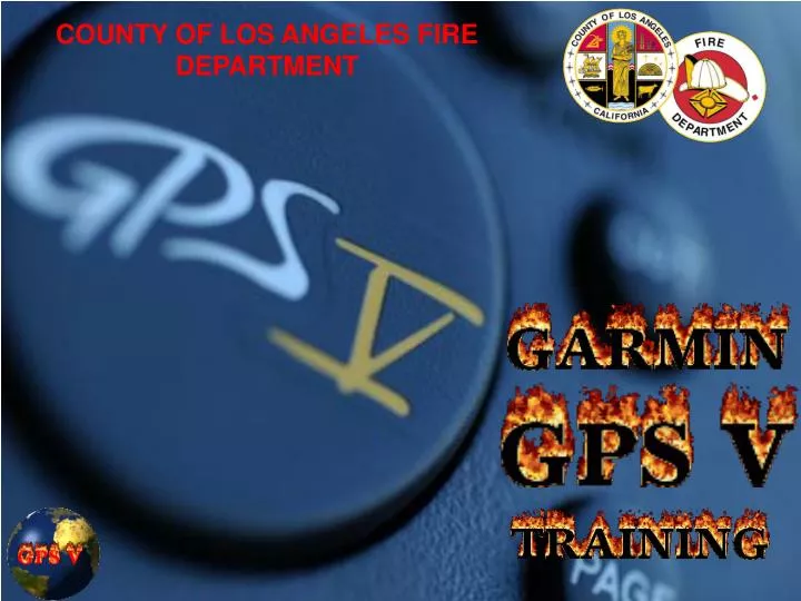
COUNTY OF LOS ANGELES FIRE DEPARTMENT. COUNTY OF LOS ANGELES FIRE DEPARTMENT GARMIN GPS V TRAINING. Lyle Koegler Forestry Technician Fire Plan Unit FORESTRY DIVISION County of Los Angeles Fire Department 12605 N. Osborne St Pacoima, CA 91331 Telephone Number: 818 890 5783

E N D
COUNTY OF LOS ANGELES FIRE DEPARTMENT GARMIN GPS V TRAINING Lyle Koegler Forestry Technician Fire Plan Unit FORESTRY DIVISION County of Los Angeles Fire Department 12605 N. Osborne St Pacoima, CA 91331 Telephone Number: 818 890 5783 Pager Number: 213 391 1431 FAX Number: 818 897 5995 “E” Mail Address: lkoegler@lacofd.org Ros Schenck Senior Survey Mapping Technician Mapping Unit INFORMATION MANAGEMENT DIVISION County of Los Angeles Fire Department 5900 South Eastern, Suite #128 Commerce, CA 90040 Telephone Number: 323 724 3472 Pager Number: 213 391 6157 FAX Number: 323 721 3042 “E” Mail Address: rschenck@lacofd.org
COUNTY OF LOS ANGELES FIRE DEPARTMENT FIELD OBSERVER GPS TRAINING SAFETY FIRST!! When your out in the field…watch out for snags…
Global Positioning System (GPS) Information and History COUNTY OF LOS ANGELES FIRE DEPARTMENT GARMIN GPS V TRAINING
COUNTY OF LOS ANGELES FIRE DEPARTMENT GARMIN GPS V TRAINING What Is GPS? • GPS, which stands for Global Positioning System, is the only system today that permits land, sea, and airborne users to determine their three-dimensional position, velocity, and time 24 hours a day, in all weather, anywhere in the world. • It is funded by and controlled by the U.S. Department of Defense (DOD). • The system was designed for and is operated by the U.S. military, however, anyone with a GPS receiver that can access the NAVSTAR (NAVigation Satellite Timing and Ranging) System can use it worldwide.
COUNTY OF LOS ANGELES FIRE DEPARTMENT GARMIN GPS V TRAINING THREE PARTS MAKE UP THE GLOBAL POSITIONING SYSTEM… 1. Space Segment 2. Control Segment 3. User Segment……YOU!!!
COUNTY OF LOS ANGELES FIRE DEPARTMENT GARMIN GPS V TRAINING THE SPACE SEGMENT… • 29 Satellites Total • 24 Navigational Satellites • 5 Active Spares • 12 Hour Orbit for each Satellite • 11,000 Nautical Miles up • 6 Orbital Planes w/ 4 satellites each • 4 Atomic Clocks to keep the accuracy (important)
COUNTY OF LOS ANGELES FIRE DEPARTMENT GARMIN GPS V TRAINING THE CONTROL SEGMENT • The GPS control, or ground, segment consists of 5 monitor stations • located around the world that broadcast signals to the satellites. • The master ground station locates at Schriever • (Falcon) Air Force • Base in Colorado Springs, Colorado. • These Ground Stations control the accuracy • of of the satellite’s position, • by using computer models and • broadcasting corrections to each • individual satellite so the GPS • receiver (YOU) can precisely • establish the location of the satellite.
COUNTY OF LOS ANGELES FIRE DEPARTMENT GARMIN GPS V TRAINING THE USER SEGMENT • The GPS User Segment consists of the GPS receivers and • the user community. • The GPS receivers detect, decode, and process GPS satellite signals • into position, velocity, and time estimates. • 4 satellites are required to compute the 4 dimensions of • X, Y, Z (position) and Time. • GPS receivers are used for navigation, • positioning, time dissemination, • and other research.
COUNTY OF LOS ANGELES FIRE DEPARTMENT FIELD OBSERVER GPS TRAINING THE USER SEGMENT
COUNTY OF LOS ANGELES FIRE DEPARTMENT GARMIN GPS V TRAINING The History of GPS… • In the late 1950's, researchers realized that the radio transmissions of a satellite in a well-defined orbit could be used to determine the position of a receiving station back on the ground. • Doppler positioning was the basis for the first satellite positioning system, known as Transit, which was put into orbit by the US military in the 1960's. It provided a positioning accuracy of about 160 meters, and was used by US Navy missile submarines.
COUNTY OF LOS ANGELES FIRE DEPARTMENT GARMIN GPS V TRAINING …more History of GPS. • As it progressed it was decided that the satellites would emit signals at precisely timed intervals, and by measuring the delay of arrival of these signals, a receiver could determine the distance of each satellite. • The first GPS satellite was launched in 1978. The first 10 satellites were developmental satellites, called Block I. From 1989 to 1993, 23 production satellites, called Block II, were launched. The launch of the 24th satellite in 1994 completed the system.
COUNTY OF LOS ANGELES FIRE DEPARTMENT GARMIN GPS V TRAINING How GPS works… • The principle behind GPS is satellite ranging- the measurement of distance (or "range") between the receiver and the satellites. • The satellites act as precise reference points by transmitting their positions and time signals to the user's receiver. The receiver determines its distance from the satellites by measuring the time delay for the signal to reach the receiver. • The measurements are collected simultaneously from four satellites and are processed to solve for the three dimensions of position, velocity and time, a technique traditionally called trilateration
COUNTY OF LOS ANGELES FIRE DEPARTMENT GARMIN GPS V TRAINING What is WAAS? (Wide Area Augmentation System) • What is WAAS? • -WAAS is a system of satellites and ground stations that provide GPS signal corrections, giving you even better position accuracy. • -How much better? Try an average of up to five times better. A WAAS-capable receiver can give you a position accuracy of better than three meters, 95 percent of the time. And you don't have to purchase additional receiving equipment or pay service fees to utilize WAAS. • The origins of WAAS • The Federal Aviation Administration (FAA) and the Department of Transportation are developing the WAAS program for use in precision flight approaches. Currently, GPS alone does not meet the FAA's navigation requirements for accuracy, integrity and availability. WAAS corrects for GPS signal errors caused by ionospheric disturbances, timing and satellite orbit errors and provides vital integrity information regarding the health of each GPS satellite. Although WAAS has not yet been approved for aviation, the system is available for civilian use, such as for boaters and recreational GPS users.
COUNTY OF LOS ANGELES FIRE DEPARTMENT GARMIN GPS V TRAINING How WAAS (Wide Area Augmentation System)works… • How it Works • WAAS consists of approximately 25 ground reference stations positioned across the United States that monitor GPS satellite data. Two master stations, located on either coast, collect data from the reference stations and create a GPS correction message. This correction accounts for GPS satellite orbit and clock drift plus signal delays caused by the atmosphere and ionosphere. The corrected differential message is then broadcast through one of two geostationary satellites, or satellites with a fixed position over the equator. The information is compatible with the basic GPS signal structure, which means any WAAS-enabled GPS receiver can read the signal. 100 meters: Accuracy of the original GPS system, which was subject to accuracy degradation under the government-imposed Selective Availability (SA) program. 15 meters: Typical GPS position accuracy without SA. 3-5 meters: Typical differential GPS (DGPS) position accuracy. < 3 meters: Typical WAAS position accuracy.
COUNTY OF LOS ANGELES FIRE DEPARTMENT GARMIN GPS V TRAINING Who Benefits from WAAS? • Who benefits from WAAS? • Currently, WAAS satellite coverage is only available in North America. There are no ground reference stations in South America, so even though GPS users there can receive WAAS, the signal has not been corrected and thus would not improve the accuracy of their unit. For some users in the U.S., the position of the satellites over the equator makes it difficult to receive the signals when trees or mountains obstruct the view of the horizon. WAAS signal reception is ideal for open land and marine applications. WAAS provides extended coverage both inland and offshore compared to the land-based DGPS (differential GPS) system. Another benefit of WAAS is that it does not require additional receiving equipment while DGPS does. • Other governments are developing similar satellite-based differential systems. In Asia, it's the Japanese Multi-Functional Satellite Augmentation System (MSAS), while Europe has the Euro Geostationary Navigation Overlay Service (EGNOS). Eventually, GPS users around the world will have access to precise position data using these and other compatible systems.
Earth’s Atmosphere Solid Structures Electro-magnetic Fields Metal COUNTY OF LOS ANGELES FIRE DEPARTMENT GARMIN GPS V TRAINING What can affect the GPS Signals? Airplanes
THE GARMIN V GPSGENERAL INFORMATION AND FEATURES COUNTY OF LOS ANGELES FIRE DEPARTMENT GARMIN GPS V TRAINING
COUNTY OF LOS ANGELES FIRE DEPARTMENT GARMIN GPS V TRAINING • Waypoints: • Total: 500 each with name, symbol, comment, and map display option. • AVERAGE WAYPOINTS for better • accuracy. • Track Log: Lots of points • (19mb Total storage) The Garmin GPS V • Accuracy: • Position: Less than 15 Meters • 15 meters (49 feet) • WITH WAAS ENABLED • Less than 3 Meters (9-10 Feet) Weight: 9 ounces (255g) w/ batteries Battery Life: Up to 25 hours (give or take with specific settings…)
COUNTY OF LOS ANGELES FIRE DEPARTMENT GARMIN GPS V TRAINING The Garmin V UNIT FEATURES
COUNTY OF LOS ANGELES FIRE DEPARTMENT GARMIN GPS V TRAINING The Garmin V UNIT FEATURES
A SHORT BREAK…watch out for the ducks… COUNTY OF LOS ANGELES FIRE DEPARTMENT FIELD OBSERVER GPS TRAINING
THE GARMIN V GPSBASIC OPERATIONS COUNTY OF LOS ANGELES FIRE DEPARTMENT GARMIN GPS V TRAINING
COUNTY OF LOS ANGELES FIRE DEPARTMENT GARMIN GPS V TRAINING The Garmin V Operation Turning it on 1. Press the Power Key (red button) andrelease.
COUNTY OF LOS ANGELES FIRE DEPARTMENT GARMIN GPS V TRAINING The Garmin V Operation Satellite Status Page 3D Navigation 2D Navigation 3D Differential (WAAS) “D” FOR DIFFERENTIAL
COUNTY OF LOS ANGELES FIRE DEPARTMENT GARMIN GPS V TRAINING The 3 Pages Position Page Satellite Status Page Map Page
COUNTY OF LOS ANGELES FIRE DEPARTMENT GARMIN GPS V TRAINING The 2 Additional Pages These pages are only an option when you have started navigation!! Current Route Page Direction Finder Page ONLY IF TRAVELING ON ROADS ONLY IF TRAVELING OFF-ROAD
COUNTY OF LOS ANGELES FIRE DEPARTMENT GARMIN GPS V TRAINING 2x 1.Press Menu two(2) times for main menu.
COUNTY OF LOS ANGELES FIRE DEPARTMENT GARMIN GPS V TRAINING • 2. Verify battery strength by looking at small battery at right • bottom side. • 3. If indicator is less than ½ full replace batteries. • This unit’s batteries will last up to 25-36 hours. • Note: Wrap a single layer of drafting/masking tape • around each battery.Use Lithium batteries when exposing unit to below • freezing temperatures.
COUNTY OF LOS ANGELES FIRE DEPARTMENT GARMIN GPS V TRAINING • Press the red Power key momentarily. A pop-up window • appears for screen settings. • 2. Use the Left/Right portion of the ROCKER KEYPAD to adjust • screen contrast. • 3. Use the Up/Down portion of the ROCKER KEYPAD to adjust • Backlighting. • 4. Press ENTER or PAGE to return to the previous screen. Or. Press QUIT • to cancel the settings
Check for Track Logs, Routes, and WaypointsBefore Performing any GPS Functions COUNTY OF LOS ANGELES FIRE DEPARTMENT GARMIN GPS V TRAINING
COUNTY OF LOS ANGELES FIRE DEPARTMENT GARMIN GPS V TRAINING Menu Page 1.Highlight Tracks with rocker keypad. 2.Press Enter.
COUNTY OF LOS ANGELES FIRE DEPARTMENT GARMIN GPS V TRAINING Active Log Page Showing Active Log This Shows ON • Verify if the Track Log is active. • If the Track Log shows “On” or there are Percentages, • then you need to first highlight “Off” & press enter. • 5. Now highlight “Clear” and press enter.
COUNTY OF LOS ANGELES FIRE DEPARTMENT GARMIN GPS V TRAINING Notice: Active log is now cleared. 6.Highlight “Yes”. 7. Press Quit once.
COUNTY OF LOS ANGELES FIRE DEPARTMENT GARMIN GPS V TRAINING 8.Highlight Find with the rocker keypad. 9.Press Enter.
COUNTY OF LOS ANGELES FIRE DEPARTMENT GARMIN GPS V TRAINING 10.Highlight “Waypoints”. 11.Press Enter. 12.Highlight “By Name”. 13.Press Enter. 14.Press Menu.
COUNTY OF LOS ANGELES FIRE DEPARTMENT GARMIN GPS V TRAINING 15.Highlight “Delete All”. 16.Press Enter. 17.Highlight “Yes”. 18.Press Enter. 19.Press Quit 3 times.
COUNTY OF LOS ANGELES FIRE DEPARTMENT GARMIN GPS V TRAINING • Highlight Routes with • the rocker keypad. • Press Enter. • Press Menu if Routes are present… • Highlight Delete All. • Press Enter.
COUNTY OF LOS ANGELES FIRE DEPARTMENT GARMIN GPS V TRAINING 27. Highlight Yes. 28.Press Enter. 29. Notice that no Routes exist. 30. Press Quit once (1) to return to the main menu.
COUNTY OF LOS ANGELES FIRE DEPARTMENT GARMIN GPS V TRAINING RESETING THE TRIP COMPUTER (Important to perform before using the GPS each time…)
COUNTY OF LOS ANGELES FIRE DEPARTMENT GARMIN GPS V TRAINING 1.Go to your Trip Information Page. 2.Press Menu. 4.Highlight Reset… with rocker keypad. 5.Press Enter. 6.Highlight Apply. 7. Press Enter. NOTE: THIS GIVES YOU THE OPTION CLEAR THE ACTIVE TRACK LOG.
COUNTY OF LOS ANGELES FIRE DEPARTMENT GARMIN GPS V TRAINING 1.Highlight OK 2.Press Enter. 4.Note Specific Fields have been reset.
COUNTY OF LOS ANGELES FIRE DEPARTMENT GARMIN GPS V TRAINING THE SETUP PAGES (Double check each time before use…)
COUNTY OF LOS ANGELES FIRE DEPARTMENT GARMIN GPS V TRAINING 1.Press Menu twice (2) to get to the Main Menu. 2. Highlight Setup. 3. Press Enter. 4.If you’re not on the System Page, use your Rocker Keypad. 5.Verify System Mode: Normal (Can Change to Battery Saver Mode.) 6.Verify Battery: Make sure you select what type of Battery. 7. Verify WAAS: Enabled (WAAS enablement will drain batteries faster.) 8. You can change the other fields as desired.
COUNTY OF LOS ANGELES FIRE DEPARTMENT GARMIN GPS V TRAINING 1. Use your Rocker Keypad to get Time Page. 2.Verify Time Format: 24 Hour 3.Verify Time Zone: Pacific 4. Verify Time: Correct time. 5. Verify UTC Offset: It must read “–08:00” 6. Verify Date: Correct Date.
COUNTY OF LOS ANGELES FIRE DEPARTMENT GARMIN GPS V TRAINING 1. Use your Rocker Keypad to get Guidance Page. 2.Verify Off-Route Recalculation: Automatic 3.Verify Next Turn Pop-up: On This is used when you are navigating while using the street database…
COUNTY OF LOS ANGELES FIRE DEPARTMENT GARMIN GPS V TRAINING 1. Use your Rocker Keypad to get Routing Page. 2. These Setting are for your preferences. 3. If you are traveling off road, be sure to highlight “Off Road” in the Route Preference field. This is used when you are navigating while using the street database…
COUNTY OF LOS ANGELES FIRE DEPARTMENT GARMIN GPS V TRAINING 1. Use your Rocker Keypad to get Units Page. 2.Verify Distance & Speed: Statute. 3.Verify Heading: Auto Mag (014 degrees E). 4.Verify Heading Display: Cardinal Letters. 5.Verify Vertical Speed: Feet/Minute. 6.Verify Elevation: Feet
COUNTY OF LOS ANGELES FIRE DEPARTMENT GARMIN GPS V TRAINING 1. Use your Rocker Keypad to get Timers Page. 2. These Setting are for your preferences. 3. You can Set an Alarm clock if you need it…