Download
1 / 27
270 likes | 420 Vues
EXPANSION OF THE SMALL SCALE PHYSICAL MODEL (SSPM) OF THE LOWERMOST MISSISSIPPI RIVER DELTA . PRESENTATION OVERVIEW. Current Small Scale Physical Model (SSPM) History Goals and Objectives General Features Results and Conclusions Expanded SSPM Project Team History

E N D
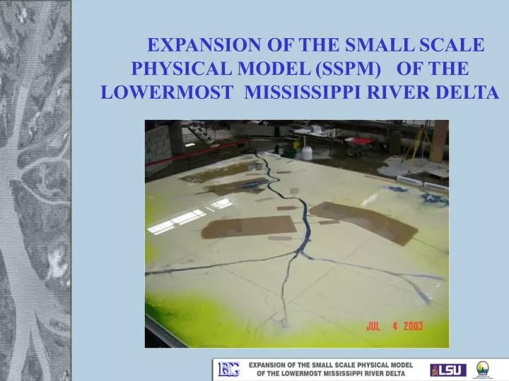
EXPANSION OF THE SMALL SCALE PHYSICAL MODEL (SSPM) OF THE LOWERMOST MISSISSIPPI RIVER DELTA
PRESENTATION OVERVIEW • Current Small Scale Physical Model (SSPM) • History • Goals and Objectives • General Features • Results and Conclusions • Expanded SSPM • Project Team • History • Goals and Objectives • Alternatives Analysis • Engineering and Design • Schedule • Questions
CURRENT SSPM History • Designed by LDNR/BCG in 2002 • Constructed and Calibrated at SOGREAH (France) in 2003 • Shipped to Louisiana and reassembled at facility on LSU’s campus • Initial Model Program performed in 2003/2004 • Final Report issued in December 2004 • Cost: ~$840,000 for Engineering, Model Construction, and Model Facility.
CURRENT SSPM Goals and Objectives • Establish baseline feasibility study for sediment management • Explore combinations of large and small diversions • Study feasibility of delta returning to its natural state (by reducing or eliminating dredging) • Consider navigation needs • Education, presentation and identification of alternatives for further investigation
CONCEPTUAL PLAN FOR DIVERSION CHANNELS • 3 large (600K cfs) diversions • 12 small (100K -200K cfs) diversions • Slack-water Navigation Channel w/ two lock gates • West Bay Sediment Diversion (50K cfs) • Bohemia Spillway / Pointe a la Hache Relief Outlet (up to 250K cfs natural overflow to the east)
CURRENT SSPM * Pointe a la Hache, LA • Horizontal scale 1:12,000 • Vertical scale 1:500 • Approximate prototype area = 3500 sq. mi. (55 miles X 63 miles) • 76 river miles represented on SSPM * Venice, LA
CURRENT SSPM Conclusions/Results • Currently virtually no land building/diversion benefits occur on the West Bank of the Lower Delta; • With no change in current sediment management practice, dredging requirement will greatly increase (after 100 years of relative sea level rise, ~70% of all transported sand will need to be dredged); • Large Diversion operating during high River flows showed extensive land building on the West Bank of the Lower Delta; • With Large Diversions operating during high River flows, virtually no dredging occurred during the first 50 years (some dredging occurred in the latter 50 years after significant RSL)
CURRENT SSPM BASE CASE SCENARIO After 100 years operation
CURRENT SPPM LARGE DIVERSION #2 After 100 years operation
CURRENT SSPM Conclusions/Results • Additional domain space upriver and downriver could’ve produced better results in certain situations; • Scale/distortion prevented modeling of more realistic sized diversions(minimum 100,000 cfs); • Modeling facility/work environment issues; • Modification to existing diversion scenarios, or addition of new diversion scenarios, was not easily implemented.
EXPANDED SSPMPlanning Phase Project Team • CPRA • Louisiana State University • Dr. Clint Willson • BCG-Dewberry JV Team: • BCG - Ken Brown, Cecil Soileau, Ike Mayer, David Dodgen, Robert Tisdale, Sultan Alam • Dewberry -Skip Notte, Jerri Daniels • Computational Hydraulics and Transport • Mobile Boundary Hydraulics • C & C Technologies • Eustis Engineering Services • Senior Advisory Panel • Dr. Chester Watson – University of Colorado • Dr. Daniel Gessler – Alden Research Laboratory • Dr. Alex McCorquodale – University of New Orleans • Dr. Forrest Holly – University of Iowa • Dr. Allison Mead – University of Texas • Dr. Allen Teeter – Computational Hydraulics and Transport • Sultan Alam – BCG-Dewberry JV
EXPANDED SSPMPlanning Phase History • LSU reported that the Current SSPM was reaching the end of its useful life in June 2010 • Extensive leaking between panels; • Rotting of plywood base; • Warping/disfiguration of model panels. • CPRA tasked BCG in December 2010 to assist in the investigation of the SSPM’s future • In February 2011 BCG reported that 11 of 24 SSPM panels needed to be replaced • CPRA initiated the Feasibility Study on Rehabilitation, Modification, and Expansion of the SSPM
EXPANDED SSPMPlanning Phase Goals and Objectives • Forecast land building potential of major diversion; • Qualitatively evaluate resulting impacts of doing nothing; • Forecast future dredging required to maintain navigation; • Accurately depict the impact of RSL on the Lower Delta.
EXPANDED SSPMPlanning Phase Goals and Objectives (continued) • Evaluate and demonstrate sediment management solutions that help address navigation concerns; • Optimize location and operation of proposed diversions; • Identify the impacts of proposed diversions on navigation; • Evaluate the impacts of proposed diversions on other diversions; • Demonstrate methods of storing sediment in deep river section to reduce dredging.
EXPANDED SSPMPlanning Phase Alternatives Analysis Assessed advantages/disadvantages, design criteria, and costs of three alternatives: • Rehabilitate existing SSPM and expand area modeled upriver and downriver one panel in both directions. • Modify existing SSPM by replacing test bed and extending model upriver to above Bonnet Carre’ Spillway and downriver one panel. • Construct a new SSPM with a larger scale to expand area modeled to area bounded to the West by the Terrebonne Ridge, RM 150 upriver, to the East by the North Shore of Lake Ponchartrain and to the south 500 ft. contour in the Gulf of Mexico.
ALTERNATIVE 1 – Scale and Domain Unchanged (Model to Wall) 4.28 m North 8.46 m (Model Width) 3.12 m (Model to Wall) 7.41 m (Model Length) 22 m (Building Length) 10.26 m (Width b/t Catwalk Rails) (Partition to Catwalk Rail) 5.41 m Entrance 14.68 m (Building Width)
ALTERNATIVE 2 – Scale Unchanged, Domain Increased 2 m 10.91 m (Model Width) North 12.21 m (Model Length) 22 m (Building Length) 12.23 m (Width b/t Catwalk Rails) 2.89 m Entrance 14.68 m (Building Width)
ALTERNATIVE 3 – Scale and Domain Increased 126.4 miles (prototype) MODEL EXTENTS 108.8 miles (prototype) 14.6 meters (model) EXISTING 16.9 meters (model)
EXPANDED SSPMPlanning Phase Alternatives Analysis Scope and Schedule: • Work Group Meeting #1: January 27, 2011 • Technical Meeting #1: February 7-9, 2011 • Technical Meeting #2: April 26-28, 2011 • Working Group Meeting #2: May 12, 2011 • Technical Meeting #3: June 26-29, 2011 • Working Group Meeting #3: August 3, 2011
EXPANDED SSPMPlanning Phase Alternatives Analysis Results: • Alternative 1 ($1,343,200) • Pros: Lowest cost; shortest implementation time • Cons: Due to unchanged domain and scale/distortion, no new goals could be accomplished • Alternative 2($1,584,400) • Pros: Low cost; Expanded domain could allow new modeling scenarios • Cons: Due to unchanged scale/distortion, no diversion smaller than ~100,000 cfs could be modeled • Alternative 3($4,198,200) • Pros: Expanded domain and scale would allow diversion as small as ~25,000 cfs to be modeled; new goals could be accomplished. • Cons: New facility; highest cost; longest implementation time
EXPANDED SSPMDesign Phase Schedule • CPRA Executive Division authorized engineering and design of Alternative 3 in September 2011 • Design Scope and Schedule developed by CPRA and BCG in October 2011. • Notice to Proceed Issued on January 5, 2012 • Project Team Kick Off Meeting held on January 19, 2012 • Pre-Design Meeting held on February 1, 2012 • Engineering and Design to be completed by October 2012
EXPANDED SSPMDesign Phase Alternative 3 – Facility • World Class Modeling Facility • Space to construct/operate other smaller scaled physical models; • Fully staffed, fully operational hydraulic laboratory; • State of the art audio/visual and presentation capabilities; • In-house computational modeling facilities; • Visitor friendly features.
EXPANDED SSPMDesign Phase Alternative 3 - Construction • Computer Numerically Controlled (CNC) Router • Uses CAD input files to route surface of 4 ft. x 8 ft. high density foam panels; • Facilitates fast, high accuracy model bed construction; • Allows for interchangeable model panels; • Would be used to construct other models at the proposed facility.
EXPANDED SSPMDesign Phase Alternative 3 - Operation • Fully Automated Operation Systems • Sediment injection • Water elevation monitoring • Overhead photography/videography • Interchangeable Model Panels • Overhead crane/hoist • Model Domain Accessibility • Remote Controlled Dredging • Water System • Rehandling • Temperature control
QUESTIONSRudolph A. Simoneaux III, P.E.Coastal Protection and Restoration AuthorityRestoration Divisionrudy.simoneaux@la.gov