Download
1 / 16
160 likes | 278 Vues
Semantic Location Based Services for Smart Spaces. Kostas Kolomvatsos, Vassilis Papataxiarhis , Vassileios Tsetsos P ervasive C omputing R esearch G roup C ommunication N etworks L aboratory Department of Informatics and Telecommunications University of Athens – Greece

E N D
Semantic Location Based Services for Smart Spaces Kostas Kolomvatsos, Vassilis Papataxiarhis, Vassileios Tsetsos Pervasive Computing Research Group Communication Networks Laboratory Department of Informatics and Telecommunications University of Athens – Greece MTSR ‘07 @ Corfu, Greece
Outline • Introduction • Spatial Ontology • GIS metadata and ontology population • Hybrid Navigation Algorithm • Conclusions
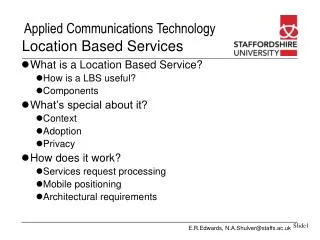
Location Based Services • LBS: The core of “smart environments” • Are the most popular context-aware services • Navigation service: One of the biggest challenges due to its complexity • Current Objective • Universal and optimized access to LBSs • Advanced user experience • Current Limitation • Existing representation techniques lead to incapability of “smart” management and exploitation of spatial data
Location Based Services (LBSs) + Semantic Web technologies Semantic LBS Motivation • Navigation • Typical representation formalism: spatial graphs • Problems • Multi-criteria search NP-hard • Redesign needed to extend an existing algorithm with more criteria • Conclusion: Traditional algorithmic approaches seem to fail • Proposed solution: Semantic enrichment of LBS
Spatial Model • Indoor Navigation Ontology • It describes the basic elements of indoor environment and the basic relationships between them • It facilitates path searching http://p-comp.di.uoa.gr/projects/ontonav/INOdoc/index.html
GIS Annotation • Layered architecture • Each layer corresponds to a basic concept (or set of concepts) in INO • Lower layer : Building blueprints • Second layer : Corridors (lines) • Points are defined upon corridors • Basic point metadata • x,y coordinates • Floor • Id • Label, etc.
Ontology Population • Spatial Database creation • Transform GIS Layers to Spatial Database Tables • Automatic instantiation of INO through GIS metadata Instances Creation Algorithm Spatial Database Ontology Instances
Instances Creation Algorithm • Based on GIS data • The algorithm involves the following steps for all floors in the building: • Find which points belong to each corridor • Find the ends of each corridor • Find the neighbors of each point • Create the instances in INO classes indicated by the GIS layers and the information extracted in the previous steps
Navigation Algorithm • Hybrid rule-based algorithm. Takes into account : • Route complexity • Euclidean route distance • User profile (capabilities and preferences) • Steps: • Create “user compatible” building graph based on user profile and application of access rules • E.g. WheelChaired_User(?x) ^ Stairway(?y) isObstacleFor(?y,?x) • Find the k-simplest paths • Assign the total cost of each path as a function of bonuses and penalties of the total path distance, preferences and perceptual rules
System Functionality (I) Building blueprints (GIS) User-compatible graph Building graph Data Migration Spatial DB INO instances User-compatible INO instances Indoor Navigation Ontology (INO) User profile (capabilities)
System Functionality (II) COM : Complexity Path Computation SEM : Semantic Path Selection User-compatible graph User profile PRS : Path Presentation SEM COM PRS K-simplest paths Best Traversable Path User User location and destination Perceptual Rules
Navigation Example A H: 4 possible paths 1) ACFGH shortest path 2) ABDIH simplest path 3) ABDEFGH, node E: stairs 4) ACFEDIH , node E: stairs Selected Path: ABDIH A little longer than ACFGH, but much easier to describe !
Implementation Details • ESRI ArcGIS software • PostGIS spatial DB • Protégé Ontology Editor • Knowledge Representation Languages • Ontology models in OWL-DL • SWRL rules • Bossam for OWL and SWRL reasoning • Mascopt Library for graph creation and path search
Semantics is not everything • Example: Orientation Issues • Two extra properties storing the real GIS coordinates of each door and not only its projection to the corridor • Compute the angle between the line vertical to user’s direction and the line specified by the user’s position to the door. • If angle θ > 90,the door is on the left side • Else, the door is on the right • Similar process for the turns.
Contributions and Open Issues • Main Contributions • Semantic representation of GIS metadata with the aid of a spatial ontology • A rule-based hybrid combination of k-simplest paths search algorithm with Euclidean distance and other application parameters like user profile and abilities/preferences. • Support for flexible navigation schemes • Content-based navigation • Presentation-based navigation • Open Issues • Immature reasoning engines in terms of performance and interoperability with rule engines • Development/Improvement of tools for spatial ontology population
Thank you! QUESTIONS? http://p-comp.di.uoa.gr