Download
1 / 15
150 likes | 305 Vues
Wind and Solar Energy Estimation and Forecasting. Presented by Fuzhong Weng. Requirement, Science, and Benefit. Requirement/Objective Commerce and Transportation: Improve accuracy of positioning capabilities to realize national economic, safety, and environmental benefits

E N D
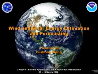
Wind and Solar Energy Estimation and Forecasting Presented by Fuzhong Weng
Requirement, Science, and Benefit Requirement/Objective • Commerce and Transportation: • Improve accuracy of positioning capabilities to realize national economic, safety, and environmental benefits • Develop the information and tools to make reliable decisions in preparedness, response, …. • Climate • Enhance NOAA’s operational decision support tools to provide climate services for national socio-economic benefits Science: How does NOAA help the nation to build the energy efficient grids? Benefit • Realize the goal of 50% of US electricity from Renewable Energy (RE) by 2030 • Weather forecasts will be significantly improved from the high-resolution RE forecast
U.S. and Global Energy DemandsContinue to Rise Growth in U.S Energy Demand Growth in Global Energy Demand Population vs. projected 10-year growth in total energy demand (% increase compared to 2006 value in each country) per capita. Population
NOAA’s Crucial Role • NOAA is responsible for national observation networks, operational weather forecasts, and climate models. These have not been optimized for the field of renewable energy and are insufficient for this field (RE). • NOAA hydrologic and hydrometeorologic forecast information has already been used by several organizations who produce hydroelectric power; e.g., the US Army Corps of Engineers, US Bureau of Reclamation, the Bonneville Power Administration, and the Tennessee Valley Authority. • NOAA has modernized sections of its information and services to meet the needs of other industries in the past, e.g., aviation industry. • If NOAA does not meet the evolving needs of the renewable energy sector, other governmental agencies will be forced to develop meteorological observation networks and forecast capabilities that fall within the scope of NOAA’s mission. • NOAA must enhance its measurements and modeling capabilities to meet the needs of the renewable energy industry and the nation.
Impact of Forecasting on Wind Generation Revenue ($/MWh of wind energy) Extrapolating GE ERCOT results to 20% US electricity production by wind in 2030: Value of SOA forecast: ~$16/MWh x 800 TWh = $13 B/year Value of improving from SOA to perfect forecast: ~$2.4 B/year
STAR Opportunities February 11, 2010: DOE and NOAA jointly released a Request for Information (RFI) on Enhancing Short Term Wind Energy Forecasting for Improved Utility Operation NOAA/NESDIS/STAR responses: • Develop a high resolution wind data near the atmospheric boundary (10 – 200 meters) • Advance data assimilation systems for real-time uses of the data in NWP models • Assess renewable energy trend from climate reanalysis and long-term data stewardship
Assessments of Satellite Solar Flux • GOES-11 channel 1 used for estimates • Compare with the SURRAD data at Sioux Falls, SD • Biases are relatively small High temporal solar flux information from satellite geostationary platform
Offshore high-spatial wind field from microwave/radar measurements ASAR • Synthetic Aperture Radar (e.g., ASAR), operating at C-band, has a high-spatial resolution of 30m x 30m. The measurements can be used to derive sea surface roughness which is a function of the sea surface wind vector. • Scatterometer (e.g., ASCAT) provide global sea surface wind vectors at a resolution of 25 km. • Passive microwave sensor (e.g., WINDSAT) provides also global wind vectors. The first space-borne polarimetric microwave sensor can obtain a hurricane’s wind field. • Wind lidar from ground and space provide a higher resolution wind profile. ENVISAT ASAR level2 wind field mapped in Google Earth
Solar and Wind Energy Forecasting from GFS Daily and 3-hourly forecasts • Using NCEP GFS data, solar energy forecast is promising. Improvements are under consideration. • Using NCEP GFS data, wind energy forecast is encouraging. Improvements are in high demand. Surface solar energy Surface wind energy Liu et al., 2009: JRSE Solar energy and wind 24 hour forecasts from GFS provide useful guidance for energy sector management and decision making
Shortwave Radiation fromGFS Analysis Field • GFS analysis outputs including downward surface solar radiation • The data sets within State of Arizona for year of 2008 are analyzed • Surface radiation (SRFRAD network data is used for validation • Errors is less than 10% for daily total radiation
Climatology of Solar & Wind Energy • NCEP/NCAR Reanalysis (1999-2008) ten-year mean solar and wind energy • Solar energy rich area: southwest of US, Western China • Wind energy: Coastal regions and Central US in Great Plane, Western China, Northern Europe Solar Wind
Wind Energy at 50 m North America A high resolution of wind energy distribution from a regional model shows more resources in great lakes, continental divides
Trend in Surface Wind Power and Temperature Increasing trends in wind energy and surface temperature are shown in both NCEP and ERA analysis. Knowledge of these climate changes aides in planning renewable energy resources for the future.
Decadal Mean Change in Past 50 Years • Shown are the difference between the periods of (1949-1958) and ( 1999-2008) • In Australia, both solar and wind energy are decreasing • In South Western US, solar energy is decreasing • In China, wind energy is decreasing and solar energy in western part is increasing Solar Wind
Challenges and Path Forward • Science challenges • How are the measurements of wind from surface to 200 meter obtained? • How are the requirements of solar and wind energy prediction accuracy at shorter time scales to be met? • How will the channels from satellite solar radiance and irradiance data be assimilated? • Next steps • Proposal to DOE and NOAA on request for information (RFI) • Higher spatial resolution of satellite measurements is required for local/regional applications • Accurate radiative transfer schemes are needed for direct and total, ultraviolet and visible downward flux calculations. • Advanced data assimilation schemes that include solar flux and wind energy in global and regional forecast systems will improve energy forecasting. • Transition Path • Work with DOE National Renewable Energy Lab • Work with ESRL on developments of a NOAA renewable forecast plan