Download
1 / 3
30 likes | 140 Vues
FEW FEAC320 Remote Sensing for Environmental Baseline and Monitoring (Partnership). Industry seeks best scientific methods to assess environmental impact of production activities.

E N D
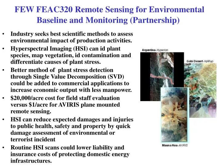
FEW FEAC320 Remote Sensing for Environmental Baseline and Monitoring (Partnership) • Industry seeks best scientific methods to assess environmental impact of production activities. • Hyperspectral Imaging (HSI) can id plant species, map vegetation, id contamination and differentiate causes of plant stress. • Better method of plant stress detection through Single Value Decomposition (SVD) could be added to commercial applications to increase economic output with less manpower. • $20,000/acre cost for field staff evaluation versus $1/acre for AVIRIS plane mounted remote sensing. • HSI can reduce expected damages and injuries to public health, safety and property by quick damage assessment of environmental or terrorist incident • Routine HSI scans could lower liability and insurance costs of protecting domestic energy infrastructures.
FEW FEAC320 Remote Sensing for Environmental Baseline and Monitoring (Partnership)
FEW FEAC320 Remote Sensing for Environmental Baseline and Monitoring (Partnership) • AVIRIS is a unique optical sensor that delivers calibrated images of the upwelling spectral radiance in 224 contiguous spectral channels (bands) with wave-lengths from 400 to 2500 nanometers (nm). • AVIRIS has been flown on a NASA ER-2 jet and a Twin Otter turboprop. The ER-2 is a U2 (spy plane) modified for increased performance which flies at approximately 20 km above sea level at about 730 km/hr • AVIRIS has been flown over North America, Europe, and portions of South America • The goal of the AVIRIS project is to identify, measure and monitor constituents of the Earth’s surface and atmosphere based on molecular absorption and particle scattering signatures well enough so that oil companies could monitor plant life near refineries, pipelines and installations and detect early signs of environmental stress in plants.