Download
1 / 33
350 likes | 604 Vues
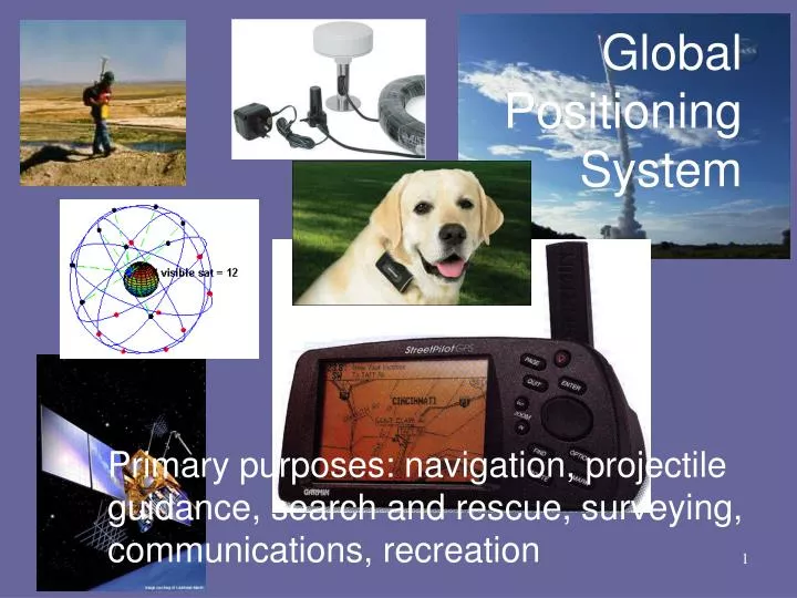
Global Positioning System. Primary purposes: navigation, projectile guidance, search and rescue, surveying, communications, recreation. Global Positioning System.

E N D
Global Positioning System Primary purposes: navigation, projectile guidance, search and rescue, surveying, communications, recreation
Global Positioning System • The GPS Master Control Station, operated by the 50th Space Wing's 2nd Space Operations Squadron at Schriever AFB is responsible for monitoring and controlling the GPS satellite constellation.
THE WHITE HOUSEOffice of the Press SecretaryFor Immediate Release May 1, 2000 STATEMENT BY THE PRESIDENT REGARDING THE UNITED STATES' DECISION TO STOP DEGRADING GLOBAL POSITIONING SYSTEM ACCURACY Bill: Today, I am pleased to announce that the United States will stop the intentional degradation of the Global Positioning System (GPS) signals available to the public beginning at midnight tonight. We call this degradation feature Selective Availability (SA). This will mean that civilian users of GPS will be able to pinpoint locations up to ten times more accurately than they do now.
Q: What happened? A: Selective Availability was removed MAY 1, 2000 MAY 3, 2000
Global Positioning System • What’s next: longer life expectancy and higher accuracy • GPS Block IIF – 2 of 12 launched (last in Aug., 2011) • GPS Block III (under development) • Much more here: http://www.gps.gov/
GPS to Google Earth This is why you average waypoints
LightDetectionAndRanging • LiDAR – air and ground based • 30 year old technology • Cost effective only recently • System components • Laser scanner with a precise clock • Requires robust computer support
LightDetectionAndRanging Airborne scanning 30,000 points per second at ~15 cm accuracy $400–$1000/mi2
LightDetectionAndRanging How do multiple- returns work?
with buildings Univ. of Wisconsin
without buildings Univ. of Wisconsin
High-resolution topography: some applications • Fault mapping • Geologic mapping • Landslide hazards & change thru time • Flood hazards • Surface water runoff modeling • Precision forestry • Noise propagation (roughness)
landslides southern Bainbridge Island
15 km west of Seattle Toe Jam Hill fault scarp Waterman Point scarp beach uplifted during 900 AD earthquake
http://www.cg.tuwien.ac.at/research/projects/LEOPOLD/Images/scanning_02.jpghttp://www.cg.tuwien.ac.at/research/projects/LEOPOLD/Images/scanning_02.jpg
Original scan by CerianGibbes, Brandon Vogt, and Steve Jennings
Original scan by CerianGibbes, Brandon Vogt, and Steve Jennings
Original scan by CerianGibbes, Brandon Vogt, and Steve Jennings
Terrestrial Laser Scanning • UCCS (Leica-Geosystems ‘TruView’) • http://www.uccs.edu/~bvogt/truview/ • Allerton Church • http://www.youtube.com/user/stevepopely#p/u/3/ahwqCl5Z9oU
GPS / LiDAR background • GPS • http://www.youtube.com/user/airforcespacecommand#p/u/5/_zM79vSnD2M • Lidar • http://video.google.com/videoplay?docid=2891533736664888395#