Download
1 / 46
470 likes | 634 Vues
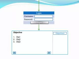
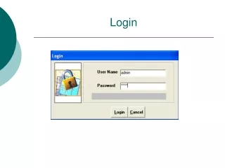
Login. www.oilsim.com. Learning Cycle. Additional knowledge/skills. Environmental issues Team work and negotiation Critical decision making , analytical skills, multi-tasking Learn through experience Economically viable volumes- reducing uncertainty Return on Investment

E N D
Login • www.oilsim.com
Additional knowledge/skills • Environmental issues • Team work and negotiation • Critical decision making, analytical skills, multi-tasking • Learn through experience • Economically viable volumes- reducing uncertainty • Return on Investment • Function appreciation
Money and Credibility • You start with $250 millionYou can apply for more money later. • Create valueMeasured by the net value of the oil and gas fields discovered MINUS all costs involved. • Correct answers and sensible decisions are awarded with CPs
Oil and Gas Value Chain Complete Value Chain Upstream
OilSim day 1 Task 2 Task 3 Task 1 Licenceaward, spreadrisk-negotiations 1 st concessionround Pre-concessionwork Gravimetric data, Magnetic data Enviromental data, Geologicalmaps 2D seismic surveys 3D seismicmaps Today’s Challenges
Gravimetric surveys • Gravimetric surveys show the gravity in the sub-surface. Measured by airborne sensors. • Sedimentary rocks have lower densities than the surrounding crystalline rocks. Low gravity means high probability of a basin below. • Low gravity are basins. • High gravity are crystalline rocks
First task • Challenge: Find three sedimentary basins in the area. Basins are sedimentary rocks in the deep subsurface where oil and gas has been generated. • Procedure: Buy and study magnetic and gravimetric surveys; and to submit the coordinates, column and row number for each basin centre.
Gravimetric surveys • Gravimetric survey:South-east quadrant
Magnetic surveys • Magnetic surveys show similar information as gravimetric surveys. The sedimentary rocks in the basins have a lower concentration of magnetic materials than the surrounding crystalline rocks. • Sedimentary basins are the areas with the lowest magnetic field. • Basins have low magnetic field • Non-basins have high magnetic fields.
Magnetic Surveys • Magnetic survey:North-west quadrant
C50 R100 C60 R110 Centre may not be the same • Example: Top basin on both maps • Calculate the midpoint between the gravimetric and magnetic centres found • = C55 and R105
Centre Midpoint calculation • 3 centres – one Centre midpoint for each basin • Example: C55, R105 • Solve before deadline. All submissions are evaluated after the deadline (and not before). • You may get 0-100 CPs. All three centres must be located to get full CPs.
Task 1 solved • All teams have submitted their answers. Basin centres are located. • Message in Inbox. All teams have answers and CPs awarded.
OilSim day 1 Task 2 Task 3 Task 1 Licenceaward, spreadrisk-negotiations 1 st concessionround Pre-concessionwork Gravimetric data, Magnetic data Enviromental data, Geologicalmaps 2D seismic surveys 3D seismicmaps Today’s Challenges
Challenge 2 : license round Sedimentary basins may contain oil and gas. The government has decided to put the blocks around one of the basins on offer. Challenge: Identify the 3 most promising blocks and offer an amount for each of them.
Source and migration 2. MIGRATION ROCK where hydrocarbons are driven through 3. CAP ROCK Impermeable rock that stops migration of hydrocarbons 1. SOURCE ROCK where organic material is put under sufficient pressure 4. PROSPECT
Traps • Geological “pockets”, that might contain hydrocarbons. Anticline trap (c) OLF Stratigraphic trap Salt dome trap Fault trap
Surface Restriction Areas Red areas You will not be allowed to bid, drill or operate in any of the red areas (environmentally sensitive areas) Green areas Blocks in area may be awarded.
Common Risk Segments • Is there a sedimentary basin and a migration route into the prospects in the area? • Is there porous reservoir rock in the area, so that the oil or gas can be stored? • Is there a sealing rock in the area, so that the oil and gas can be trapped? • If all are positive, then green • If some negative, then orange • If mostly negative, then red
Common Risk Segment CRS. Common Risk Segment surveys tell you about the probability of a structure in the block/cell containing oil or gas Surface Layer 3 Eocene 1500m below the surface Layer 2 Paleocene 2500m below the surface Layer 1 Cretaceous 3500m below the surface
2D Seismic surveys • Traps can be found with seismic surveys • 2D seismic survey is a cross section of the geological layers along either a column or a row. • 2D seismic surveys are used for locating prospects.
2D Seismic in OilSim Unprocessed Processed Red is top of the sealing rock Green is top of the reservoir rock Interpreted
Leakage? Leakage Sealant rock
Order seismic • Buy 2D seismic from the survey shop
Order Seismic • What type of data do you want? • Columns or Rows • Unprocessed or processed data • Interpreted or not Only buy maximum of 2 block of data at a time to speed up processing
View the Seismic • Red circles – navigate through the 2D seismic • Yellowsquare – Row 1 from Column 1-56
Cross-sections Column Row Prospect, Reservoir Basin,Source
Enter bids Minimum bid is $250K Maximum bid is $7.5M Enter numbers without commas (ex: 250000) You will bid for 3 licenses but each team will only be awarded one license Highest bid wins the license If two teams bid the same, the team with the most CP’s gets it Random license awarded if none of your bids are high enough Submit your bid before the deadline!
Recap on Task 2 • Environmental Sensitive Areas map to see which blocks to avoid • Common Risk Segment surveys to see which blocks to examine closer • 2D surveys seismic to identify which ones have the most (big) structures • Remember to submit 3 bids
Task 2 solved Message sent to all teams with the results Credibility Points are given for prosperity of the blocks you bid for Every team has got one exploration license
OilSimday 1 Task 2 Task 3 Task 1 Licenceaward, spreadrisk-negotiations 1 st concessionround Pre-concessionwork Gravimetric data, Magnetic data Enviromental data, Geologicalmaps 2D seismic surveys 3D seismicmaps Today’s Challenges
Task 3 Exploration Drilling • HQ is happy with the license awarded. • Challenge: Farm-out minimum 20% from your license – and farm-in as much as you can in other good licenses. • Acquire 3D Seismic interpretations for the block you operate, and study the results from the licensing round • Get others to invest 20% or more in your license – you can show/send 3D seismic
Real 3D Seismic • Shows the subsurface structure in a cube.
3D Seismicin OilSim Layer 3 Eocene Layer 2 Paleocene Layer 1 Cretaceous
Partnerships • Spread the risk: e.g Investing in other blocks divides the risks amongst all partners, much more preferable than keeping 100% of one field and all the risk. • Increase probability of profit: investment in only 1 field which could be a dry prospect is possible, whereas the likelihood of investing in 5 fields which are all dry is unlikely.
Farm-in • Enter the percentage and total amount for have agreed to offer • Minimum $100,000 per % • Add a message to the seller • Press “Send offer”
Farm-in When a team receives a Farm-In offer to appears under Financing. This is where a team can receive finance or money for a % of their own blocks
Farm-in • License OWNER decides whether to ACCEPT or REJECT the offer • Partnerships established every time a license owner accepts an offer. • Overview: On the main page, you can see all licenses. 1) licenses you operate, 2) licenses you have invested in, and other licenses.
Farm-in All your farm-in offers to other teams are shown under “Investing”on the right-hand side of the homepage . This is where a team offers investments to other teams for a % of their blocks
Partnerships • Partners pay a proportional share of all future costs • Partners receive a proportional share of the net proceeds from oil and gas • The operator team makes all decisions regarding drilling • Teams can farm-out up to 70% of licence • Operators must keep 30% of licence