Download
1 / 62
660 likes | 927 Vues
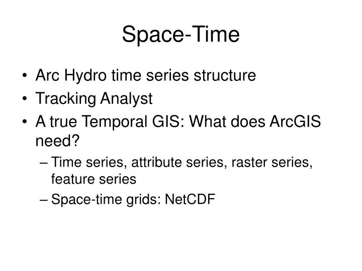
Space-Time. Arc Hydro time series structure Tracking Analyst A true Temporal GIS: What does ArcGIS need? Time series, attribute series, raster series, feature series Space-time grids: NetCDF.

E N D
Space-Time • Arc Hydro time series structure • Tracking Analyst • A true Temporal GIS: What does ArcGIS need? • Time series, attribute series, raster series, feature series • Space-time grids: NetCDF
In 1905, Albert Einstein published his famous Special Theory of Relativity and overthrew commonsense assumptions about space and time. http://archive.ncsa.uiuc.edu/Cyberia/NumRel/NumRelHome.html
Space-Time • Arc Hydro time series structure • Tracking Analyst • A true Temporal GIS: What does ArcGIS need? • Time series, attribute series, raster series, feature series • Space-time grids: NetCDF
Space-Time Cube Time TSDateTime Data Value TSValue FeatureID Space Variable TSTypeID
Arc Hydro TSType Table Units of measure Regular or Irregular Time interval Type Of Time Series Info Recorded or Generated Type Index Variable Name • Arc Hydro has 6 Time Series DataTypes • Instantaneous • Cumulative • Incremental • Average • Maximum • Minimum
Time Series Types Incremental Instantaneous Average Cumulative Minimum Maximum
Space-Time • Arc Hydro time series structure • Tracking Analyst • A true Temporal GIS: What does ArcGIS need? • Time series, attribute series, raster series, feature series • Space-time grids: NetCDF
Tracking Analyst • Simple Events • 1 feature class that describes What, When, Where • Complex Event • 1 feature class and 1 table that describe What, When, Where Arc Hydro
Simple Event Unique Identifier for objects being tracked through time Observation Time of observation (in order) Geometry of observation
Complex Event (stationary version) Cases 1, 2, 3, 4, 5 The object maintains its geometry (i.e. it is stationary)
Complex Event (dynamic version) Cases 6 and 7 The object’s geometry can vary with time (i.e. it is dynamic)
Temporal Layer Shape from feature class is joined to time series value from Time Series table
Space-Time • Arc Hydro time series structure • Tracking Analyst • A true Temporal GIS: What does ArcGIS need? • Time series, attribute series, raster series, feature series • Space-time grids: NetCDF
Variable Time Time and Space in GIS Time Series Feature Series t3 t2 Value t1 Time Attribute Series Raster Series Value t3 t2 t1 t1 t2 t3 y x
Variable Time t1 t2 t3 Time Series and Temporal Geoprocessing DHI Time Series Manager Time Series Feature Series t3 t2 Value t1 Time Attribute Series Raster Series Value t3 t2 t1 y x ArcGIS Temporal Geoprocessing Adobe picture
South Florida Water Management Project • Prototype region includes 24 water management basins, • More than 70 water control structures managed by the South Florida Water Management District (SFWMD) • Includes natural and managed waterways Prototype Area Lake Kissimmee Lake Istokpoga Lake Okeechobee
DBHydro TimeSeries Achieve of Water Related Time Series Data currently used by SFWMD Example of Flow Data: Daily Average Flow [cfs] at Structure S65 (spillway) Spatial Information About point of measurement Unique 5-digit alphanumeric code calledDBKEY Date/Time Value • DBHydro can be accessed at:http://www.sfwmd.gov/org/ema/dbhydro/index.html
Arc Hydro Attribute Series TSDateTime Feature Class (point, line, area) TSValue FeatureID TSType TSType Table
Attribute Series Typing TSType Attribute Series • Map time series e.g. Nexrad • Collections of values recorded at various locations and times e.g. water quality samples • This is current Arc Hydro time series structure 1 * Type Units Regular …. Type Time FeatureID Value
Irregularly recorded water quality data form an Attribute Series • A point feature class defines the spatial framework • Many variables defined at each point • Time of measurement is irregular • May be derived from a Laboratory Information Management System Field samples Laboratory Database
Fecal Coliform in Galveston Bay(Irregularly measured data, 1995-2001) Coliform Units per 100 ml Tracking Analyst Demo
Nexrad over South Florida • Real-time radar rainfall data calibrated to raingages • Received each 15 minutes • 2 km grid • Stored by SFWMD in Arc Hydro time series format
Nexrad data as Attribute Series Attribute series Display as a temporal layer in Tracking Analyst
Time series from gages in Kissimmee Flood Plain • 21 gages measuring water surface elevation • Data telemetered to central site using SCADA system • Edited and compiled daily stage data stored in corporate time series database called dbHydro • Each time series for each gage in dbHydro has a unique dbkey (e.g. ahrty, tyghj, ecdfw, ….)
Hydraulic head Land surface h Mean sea level (datum) Hydraulic head is the water surface elevation in a standpipe anywhere in a water system, measured in feet above mean sea level
Map of hydraulic head Z Hydraulic head, h h(x, y) x y X Y A map of hydraulic head specifies the continuous spatial distribution of hydraulic head at an instant of time
Time sequence of hydraulic head maps z t3 t2 t1 Hydraulic head, h x y
Inundation d h L Depth of inundation = d IF (h - L) > 0 then d = h – L IF (h – L) < 0 then d = 0
Inundation Time Series d(x,y,t) = h(x,y,t) – LT(x,y) h (x,y,t) LT(x,y) d(x,y,t) t Time DEMO: DHI Time Series
Ponded Water Depth Kissimmee River June 1, 2003
1 2 3 4 Variable Time t y x Hydroperiod Tool TimeSeries Framework Time Series Feature Series Attribute Series Raster Series
Depth Classification Depth Class 11 5 9-10 4 7-8 3 5-6 2 3-4 1 1-2 0 0 -1