Download
1 / 16
200 likes | 408 Vues
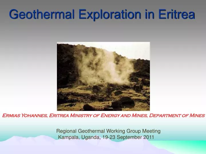
Geothermal Exploration in Eritrea. Ermias Yohannes, Eritrea Ministry of Energy and Mines, Department of Mines. Regional Geothermal Working Group Meeting Kampala, Uganda, 19-23 September 2011. TABLE OF CONTENTS. Introduction Regional Tectonic Setting Geologic and Geothermal Setting

E N D
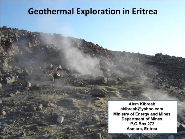
Geothermal Exploration in Eritrea Ermias Yohannes, Eritrea Ministry of Energy and Mines, Department of Mines Regional Geothermal Working Group Meeting Kampala, Uganda, 19-23 September 2011
TABLE OF CONTENTS • Introduction • Regional Tectonic Setting • Geologic and Geothermal Setting • Recommendation
Introduction- Previous works • Geothermal assessment was intiated during 1902 by Angelo Marini from the Italian Institute for Military Geography on Alid geothermal manifestations (Marini, 1938). • UNDP sponsored work was carried out a reconnaissance survey in 1973 by a Geological Survey of Ethiopia team (UNDP, 1973). • In 1992, the late Prof. Giorgio Marinelli and a staff member from the Department of Energy visited Alid area and prepared proposal for detail study. • In 1994, Mikhail Beyth of the Geological Survey of Israel surveyed the Alid hydrothermal area for the possibility of epithermal gold deposition. • A team of staff from the United States Geological Survey (USGS) and the Ministry of Energy and Mines of Eritrea (MEM) carried out a geological and geochemical investigation at Alid and its surroundings during in 1996 (Clynne et al., 1996). • Reinterpretation of the chemistry of water and gas samples (Yohannes, 2004). • Fault and fracture analysis (Yohannes et al., 2006), resistivity survey (Berhe et al, 2006) and hydrogeological investigation (Tesfalidet et al., 2006) was carried out on Alid and surroundings.
Regional Tectonic Setting • zone of crustal extension • Downdropped crustal sections, bounded by deep-rooted normal faults (forming grabens) that cut into the basaltic lavas, extruded in the resulting depressions.
The tectonic setting and geological make up of the Danakil depression provides a suitable environment for the occurrence of geothermal energy. • Alid and Nabbro-Dubbi are the notable prospect
High temperature prospects: Geological and Geothermal Setting Location map of Alid and Nabro-Dubbi geothermal areas
Geological and Geothermal Setting-Alid • 112 Km from Massawa - 30 Km south of Irafaile village • 600 – 900m asl and 700 m uplifted from surrounding • Arid to semi-arid climate 350 – 400C
Alidgeothermal prospect • A high temperature reservoir (2500C) is predicted on the Alid prospect. • Lineament analysis carried out in Alid justify the presence of fracture conducive for reservoir and fluid pathways. • The resistivity survey carried out both MT and TEM signify an anomaly deep at Alid but need more survey points. n.a.: not analyzed; H and O isotopes analyzed using mass spectrometry.
Outline geology of Nabbro-Dubi area Budget • Nabro Lies 2218m asl and 600m above Mabda • Trachytic lava flows and pyroclastic emplace primarily on the Nabro • Dubbi – the largest reported historical 1861 eruption in Africa • Extensive basaltic lava fields cover wide area • The major transverse structure separates the Danakil blocks into two geological set up
Nabro-Dubbi: An active site of geothermal • Reconnaissance survey was conducted • Geothermal manifestations include both fumarole and spring with alteration zones. • It was the site for the current volcanic eruption
RECOMMENDATIONS The current study recommends the following detail works on Alid: Conduct CO2 mapping of the area to clearly identify zones of heat flow. worth to commence MT and TEM geophysical survey Drill slim hole to map temperature gradient of the area. Collect samples for isotopic analysis to exactly constraint the genesis and construct reaction paths. Perform prospect investigation on NabbroDubbi including: Conduct geological mapping. Collect water and gas samples and perform geochemical interpretation.