Download
1 / 26
260 likes | 389 Vues
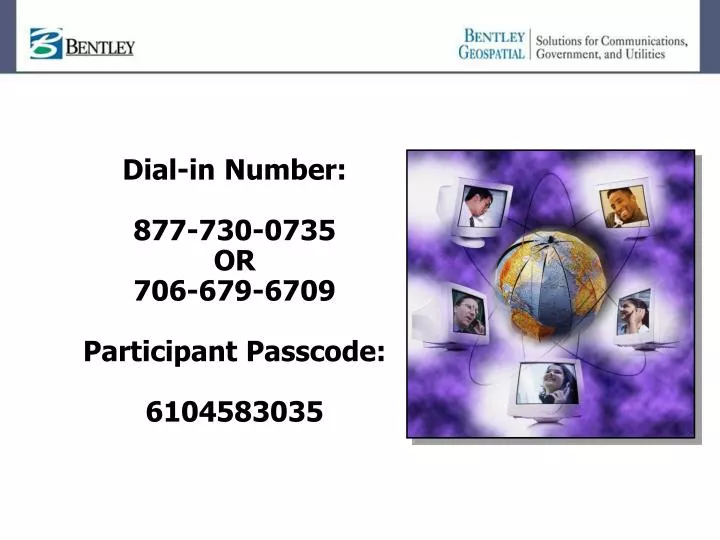
Dial-in Number: 877-730-0735 OR 706-679-6709 Participant Passcode: 6104583035. ProjectWise Connector for Oracle. For mapping and engineering workflows where Oracle is the enterprise data store. Agenda. Oracle Connector Bentley-Oracle Relationship Strategy Connector Workflows

E N D
Dial-in Number: 877-730-0735 OR 706-679-6709 Participant Passcode: 6104583035
ProjectWise Connector for Oracle For mapping and engineering workflows where Oracle is the enterprise data store
Agenda • Oracle Connector • Bentley-Oracle Relationship • Strategy • Connector Workflows • Connector Product Functionality • Product Demonstration • Benefits • Questions & Answers Todd Rothermel Director, Geospatial Products Exton, PA Francois Valois Product Manager, Geospatial Server Products Quebec, Canada
Bentley Geospatial and Oracle • Bentley is an Oracle Certified Partner • Solid long-term relationship • Complementary products • Oracle: Geospatial Datastore • Bentley Geospatial: Design, Build, Data capture, Data analysis, Mapping, etc • Bentley Geospatial products using Oracle • MicroStation GeoGraphics • MicroStation Map • Bentley ProjectWise Connector for Oracle • Bentley Fiber, Bentley Coax, Bentley Inside Plant, Bentley Copper • Oracle is becoming the interoperability standard
Bentley Geospatial Strategy • AEC (Engineers) • Functions • Design, Build, Operate • Data • Models/Documents • Large Scale • Multiple states • Needs • Project Oriented • Combine information • Base maps + Large Scale Plans • Geospatial (Planners) • Functions • Planning, Analysis • Data • Base Maps • Continuous • Medium/Small Scale • Current State • Needs • One source of information Most medium and large organizations have both departments Bentley addresses both sides of the equation
ProjectWise Oracle Spatial database Projects Bentley Geospatial Strategy • Geospatial (Planners) • MicroStation GeoGraphics • MicroStation Map • Other GIS Applications • AEC (Engineers) • ProjectWise • Microstation • Civil products • MicroStation GeoGraphics • MicroStation Map • Comms • Electric Connector
The Connector Strategy • Solves organizational workflows… • Full Integration between the Managed Environment and Spatial databases • Access control, Workflow Management, multi-user editing, audit trail, repeatable, large amount of data,… • Intelligent exchange of data following Oracle standards • More than just data (Relations, Validation rules, Projections,…) • Fidelity • Productive desktop experience • MicroStation GeoGraphics renowned for productive data capture & editing • Fully leverage the XFM Strategy (PBS, PBA,…) • Customizable • Disconnected editing
Oracle Connector - Functionality • Oracle Spatial Geometry • Point, Linestring, Polygon, Polygon w/ Holes, Arcs, Circles, Multipoint, Multilinestring, Multipolygon • Tabular Attributes • Oracle field types supported • Coordinate systems transformation and management • All GeoGraphics coordinate systems supported (5500+) • Oracle workspace manager • Leveraged Oracle Standard versioning system
Oracle Connector - Functionality • Oracle views • Support of database view • Example: To hide SSN information from data editor • Coded Domains • Restrict possible input values when editing • Simple Text • Simple text support based on point • Feature-linked text
Oracle Connector - Support • Oracle Locator or Spatial • Supports 9i (9.2.0.5 and higher) • Supports 10g
Oracle Connector - Workflows • Extract for view only • Extract backdrop info from database • Extract/Modify/Post • Extract data with the intent to modify the feature and to post the result to the database • Post • Post new data to the database
Oracle Connector - Demo • Demo 1 – Extract/Modify/Post w/XFM • Extraction data from Oracle • Data Modification in MicroStation GeoGraphics • Post modifieddata to Oracle
Extracting the project data from Oracle Schema and XFM Environment MicroStation PowerMap Field Mapping Communications Municipal Electric DGN XFM ArcGIS Oracle GeoGraphics 2004 Connector Geo Web Publisher Geospatial Management PowerMap
Extracting the project data from Oracle Schema and XFM Environment PowerMap Field MicroStation Mapping Communications Municipal Electric DGN XFM Extract ArcGIS Oracle GeoGraphics 2004 Connector Geo Web Publisher Geospatial Management PowerMap
Designing with GeoGraphics Schema and XFM Environment PowerMap Field MicroStation Modify (XFM) Mapping Communications Municipal Electric DGN XFM ArcGIS Oracle GeoGraphics 2004 Connector Geo Web Publisher Geospatial Management PowerMap
Posting the data in Oracle Schema and XFM Environment PowerMap Field MicroStation Mapping Communications Municipal Electric DGN XFM Post ArcGIS Oracle GeoGraphics 2004 Connector Geo Web Publisher Geospatial Management PowerMap
Oracle Connector - Demo • Demo 2 – Conflict Resolution • Two “editors” work in same extracted area • Both Modify and post same feature to Oracle • Reconciliation by team leader
Benefits • Extract/Modify/Post from/to Oracle database • Batch Extraction/Post • Disconnected Editing • Workflows, documents and spatial databases integration • User-defined workflow states • Long Transaction
Benefits • Excellent Oracle Database Citizen • Create 100% Oracle Spatial Standard data • Use Oracle Spatial metadata and coordinate systems • Use Oracle standard versioning (Workspace Manager) • Not requiring any proprietary schemas, tables or fields (no MSLink) • Implementation reviewed by Oracle Spatial team • Scalable Solution • Distributed processing • Example: server farm
More Information? • Oracle Connector on Bentley.com • Product Sheet • An overview of the Oracle Connector along with features and prerequisites. • Features and Benefits • Native Oracle Support • Interoperability • Multi-User Editing via Oracle Standard Versioning • Centralized Easy-to-Use Administration Tool • On-the-Fly Coordinate System • Intelligent Information Exchange • Technical Requirements
Coming in XM… • Static document • Disconnected editing, workflow management • Dynamic document • Direct connection to Oracle • Allow editing of database data in a fixed extent (determine by document) • Allow workflow management for document (state and user security combined) • States Example: Initial, Modification, Verification, Approved • Oracle 10G Topology • View only through static document and dynamic document • Extract/modify/post through the dynamic document • Post only through static document
Coming in XM… • Oracle valid time support on geometry table (not yet supported in Oracle topology) • Support of “wm_period” Oracle type • Allow: history/future tracking, historical/future query • Eg: show me the census blocks as they were on the Census 2000 • Eg: show me this planned section of highway as it will be in 2007 • DGN2SDO data loader • Convert raw DGN into SQL Loader Scripts (geometry and topology)
Future Technology Spotlights • December 14, 2005 • Bentley Water/Wastewater • January 11, 2006 • MicroStation Map • February 8, 2006 • MicroStation Map for Land Management Register today at www.bentley.com!