Download
1 / 23
230 likes | 233 Vues
This research focuses on detecting and locating mesoscale oceanographic features, such as eddies and upwelling, using high-resolution satellite data. The approach utilizes dominant patterns and variability to characterize the spatial segmentation properties of these features. This tool will provide oceanographers with unprecedented synopticity and the ability to study these phenomena in real-time.

E N D
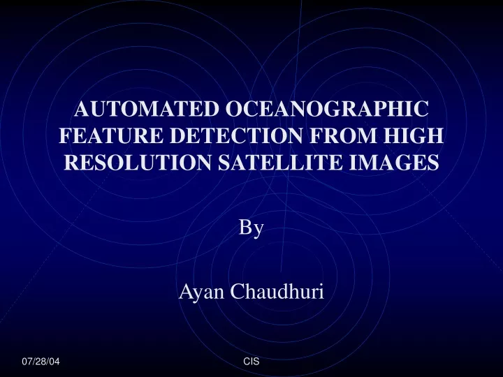
AUTOMATED OCEANOGRAPHIC FEATURE DETECTION FROM HIGH RESOLUTION SATELLITE IMAGES • By • Ayan Chaudhuri 07/28/04 CIS
Topics Of Discussion • Objective • Background • Related Work • Theory • Methodology • Results • Future Work • Summary
Background • Satellites remotely measure different energy levels of a parameter of interest. • Remote Sensors for oceans • Advanced Very High Resolution Radiometer (AVHRR) • Sea-viewing Wide Field-of-view Sensor (SeaWiFS) • Moderate Resolution Imaging Spectroradiometer (MODIS) • Parameter of interest for oceans • Sea Surface Temperature (SST) • Chlorophyll_a (Color)
Objective • Objective is to detect and locate mesoscale oceanographic features, such as eddies and upwelling by processing of high-resolution Sea Surface Temperature (SST) and Chlorophyll_a (Ocean Color) observations from satellite data. • Approach is to identify these features by utilizing their dominant patterns and variability to characterize their spatial segmentation properties.
Objective • It will provide a tool for oceanographers to observe mesoscale, submesoscale and fine-scale features with unprecedented synopticity. • It will allow researchers to study these phenomena from real-time data.
Related Work • Most of the previous work in learning about mesoscale and fine-scale ocean features have been done using computer based Ocean Modeling. • Circulation models that have been developed to quantitatively reproduce structures like eddies, fronts, filaments, meanders and upwelling regions. • Lack of proper assimilation of real-time data may well create errors on spatial and temporal scales.
Related Work • Remote sensing and visualization has contributed immensely in understanding ocean features. • Remote sensing has become a mainstay of many research efforts for nowcasting and forecasting ocean systems using SST and Ocean Color datasets. • Visualization techniques provide mechanisms to aid researchers to observe physical phenomena with respect to ocean sciences. • Effective schemas should be able to extract regions, accurately classify and visualize them.
Theory Source: NASA JPL • Mesoscale Eddies • Eddies are ocean vortices that are created when a large meander loops back on itself and detaches from the main current. • Have a water temperature different from surrounding water. • Spatial scale ranging from 10 to 100 km horizontally.
Theory • Coastal Upwelling Regions Source: oceanoasis.org • Wind – driven phenomenon that brings cold, nutrient rich water from the deep ocean to the surface. • The cold nutrient-rich deep water enhances biological productivity. • Have a water temperature colder from surrounding water.
Methodology • Mesoscale structures is that they have physical characteristics that are different from the water surrounding them –basic criteria of feature detection • Eddy Tracer Equation by (Gangopadhyay et.al.) • T(r) = Tc - [Tc - Tk] {1-exp(-r/R)} • ‘r’ is the radial distance from the center of the eddy. • ‘Tk’ is the background temperature. • ‘Tc’ is the core temperature. • R= 5*R0, where R0 is the Rossby radius.
Algorithm • Eddy/Upwelling Detection • Inputs of core temperature( Tc), background temperature (Tk) and radial distance (r) from user. • Datasets thresholded with Tc and Tk. • Radial distance provided by user, converted to pixel distance.
Algorithm • Disk Shaped Structuring Element (SE) is constructed using r with error measure at 70%. • SE is traversed to identify regions of interest. • The center of mass of identified candidate regions are calculated. For near-circular eddies center of mass is eddy center else it’s the centroid of the regions. • After initial segmentation, positive identification of eddy and upwelling regions differ which is attributed to their individual characteristics.
Algorithm • Eddy Specific Detection (E) • E9. Circular definition of eddies facilitates us to expect a sharp change in temperature gradient occurring at a uniform distance from eddy center. • E10.each region is concentrically traversed outward in circular iterations starting from the center of mass. • E11.normalized temperature value is calculated in each iteration as we move outward in a circle. • E12.expected temperature within the eddy will be comparable, we place the normalized values in the proximity (1/2 stipulated distance) of the center of mass into a regression line algorithm.
Algorithm • Eddy Specific Detection (E) • E13.Perform least Squares Fit Linear Regression to determine co-efficients a0 and a1. • y = a0 + a1 t • where, a0 = intercept; a1= slope; and • t = distance from the center of mass • E14.Near (-1/2 stipulated distance) to the expected eddy boundary subsequent normalized temperature values are compared to fit the curve equation. If outlier found (2 S.D) into a regression line algorithm, it is marked a sharp temperature gradient.
Algorithm • Eddy Specific Detection (E) • E15. The region is marked as a positive eddy identification and eddy boundary is contoured based on current distance from eddy center. • E16. If no outlier is identified till (+1/2) stipulated distance, the region is rejected.
Algorithm • Upwelling Specific Detection • U9. upwelling regions do not have a defining shape like eddies, however as they are enclosed regions • U10.They will have a sharp increase in the temperature gradient around their boundaries. • U11.Similar to eddy detection, it is reasonable to expect that the temperature around the center of mass to remain uniform • U12.start at a random direction from the center of mass and keep moving outward, placing points close (1/2 stipulated distance) to the center into a regression equation
Algorithm • Upwelling Specific Detection • U13.Normalized temperature values of points beyond this limit are compared for extreme variation. • U14.If outlier (2 SD) found in curve fitting, it is marked as possible upwelling edge. If no outlier till (+1/2 stipulated distance) continue to next step. • U15.Repeat process by changing direction by 1 deg, and go around all 360 degrees, marking outliers. • U16.If no. of hits (outliers found in one direction) to total no. of directions is 60%, the region is identified as a positive upwelling region else the region is rejected.
Results SST- Monterey Bay, CA. 08/15/2003AVHRR Eddy Inputs Tc = 18 degC Tk = 18.5 degC R = 50 km Upwelling Inputs Tc = 12 degC Tk = 15 degC R = 25 km
Results Color- Monterey Bay, CA. 08/15/2003SeaWifs This feature was detected in the SeaWIFS Chlorophyll image and then overlaid onto the AVHRR SST plot, just above the detected eddy. This result highlights a dynamic feature of the recognition system. The mushroom feature identified in the ocean color dataset goes unnoticed to the naked eye in the SST dataset for the same region. Thus our system provides a platform to combine both ocean color and SST datasets that could result in detection of invisible features in either of the datasets.
Results- Color: Gulf of Mexico 03/18/2002MODIS Eddy Inputs Tc = 0.5 mg/m3 Tk = 0.45 mg/m3 R = 50 km These results establish that the recognition system is data independent and can be used to perform detection on any scientific dataset.
Future Work • Enhancing the SE technique to obtain accurate contours of the physical mesoscale features. • Providing further evidence of our system as a correlating platform amongst SST and Ocean Color datasets. • Designing a feature-tracking algorithm by using visualization techniques such as 2-D motion analysis mechanism. • Utilizing extracted feature observations in interpreting physical sub-surface flow based on current feature-oriented modeling techniques. • Exporting of the user interface into an open-ended web application to provide quantitative feature related information using this system for nowcasting and forecasting.
Summary • An automated approach to identify and detect oceanographic features from high resolution satellite images of SST and Ocean Color was presented. • Approach relies on a set of input values about the features of interest • Algorithm is based on prior oceanographic knowledge of these ‘features’ and image processing techniques. • Application was demonstrated on Monterey Bay, CA and Gulf of Mexico. • Additionally a case was presented where the algorithm was used for both SST and ocean color to extract more information than each of the individual images. • Algorithm was shown to be dataset independent by using it AVHRR, SeaWifs and MODIS datasets.
References [1] A. Gangopadhyay, A.R. Robinson, and H.G. Arango, Circulation and Dynamics of the Western North Atlantic, I: Multiscale Feature Models. Journal of Atmospheric and Oceanic Technology,14(6), 1997, 1314-1332. [2] A. Gangopadhyay, A.R. Robinson, P.J. Haley, W.J. Leslie, C. J. Lozano, James J. Bisagni, and Z. Yu, Feature Oriented Regional Modeling and Simulation (FORMS) in the Gulf of Maine and Georges Bank, Continental Shelf Research, 23(3-4), 2003, 317-353. [3] A. Gangopadhyay, and A.R. Robinson, Feature oriented regional modeling of Oceanic Fronts, Dynamics of Atmosphere and Oceans, 36(1-3), 2002, 201-232. [4] A.Gangopadhyay and A.R. Robinson, Circulation and Dynamics of the Western North Atlantic, III: Forecasting the Meanders and Rings. Jour. of Atmospheric and Oceanic Technology, 14(6), 1997, 1352-1365. [5] W.S. Brown, A. Gangopadhyay, F.L. Bub, Z.Yu, G.Strout, and A. Robinson, An operational system for nowcasting and forecasting Gulf of Maine Circulation, Submitted to Journal of Marine Systems, 2004. [6] Balasubramanian, R., A. Tandon, B. John and V. Sood, Detecting and Tracking of Mesoscale Oceanic Features in the Miami Isopycnic Circulation Ocean Model.The IASTED International Conference on Visualization, Imaging, and Image Processing VIIP, Benalmedena, Spain, 2003, 169-174. [7] Li P., Supercomputing Visualization for Earth Science Datasets.Proceedings of 2002 NASA Earth Science Technology Conference, Pasadena, CA, 2002. [8] Wallcraft A.J, Hurlbert H. E, Metzger E.J, Rhodes R. C.,Shriver J.E, Real-time Ocean Modeling System, Computing in Science and Engineering, IEEE Computer Society and American Institute of Physics, 2002, 4(2), 50-57. [9] Lehner, S., J. Schulz-Stellenfleth, B. Schattler, H. Breit and J. Horstmann, Wind and wave measurements using complex ERS-2 SAR wave mode data, IEEE Trans. Geosci. Rem. Sens., 2000, 38(5), 2246-2257. [10] D. Silver and Xin Wang, Volume Tracking, Proceedings of IEEE Visualization, San Francisco, CA, 1996, 157-164. [11] K.H. Brink, R.C. Beardsley, J.Paduan, R. Limeburner, M.Caruso, and J.G. Sires, A view of the 1993-1994 California Current based on surface drifters, floats, and remotely sensed data, Journal of Geophysical Research, 2000, 105(C4), 8575-8604. [12] J.F. Cayula and P. Cornillon, Edge detection Algorithm for SST images, Journal of Atmospheric and Oceanic Technology, 1992, 9(1), 67-80.