Download
1 / 45
450 likes | 463 Vues
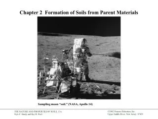
4. FORMATION OF SOILS. Q: What is Soil?. The word ‘soil’ means different things to different disciplines:. Geology Soil science Engineering.

E N D
Q: What is Soil? The word ‘soil’ means different things to different disciplines: • Geology • Soil science • Engineering But basically it may be defined as the solid material on the earth’s surface that results from weathering on the soil parent material or underlying hard rock. • To an engineer:any unconsolidated material above bedrock.
Weathering Weatheringis the process of breaking down rocks by mechanical and chemical processes into smaller pieces. I. Mechanical Weathering: “Disintegration” It is the physical disintegration of the original rock mass into smaller particles without any change in the chemical composition. Common Processes: • Unloading e.g. uplift, erosion, or change in fluid pressure. • Thermal expansion and contraction (Insolation) • Expansion or contraction of rock, caused by temperature changes result in the development of thermal stresses in rocks. • The repeated heating and cooling exerts stress on the outer layers of rocks, which can cause their outer layers to peel off in thin sheets.
Alternate wetting and drying • Crystal growth, including frost action • When water that has entered the joints freezes, the ice formed strains the walls of the joints and causes the joints to deepen and widen. When the ice thaws, water can flow further into the rock. Repeated freeze-thaw cycles weaken the rocks which, over time, break up along the joints into angular pieces. • Organic activity • Growth of plant roots in a crevice of rocks exert physical pressure as well as providing a pathway for water and chemical infiltration.
II. Chemical Weathering Chemical weathering occurs in all environment, but is dominant in hot and humid lands where: • Temperatures are high • Large amounts of water are available • Vegetations flourishes Common Processes: 1. Solution (Carbonation) Disassociation of minerals into ions, aided by the presence of carbon dioxide. Carbonation occurs on rocks which contain calcium carbonate, such as limestone. 2. Oxidation The combination of oxygen with a mineral to form oxides or hydroxides.
3. Hydrolysis Hydrogen ions in percolating water replace mineral cations (no reduction-oxidation occurs) Example: during hydrolysis, the feldspar in granite changes to clay mineral which crumbles easily, weakening the rock and causing it to break down. 4. Reduction The release of oxygen from a mineral to its surrounding environment. 5. Hydration Water combines with a rock constituent producing a mineral that has a hydroxyl groups (OH) in its structure. Ex. Anhydrite ---- Gypsum
Rates of Weathering of Rocks • Rocks weather chemically according to the rate at which their constituent minerals weather. • Limestone weathers the most rapidly because it dissolves so readily in water. This may lead to collapse of ground. • Sandstone and shale are more resistant to chemical weathering • Fine-grained rocks weather more slowly than coarse-grained rocks of the same mineral composition. • Igneous rocks (excluding certain volcanic rocks that weather rapidly) and quartzite are the most resistant.
Soil Forming Factors Soils develop as a result of the interplay of 5 factors; Parent material, climate, organisms, relief and time.
Parent Rock Residual soils Transported soils in situ weathering (by physical & chemical agents) of parent rock ~ weathered and transported far away by wind, water, ice, gravity.
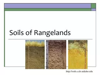
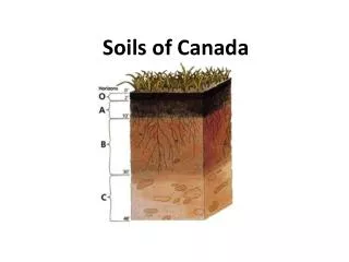
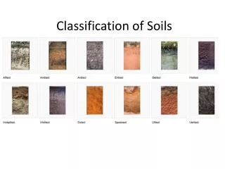
Residual Soil Profile A. RESIDUAL SOILS These are soils which were formed in its present location through weathering of rocks. • A soil profile or weathering profile is a natural succession of zones or strata below the ground surface. It can be seen if a vertical cut is made in a residual soil, the vertical section is called soil profile. Residual Soil Horizon • Soil Horizons are the individuallayers of a soil profile. The boundary between individual soil layers (horizons) may be sharp or gradual.
Soil Horizons • O: Organic layer:: organic (black) • A: layer of maximum leaching: Mineral (dark) • E: Leached (pale) • B: Layer of maximum deposition: Accumulation • C: Weathered parental material: Little-altered • R: Parental material: Unweathered • Soil profiles may extend to various depths, and each stratum may have various thicknesses. • The boundaries between individual horizons may be sharp or gradual.
B. Transported Soils These are soils which were formed from rock weathering at one site and are now found at another site. The transporting agent may be: • Water (Principal transporting agent) • Glaciers • Wind • Gravity Transported soils are very important in engineering because nearly all major cities are located, at least in part, on flood plains, deltas, and coastal plains.
The transported soils may be classified into several groups, depending on their mode of transportation and deposition: • Glacial soils— formed by transportation and deposition of glaciers 2. Alluvial soils—transported by running water and deposited along streams 3. Lacustrine soils—formed by deposition in quiet lakes 4. Marine soils—formed by deposition in the seas 5. Aeolian soils—transported and deposited by wind 6. Colluvial soils—formed by movement of soil from its original place by gravity, such as during landslides
Common Soil formations in the Kingdom 1. Sabkhas • These are deposits which accumulates along coastal lines exposed to hot dry weather and prolonged evaporation. This deposit is called salt flats or in Arabic Sabkhas or Sebkhas. • Definition: Sabkhas are mudflat contain extensive deposits, brown in color, of wind – blown sand mixed with crystals of salt and sulphates of calcium. • Sabkha deposits cover vast areas of the coast of middle eastern and North African countries.
Development of Sabkha Deposits • A barrier is formed • A sediment is formed behind the barrier which entrapped with it sea water. • Carbonate and sulphate minerals are deposited within the sedimentary layers of the sabkha (deposit which is entrapped behind the barrier). The chemical precipitates, or evaporites, are laid down in cycle, with gypsum and anhydrite forming first, and then dolomite forming by reaction between brines (salt water) and underlying carbonate sediment. • Some salt water is precipitated on the sediments from the bordering sea. • Water evaporates with time and sabkha deposit formed.
Engineering Problems Associated with Sabkhas • Sabkhas are not good as foundation materials, special provisions are needed when building on them. • The groundwater within sabkhas is usually hypersaline • Some sabkha deposits contain appreciable organiccontents. • Sabkha soils are designated as one of the problematic soil formations encountered here in the Kingdom.
المشاكل الفنية للتربة الموجودة في المملكة الاشتراطات الفنية لإعداد الدراسات الجيوتقنية (وزارة الشؤون البلدية والقروية) السبخة Sabkha : السبخة هي ترسبات ملحية مختلطة بتربة رملية أو طميية مع قليل من الطين ، توجد في المناطق الساحلية الحارة على ساحل البحر الأحمر والخليج العربي ، وتكونت هذه الترسبات بفعل تشبع التربة بمياه البحر المالحة مع سرعة تبخر المياه السطحية منها بفعل أشعة الشمس والحرارة الزائدة تاركة الترسبات الملحية ، وتمتاز تربة السبخة بضعفها وقابليتها للانضغاط والهبوط لاحتوائها على نسبة عالية من الفراغات ونسبة رطوبة عالية ، كما تمتاز بتميعها في حالة حدوث هزات أرضية، ولقد تسبب هذا النوع من التربة في العديد من المشاكل الجيوتقنية والتي منها الهبوط الغير منتظم والانهيارات.
2. Sand Dunes They are sand deposits formed by wind action rolling the sand, which is too large for air transport, along the ground until abstraction is met, whereupon a dune (or mound) forms.
Soil-Particle Size Grain size of soil refers to the diameters of the soil particles making up the soil mass. This is however a loose description of soil since most soil particles have irregular shapes and are not round. The sizes of the soil particles are important factors which influence soil properties including: • Strength • Deformation • Permeability • Suitability as a construction materials like in dams and sub base for pavements.
Depending on the predominant size of particles within the soil, the sizes of particles that make up soils vary over a wide range. Soils generally are called: • Gravel • Sand • Silt • Clay • To describe soils by their particle size, several organizations have developed particle-sizeclassifications.
Mechanical Analysis of Soils Mechanical Analysis is the determination of size of particles in a soil, expressed as a percentage of the total dry weight. Two methods generally are used to find the particle size-distribution of soil: • Sieve Analysis: for particle size greater than 0.075 mm in diameter (i.e. Gravel and Sand). • Hydrometer Analysis: for particle size smaller than 0.075 mm in diameter (i.e. Silt and Clay).
Sieve analysis consists of shaking the soil sample through a set of sieves that have progressively smaller openings. Sieve Analysis • The sieve is given a number that correspond to the number of opening per LINEAR INCH of screen, for example NO. 4 sieve has four 0.187-in openings per inch. • The complete procedure for this test is outlined in ASTMC 136 and AASHTOT 27.
Hydrometer Analysis • Based on the principle of sedimentation of soil grains in water. • It is assumed that all the soil particles are spheres. Stoke’s Law Refer to CE 380
Limitation of Using Stoke's Equation in Hydrometer Analysis: • Stoke’s equation was developed using a sphere, whereas most silt and practically clay particles are platey shaped. (Hence the hydrometer method is more applicable to Silts than to Clays). • Stoke’s equation was developed using only a single sphere, which in soil sample many particles are present, and they affect the settlement (fall) of each other. Also particles next to the wallare affected. • The specific gravity of Stoke’s sphere was accurately known, which in the hydrometer analysis only the averageGs issued. • The adsorbed water along the surface of clay particles affect their falls.
IMPORTANT NOTES • It must be realized that there is a difference in the definition of particle size as measured by the sieve and hydrometer analysis. Sieve analysis gives the INTERMEDIATE dimension of a particle; hydrometer analysis gives the diameter of a SPHERE which would settle at the same rate as the soil particles. This led to discontinuity in the gradation curve when the two results overlap. • The particle size equal to the No. 200 sieve opening is considered to be about the SMALLEST individual particle that can be seen by the unaided (naked) human eye. • We use logarithmic scale in the abscissa of the gradation curve because of the range of possible particle sizes in soils is TREMENDOUS.
Particle (GRAIN)-Size Distribution Curve The results of mechanical analysis (sieve and hydrometer analysis) are generally presented by semi logarithmic plots known as GRAIN or PARTICLE-SIZE DISTRIBUTION CURVES. 1. Effective Size D10 2. Uniformity Coefficient 3. Coefficient of Gradation
Characteristics of the Grain size Distribution Curve The appearance (shape) of the particle-size distribution curve depends on the range and amounts of the various sizes of particles in the soil sample. These in turn have been affected by: • The soils’s origin • The method of deposition Types of soils with regard to shape of their distribution curves: 1. Well-graded soil: The curve is smooth and covers a wide range of sizes. This indicates that the soil is NON-UNIFORM.
2. Poorly-graded soil: The curve is nearly vertical. This indicates that the soil is UNIFORM. 3. Gap-graded soil: This is the case when intermediate sizes are absent. This could be the case when two separate soils are mixed. Requirements for a soil to be Well- Graded If the soil fails one or both, of these criteria, it is considered to be POORLY-GRADED.
0.075 mm 4.75 mm 2.0 mm 0.425 mm
Remarks: • Cu and Cc have no meaning when more than about 10% of the soil passes the No. 200 Sieve. • Ccis also known as curvature coefficient or concavity coefficient. • The uniformity coefficient Cu is misnamed since the smaller the number the more UNIFORM the gradation. So it is really a coefficient of “DISUNIFORMITY”. • The D50 of a soil is the median particle size. • The D85 and D15 sizes are used to design filters for drainage systems in EARTH DAMS and other structures.
Particle Shape The shape of particles present in a soil mass is equally as important as the particle-size distribution because it has significant influence on the physical properties of a given soil such as void ratio, strength, compressibility, etc.. Bulky • Bulky • Flaky • Needle shape
Specific gravity, Gs Specific gravity is defined as the ratio of the weight of a unit of volume of any material to the weight of a unit volume of water at 4oC. i.e. the specific gravity of a certain material is ratio of the unit weight of that material to the unitweight of water at 4oC. Gw = 1 Gmercury = 13.6 Ggold = 19.3 The specific gravity of soil solids is often needed for various calculations in soil mechanics.
The specific gravity of sand, which is mostly made of quartz, may be estimated to be about 2.65; for clayey and silty soils, it may vary from 2.6 to 2.9.