Download
1 / 28
280 likes | 342 Vues
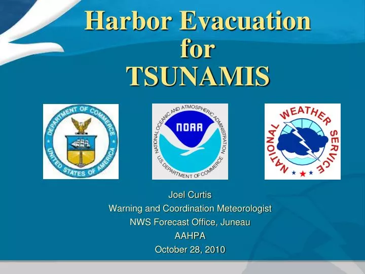
Harbor Evacuation for TSUNAMIS. Joel Curtis Warning and Coordination Meteorologist NWS Forecast Office, Juneau AAHPA October 28, 2010. Purpose. The NWS primary mission is to protect life and property from natural hazards, and to enhance the welfare and economy of the Nation.

E N D
Harbor Evacuationfor TSUNAMIS • Joel Curtis • Warning and Coordination Meteorologist • NWS Forecast Office, Juneau • AAHPA • October 28, 2010
Purpose • The NWS primary mission is to protect life and property from natural hazards, and to enhance the welfare and economy of the Nation. • Raise Awareness of the Threat of Tsunamis and the Considerations for a Harbor Evacuation • PLAN AHEAD !
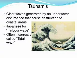
Harbor Evacuation? “The life-blood of our communities is in our harbors.”
State of Tsunami Prediction & Warnings • Earthquake Detection – Excellent • Tsunami Generated ? – Good • Detection / Evaluation – Good as the Observations • Arrival Timing – Very Good (First Wave) • Wave Height – Fair (Models) Not in the Forecast yet • Inundation Maps – Some Progress • Preparedness – NEVER ENOUGH ! • Dissemination – Good and Getting Better - “Tsunami Portal”
Tsunami Behavior • NOT A SINGLE WAVE – may last for HOURS • TOTAL WATER COLUMN “ten min. surge” • Second Wave may biggest • WAIT FOR OFFICIAL “ALL CLEAR”
Four new threat levels • Defined between coastal break points
Tsunami WARNING Thresholds • Magnitudes less than 7.0 • Tsunami information statement • Magnitudes from 7.1 to 7.5 • Warningfor an area within 350km either side of the epicenter (e.g., 700 km warning area) • Magnitudes 7.6 to 7.8 • Warningfor an area within 500km either side of the epicenter (e.g., 1000 km warning area) • Magnitudes 7.9 and greater • Warningif wave arrival within 3 hours travel time from epicenter • - Watch if wave within 6 hours travel time from epicenter Good Friday Alaska Earthquake – 1964 Magnitude – 9.2 http://wcatwc.arh.noaa.gov/
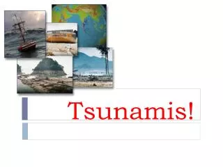
Potential Advisory Level Damage Crescent City after the Kuril Island quake / tsunami of 11-15-2006 Dengler et. al. Santa Cruz harbor, CA - 14 hours after the Chilean quake 2/27/2010
Potential Warning level damage Pago Pago Samoa 9-29-2009 7 m runup Khao Lak : 12-26-2004 12 m runup
How will YOU and your customers find out? • Emergency Alert System (EAS Radio TV) • EM Sirens, City Radio, Phone Tree Call-out • NOAA Weather Radio Alert • Internet Alerts • “Voluntary” Commercial Radio & TV • AKWAS “Red Telephone” • Amateur Radio • Grapevine in Villages
Human Psychology • Research – 3 Independent Confirmations • Takes TIME! • NWS uses multiple channels • At this point…NO WAVE HEIGHT FOR YOUR HARBOR • Warning > 1.0 m Advisory < 1.0 m • The NWS will not advise you what to do… • SO WHAT HAPPENS?
DECISION • Independent Confirmation(s) • Evaluate Threat • Evacuate or Not • Get to Higher • Ground ! ( EM )
PLAN AHEAD! • Role of the Harbormaster • Role of the Harbor Staff • Vessel Owners / Operators • Emergency Manager • Police / Fire / USCG • It is much better to work this out now than during the event!
Evaluate • WARNING, WATCH, or ADVISORY ? • ARRIVAL TIME (first wave) • Proximity to “SAFE” Water • Time of Day • Weather • Tide • Other Factors • History • Effective Plan • Practice
More Questions • Lines of Authority – Who’s in Charge? • Do your customers know about Tsunamis? • Pros and Cons of Evacuation? • Pros and Cons of NOT Evacuating? • Evacuation Orders by Local Authority • The answers are only possible through preparedness planning!
Plan Consultants • Your Emergency Manager • Your LEPC • USCG • NWS • Network of Harbormasters • AK DHS&EM • Most of All: Your Experience You might need a traffic cop?
Evaluate (cont’d) Wave Direction? Safe Zones?
8) Plan Considerations Slow, but seaworthy! • Owner / Ops Contacts • Time / Dist 50 FA • Community Involvement • Channel / Entrance • Vessel Types • Boat Launch / Ramp • Communications (VHF, cell phone lock-up) • Curiosity / Congestion • Can you think of many more?
9) Practice 50 FA • Table Top • Practical / Drill • Monthly Comms Test
Tsunami Portal • Forecasted and observed sea levels at forecast points • Well organized travel times and forecast data • Special product permissions • Both centers are represented
Chile • CHILE 2/27/10
Director Paul Whitmore West Coast and Alaska Tsunami Warning CenterPalmer AK907 - 745 - 4212 http://tsunami.gov Tsunami Operations Center
Alaska Region Partners Office of Response and Restoration a.k.a NOAA HAZMAT
Contacts Get to know your WCM! • WCATWC: Bill Knight 745 – 4212 • AK Region: Jeff Osiensky 271 – 5132 • Anchorage: Sam Albanese 266 - 5117 • Fairbanks: John Lingaas 458 - 3712 • Juneau: Joel Curtis 790 - 6803
NWS Commitment!We can give you more than the forecast! • How can we help you better in Operations? • We are Available : Phone, Internet, Person • Preparedness and Mitigation ...Getting ready for the next one makes everyone’s job easier during and after the event. • Science – Meteorology and Oceanography • Forensics – Historical Data and Analysis • New Products and Services
Above All…Tell Us What You Need - • We will work very hard to provide it !