Download
1 / 64
670 likes | 859 Vues
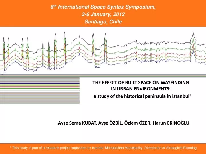
8 th International Space Syntax Symposium, 3-6 January, 2012 Santiago, Chile. THE EFFECT OF BUILT SPACE ON WAYFINDING IN URBAN ENVIRONMENTS:. a s tudy of the h istorical p eninsula in İstanbul 1. Ay ş e Sema KUBAT, Ayşe ÖZBİL , Ö zlem Ö ZER, Harun EK İ NO Ğ LU.

E N D
8th International Space Syntax Symposium, 3-6 January,2012 • Santiago, Chile THE EFFECT OF BUILT SPACE ON WAYFINDING IN URBAN ENVIRONMENTS: • astudy of the historicalpeninsula in İstanbul1 Ayşe Sema KUBAT, AyşeÖZBİL, ÖzlemÖZER, Harun EKİNOĞLU 1This study ispart of a research project supported by Istanbul Metropolitan Municipality, Directorate of Strategical Planning.
Introduction Research Background Analytical Framework Study area Spatial Layout and Wayfinding Behavior Conclusion The Effect of Built Space on Wayfinding in Urban Environments: A Study of the Historical Peninsula in İstanbul KUBAT, A. S.; OZBIL, A.; OZER, O.; EKINOGLU, H.
Introduction • Research Background • Analytical Framework • Study area • Spatial Layout and Wayfinding Behavior • Conclusion The Effect of Built Space on Wayfinding in Urban Environments: A Study of the Historical Peninsula in İstanbul KUBAT, A. S.; OZBIL, A.; OZER, O.; EKINOGLU, H.
Introduction • The question asked here is whether the configuration of urban space influences the patterns of exploration in an urban environment, over and above the influence that may be exerted by development densities. • The study investigates mainly the accessibility and visibility properties of urban layouts but also aims to unveil the significance of local urban design parameters in shaping the patterns of wayfinding behavior. This paper reconsiders the question of how the built environment, in terms of the spatial configuration of urban layout and land-use patterns, affects wayfinding performance. The Effect of Built Space on Wayfinding in Urban Environments: A Study of the Historical Peninsula in İstanbul KUBAT, A. S.; OZBIL, A.; OZER, O.; EKINOGLU, H.
Introduction Bosphorous Golden Horn Marmara Sea This study is part of an ongoing research supported by Istanbul Metropolitan Municipality, whose primary aim is to enhance the spatial and visual organization of Istanbul’s Historic Core by evolving a spatial regeneration strategy from the perspective of the pedestrian. The Effect of Built Space on Wayfinding in Urban Environments: A Study of the Historical Peninsula in İstanbul KUBAT, A. S.; OZBIL, A.; OZER, O.; EKINOGLU, H.
Introduction • Research Background • Analytical Framework • Study area • Spatial Layout and Wayfinding Behavior • Conclusion The Effect of Built Space on Wayfinding in Urban Environments: A Study of the Historical Peninsula in İstanbul KUBAT, A. S.; OZBIL, A.; OZER, O.; EKINOGLU, H.
Research Background • In an attempt to quantify the built environment, most of the related literature has addressed two dimensions of urban form: accessibility and visibility patterns of spatial layouts. A wide range of disciplines has investigated the ways in which people understand, represent and move around the built environment.The common difficulty within these disciplines is finding ways to describe and quantify the configurational variables of the physical environment in a systematic way. The Effect of Built Space on Wayfinding in Urban Environments: A Study of the Historical Peninsula in İstanbul KUBAT, A. S.; OZBIL, A.; OZER, O.; EKINOGLU, H.
Research Background • Theories regarding how the accessibility patterns of urban networks affect wayfinding behavior have mainly focused on two aspects of urban structure: • metric distance (total path length); • directional distance (number of turns along the path). The Effect of Built Space on Wayfinding in Urban Environments: A Study of the Historical Peninsula in İstanbul KUBAT, A. S.; OZBIL, A.; OZER, O.; EKINOGLU, H.
Research Background • Since understanding the layout of a city involves operationalizing the sequence of views created with one's movement in the environment, researchers have developed a set of analytical measures –isovists, viewsheds, ‘alllinesmap’, etc.– to quantify the visual dimensions of spatial environments. Direction changes have been confirmed to have significant impact on cognitive effort during navigation.Studies on spatial cognition demonstrate that increased number of direction changes reduce the accuracy of orientation and spatial cognition as well as affectingtheestimation of metricroutelength. The Effect of Built Space on Wayfinding in Urban Environments: A Study of the Historical Peninsula in İstanbul KUBAT, A. S.; OZBIL, A.; OZER, O.; EKINOGLU, H.
Research Background Using these measures, studies on wayfinding research have found that the visual dimension of built space has a strong influence on the way people move around in such complex built environments. However; since visual perception is relatively a local spatial property compared to the overall pattern of street connections within the entire urban network, navigation through any complex environment requires a multilayered description of the spatial structure. The Effect of Built Space on Wayfinding in Urban Environments: A Study of the Historical Peninsula in İstanbul KUBAT, A. S.; OZBIL, A.; OZER, O.; EKINOGLU, H.
Introduction • Research Background • Analytical Framework • Study area • Spatial Layout and Wayfinding Behavior • Conclusion The Effect of Built Space on Wayfinding in Urban Environments: A Study of the Historical Peninsula in İstanbul KUBAT, A. S.; OZBIL, A.; OZER, O.; EKINOGLU, H.
Analytical Framework Building on the existing literature, the theoretical question that this paper deals with is: How do connectivity patterns, visual fields, and land-use compositions interact to anticipate patterns of wayfinding behavior? In exploring this question, we concentrate on a syntactic analysis of directed search performance. Thus, we chose to describe the configurational properties of the urban space with regard to both street connectivity and visibility patterns to determine the extent to which spatial patterns affect navigational performance. The Effect of Built Space on Wayfinding in Urban Environments: A Study of the Historical Peninsula in İstanbul KUBAT, A. S.; OZBIL, A.; OZER, O.; EKINOGLU, H.
Analytical Framework The analysis is based on standard segment-based representations of street networks according to street center-lines. • 1Peponis, J., Bafna, S., Zhang, Z. (2008). The connectivity of streets: reach and directional distance. Environment and Planning (B): Planning and Design, 35: 881-901. Segment-based Measures of Connectivity Streetconnectivity measures applied in this research were developed by Peponis et al.1 at GaTech. They offer a systematic framework through which to evaluate the urban fabric in terms of its potentiality(density of streets) and structure (directional bias based on configuration). The Effect of Built Space on Wayfinding in Urban Environments: A Study of the Historical Peninsula in İstanbul KUBAT, A. S.; OZBIL, A.; OZER, O.; EKINOGLU, H.
Analytical Framework • Segment-based Measures of Connectivity • The unit of analysis is the road segment. Road segments may contain one or more line segments. • 1Peponis, J., Bafna, S., Zhang, Z. (2008). The connectivity of streets: reach and directional distance. Environment and Planning (B): Planning and Design, 35: 881-901. The Effect of Built Space on Wayfinding in Urban Environments: A Study of the Historical Peninsula in İstanbul KUBAT, A. S.; OZBIL, A.; OZER, O.; EKINOGLU, H.
Analytical Framework This is measured by the total street length accessible from each road segment moving in all possible directions up to a parametrically specified metric distance threshold. Peponis et al. (2008). Segment-based Measures of Connectivity Metric reach captures the density of streets and street connections accessible from each individual road segment. The Effect of Built Space on Wayfinding in Urban Environments: A Study of the Historical Peninsula in İstanbul KUBAT, A. S.; OZBIL, A.; OZER, O.; EKINOGLU, H.
Analytical Framework • This is measured by the street length which is accessible from each road segment without changing more than a parametrically specified number of directions. Peponis et al. (2008). Segment-based Measures of Connectivity Directional reach measures the extent to which the entire street network is accessible with few direction changes. The Effect of Built Space on Wayfinding in Urban Environments: A Study of the Historical Peninsula in İstanbul KUBAT, A. S.; OZBIL, A.; OZER, O.; EKINOGLU, H.
Analytical Framework Isovists are of interest to spatial analysis, because they offer a systematic framework of addressing the relationship between the navigator and her immediate spatial environment. Depthmap2was used for the visibility graph analysis. To study a large urban complex such as the Sultanahmet district, one global and two local measureswere used. Visibility Graph Analysis VGA identifies the extent towhich locations are mutually visible in a spatial network. Two nodes are connected if the corresponding locations are mutually (both) visible (foreachother). The Effect of Built Space on Wayfinding in Urban Environments: A Study of the Historical Peninsula in İstanbul KUBAT, A. S.; OZBIL, A.; OZER, O.; EKINOGLU, H.
Analytical Framework visual integration (HH) describes the relative visibility of a point to all others withinthe system; reflects the centrality of a node with respect to the whole graph. visual connectivity is a local measure which captures the amount of space directly visible from each node, and thus approximates isovist area. visual clustering coefficient (Ci) reveals the intervisible space within the visibility neighborhood of a point; detects how visual information varies as one navigates the system. Visibility Graph Analysis The Effect of Built Space on Wayfinding in Urban Environments: A Study of the Historical Peninsula in İstanbul KUBAT, A. S.; OZBIL, A.; OZER, O.; EKINOGLU, H.
Analytical Framework Parcel-based data were categorized into residential and non-residential(office, retail, institution, recreation, industrial) to distinguish between the effects of each on the distribution of movement. The Effect of Built Space on Wayfinding in Urban Environments: A Study of the Historical Peninsula in İstanbul KUBAT, A. S.; OZBIL, A.; OZER, O.; EKINOGLU, H. Land-use Compositions
Analytical Framework Gross densities of land use were calculated as a linear measure at the street segment scale. The Effect of Built Space on Wayfinding in Urban Environments: A Study of the Historical Peninsula in İstanbul KUBAT, A. S.; OZBIL, A.; OZER, O.; EKINOGLU, H. Land-use Compositions
Analytical Framework • Residential and non-residential building square meter associated with each individual street segment was computedand relativized by segment length. The Effect of Built Space on Wayfinding in Urban Environments: A Study of the Historical Peninsula in İstanbul KUBAT, A. S.; OZBIL, A.; OZER, O.; EKINOGLU, H. Land-use Compositions
Introduction • Research Background • Analytical Framework • Study area • Spatial Layout and Wayfinding Behavior • Conclusion The Effect of Built Space on Wayfinding in Urban Environments: A Study of the Historical Peninsula in İstanbul KUBAT, A. S.; OZBIL, A.; OZER, O.; EKINOGLU, H.
The Study Area The Effect of Built Space on Wayfinding in Urban Environments: A Study of the Historical Peninsula in İstanbul KUBAT, A. S.; OZBIL, A.; OZER, O.; EKINOGLU, H. Sultanahmet Sultanahmet district, the heart of historic old Istanbul and a popular sightseeing area, was chosen as the study area.
The Study Area • Sultanahmet • The old city of istanbul, oncethecapital of the Roman, Byzantine and Ottoman Empires, reflects the unique values of these cultures through urban, historical, archeological and natural sites. The Effect of Built Space on Wayfinding in Urban Environments: A Study of the Historical Peninsula in İstanbul KUBAT, A. S.; OZBIL, A.; OZER, O.; EKINOGLU, H.
The Study Area • Sultanahmet • Embedded within a rich cultural and historical heritage, the peninsula includes monuments, examples of civil architecture, and archeological remains. The Effect of Built Space on Wayfinding in Urban Environments: A Study of the Historical Peninsula in İstanbul KUBAT, A. S.; OZBIL, A.; OZER, O.; EKINOGLU, H.
The Study Area Sultanahmet The spatial layout of the area is comprised of two separate layers: the retail-led live centre including the prominent historic landmarks; the seaside Promenades on the Northern and Southern sides serving as entry points opening onto the centre. The Effect of Built Space on Wayfinding in Urban Environments: A Study of the Historical Peninsula in İstanbul KUBAT, A. S.; OZBIL, A.; OZER, O.; EKINOGLU, H.
The Study Area Golden Horn Bosphorous Marmara Sea The Effect of Built Space on Wayfinding in Urban Environments: A Study of the Historical Peninsula in İstanbul KUBAT, A. S.; OZBIL, A.; OZER, O.; EKINOGLU, H. Sultanahmet "High Street” which survived through the Byzantine and Ottoman times to the present is the main spine and the dominant axis of the old city.
The Study Area The “High Street” linking the Golden Gate, the largest of the city Wall Gates, to the city center passed through several urban spaces, before leading to the Hagia Sofia Square, which is the historical centre of the city. Golden Horn Marmara Sea The Effect of Built Space on Wayfinding in Urban Environments: A Study of the Historical Peninsula in İstanbul KUBAT, A. S.; OZBIL, A.; OZER, O.; EKINOGLU, H. Sultanahmet
The Study Area Sultanahmet The “High Street” crosses the historic core on the east-west axis, linking the centre with the surrounding neighborhoods. The Effect of Built Space on Wayfinding in Urban Environments: A Study of the Historical Peninsula in İstanbul KUBAT, A. S.; OZBIL, A.; OZER, O.; EKINOGLU, H.
The Study Area In spite of the recent attempts by theMunicipality to encourage walking bybanningvehiclecirculationalongcertain streets and remodeling sidewalks, the touristic area seems to generate a number of wayfinding problems. Sultanahmet The area was recently exposed to an intense vehicle and pedestrian demand that led to its degeneration. The Effect of Built Space on Wayfinding in Urban Environments: A Study of the Historical Peninsula in İstanbul KUBAT, A. S.; OZBIL, A.; OZER, O.; EKINOGLU, H.
The Study Area Centre Wayfinding problems In spite of their proximity to the historic core, the Northern and Southern Promenades are isolated from each otherdue to their reduced visual permeability. Hence; they fail to form a unified city center. The Effect of Built Space on Wayfinding in Urban Environments: A Study of the Historical Peninsula in İstanbul KUBAT, A. S.; OZBIL, A.; OZER, O.; EKINOGLU, H.
The Study Area • views from the promenades into the historic core The Effect of Built Space on Wayfinding in Urban Environments: A Study of the Historical Peninsula in İstanbul KUBAT, A. S.; OZBIL, A.; OZER, O.; EKINOGLU, H. Wayfinding problems Uninviting views from the Promenades into the center hinder urban legibility and lack in appeal for visitors to enter into the neighborhood behind. Consequently, seaside Promenades fail to operate at levels required for a thriving gate to the historic centre.
The Study Area Wayfinding problems The adjacent intersecting streets are disconnected from the High Street both spatially and visually. Hence, pedestrian activity is distributed along this linear axis, failing to penetrate into the adjacent spaces. The Effect of Built Space on Wayfinding in Urban Environments: A Study of the Historical Peninsula in İstanbul KUBAT, A. S.; OZBIL, A.; OZER, O.; EKINOGLU, H.
The Study Area • Spatial Analysis of the Area • In order to reveal the visibility patterns of the Sultanahmet district as a function of its spatial configuration, a visibility graph of the area was constructed. The historic core of the district and the part of the High Street that is closest to the core are favored by visual connectivity. The pattern of clustering coefficient showsthat Sultanahmet square, the High Street and the spaces linking the pier with the core offer multidirectional fields of view, suggesting a space system with potential for possible copresence and interaction. As we move through the transitional spaces surrounding the historic core towards the neighboring areas, spaces become gradually more clustered. visual clustering coefficient. visual connectivity The Effect of Built Space on Wayfinding in Urban Environments: A Study of the Historical Peninsula in İstanbul KUBAT, A. S.; OZBIL, A.; OZER, O.; EKINOGLU, H.
The Study Area • Spatial Analysis of the Area In the directional accessibility model the High Street, secondary streets intersecting the High Street perpendicularly, and the diagonal street connecting the Sultanahmet Square with the Cistern Basilica are picked up. streets are color-coded at the same scale according to 0-directional reach (10o). The Effect of Built Space on Wayfinding in Urban Environments: A Study of the Historical Peninsula in İstanbul KUBAT, A. S.; OZBIL, A.; OZER, O.; EKINOGLU, H.
Introduction • Research Background • Analytical Framework • Study area • Spatial Layout and Wayfinding Behavior • Conclusion The Effect of Built Space on Wayfinding in Urban Environments: A Study of the Historical Peninsula in İstanbul KUBAT, A. S.; OZBIL, A.; OZER, O.; EKINOGLU, H.
Spatial Layout and Wayfinding Behavior • Wayfinding Data To understand how urban spatial configuration affects wayfinding performance, first-time visitors’ directed search patterns within a 2x2km area in the historical peninsula were recorded. The recorded data were analyzed to determine the extent to which spatial measures are related to spatial learning –path selection for exploratory movement. 19 undergraduate architecture students without any prior familiarity with the urban context were asked to conduct directed searches for specific locations. The Effect of Built Space on Wayfinding in Urban Environments: A Study of the Historical Peninsula in İstanbul KUBAT, A. S.; OZBIL, A.; OZER, O.; EKINOGLU, H.
Spatial Layout and Wayfinding Behavior • Students were asked to navigate between 6 predetermined landmarks in the area. • These specific locations are the most frequently visited locations by tourists and the main sites included in guided walking tours. • Subjects were divided into two groups with different starting but same ending points. The Effect of Built Space on Wayfinding in Urban Environments: A Study of the Historical Peninsula in İstanbul KUBAT, A. S.; OZBIL, A.; OZER, O.; EKINOGLU, H.
Spatial Layout and Wayfinding Behavior Northern Promenade Southern Promenade The Effect of Built Space on Wayfinding in Urban Environments: A Study of the Historical Peninsula in İstanbul KUBAT, A. S.; OZBIL, A.; OZER, O.; EKINOGLU, H.
N • Spatial Layout and Wayfinding Behavior starting point: pier tramline • Before performing the search tasks, subjects were shown an abstract mapto get familiarized with the area. railway terminus Old Postoffice Nuriosmaniye Mosque Beyazıt Mosque Grand Bazaar Basilica Cistern Topkapı Palace High Street and tramline • The tracks they followed were recorded with a GPS device. Hagia Sophia Palace of Justice rampart Turkish-Islamic Museum Blue Mosque Sea of Marmara Little Hagia Sophia The Effect of Built Space on Wayfinding in Urban Environments: A Study of the Historical Peninsula in İstanbul KUBAT, A. S.; OZBIL, A.; OZER, O.; EKINOGLU, H.
N • Spatial Layout and Wayfinding Behavior tramline • Subjects were instructed to read signage available but not to ask any questions during their search. • At the end of their search subjects were interviewed with regard to their wayfinding behaviors. railway terminus Old Postoffice Nuriosmaniye Mosque Beyazıt Mosque Grand Bazaar Basilica Cistern Topkapı Palace High Street and tramline Hagia Sophia Palace of Justice rampart Turkish-Islamic Museum Blue Mosque starting point Little Hagia Sophia Sea of Marmara The Effect of Built Space on Wayfinding in Urban Environments: A Study of the Historical Peninsula in İstanbul KUBAT, A. S.; OZBIL, A.; OZER, O.; EKINOGLU, H.
Spatial Layout and Wayfinding Behavior • Wayfinding routes starting from and ending at the Northern Promenade • Wayfinding routes starting from the Southern promenade and ending at the Northern Promenade The Effect of Built Space on Wayfinding in Urban Environments: A Study of the Historical Peninsula in İstanbul KUBAT, A. S.; OZBIL, A.; OZER, O.; EKINOGLU, H.
Spatial Layout and Wayfinding Behavior • This indicates that analyzing the movement patterns as a function of configurational variables may prove fruitful in understanding wayfinding behavior in the Sultanahmet area. • The overall search patterns demonstrate that visitors’ distribution is strongly biased towards the central spaces at the core of the district. They then tend to move along the central axis of the area along the High Street and along a series of shorter cross axes. The Effect of Built Space on Wayfinding in Urban Environments: A Study of the Historical Peninsula in İstanbul KUBAT, A. S.; OZBIL, A.; OZER, O.; EKINOGLU, H.
Spatial Layout and Wayfinding Behavior • To carry out quantitative analysis, we developed regression models. When bivariate regression equations were estimated for metric reach for 1, 0.5, and 0.25 mile ranges and directional reach for 0 and 2 direction changes separately, the highest coefficient of determination (r2) was obtained for 1 mile range and 0 direction changes. As a result, we report the coefficients of linear models computed with metric reach (1 mile) and 0-directional change (10o). The Effect of Built Space on Wayfinding in Urban Environments: A Study of the Historical Peninsula in İstanbul KUBAT, A. S.; OZBIL, A.; OZER, O.; EKINOGLU, H.
Spatial Layout and Wayfinding Behavior • In the multivariate model, we first included thevisibility properties in the model, and then added the connectivity measures, and land-use measures to the model respectively. Note: Numbers in bold=significant difference (p<0.01); * significant difference (p < 0.05) The Effect of Built Space on Wayfinding in Urban Environments: A Study of the Historical Peninsula in İstanbul KUBAT, A. S.; OZBIL, A.; OZER, O.; EKINOGLU, H.
Spatial Layout and Wayfinding Behavior • Results of multivariate regressions estimating the frequency of use of road segments reveal a considerable effect of urban layout on directed search performance. Note: Numbers in bold=significant difference (p<0.01); * significant difference (p < 0.05) The Effect of Built Space on Wayfinding in Urban Environments: A Study of the Historical Peninsula in İstanbul KUBAT, A. S.; OZBIL, A.; OZER, O.; EKINOGLU, H.
Spatial Layout and Wayfinding Behavior • 42% of space occupancy can be explained by the spatial structure of the urban environment. Note: Numbers in bold= significant difference (p<0.01); * significant difference (p < 0.05) The Effect of Built Space on Wayfinding in Urban Environments: A Study of the Historical Peninsula in İstanbul KUBAT, A. S.; OZBIL, A.; OZER, O.; EKINOGLU, H.
Spatial Layout and Wayfinding Behavior • That is; the highest levels of visitors’ roadchoicewere observed in visually most connected areas and in street networks with more direct connections. Note: Numbers in bold= significant difference (p<0.01); * significant difference (p < 0.05) The Effect of Built Space on Wayfinding in Urban Environments: A Study of the Historical Peninsula in İstanbul KUBAT, A. S.; OZBIL, A.; OZER, O.; EKINOGLU, H.
Spatial Layout and Wayfinding Behavior • The average visual connectivity is found to be the strongest determinant of search patterns. Note: Numbers in bold= significant difference (p<0.01); * significant difference (p < 0.05) The Effect of Built Space on Wayfinding in Urban Environments: A Study of the Historical Peninsula in İstanbul KUBAT, A. S.; OZBIL, A.; OZER, O.; EKINOGLU, H.
Spatial Layout and Wayfinding Behavior • Adding accessibility measures, metric reach (1 mile) and 0-directional reach (10o), increases the explanatory power of the model, though marginally. Note: Numbers in bold= significant difference (p<0.01); * significant difference (p < 0.05) The Effect of Built Space on Wayfinding in Urban Environments: A Study of the Historical Peninsula in İstanbul KUBAT, A. S.; OZBIL, A.; OZER, O.; EKINOGLU, H.