Download
1 / 86
940 likes | 1.29k Vues
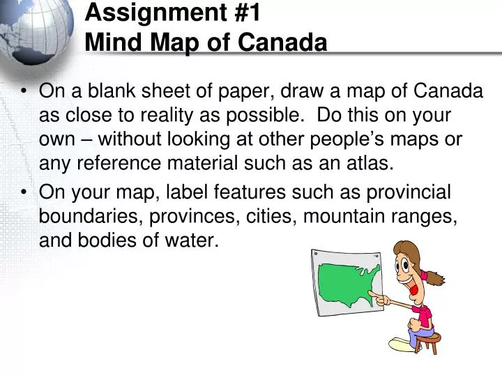
Assignment #1 Mind Map of Canada. On a blank sheet of paper, draw a map of Canada as close to reality as possible. Do this on your own – without looking at other people’s maps or any reference material such as an atlas.

E N D
Assignment #1Mind Map of Canada • On a blank sheet of paper, draw a map of Canada as close to reality as possible. Do this on your own – without looking at other people’s maps or any reference material such as an atlas. • On your map, label features such as provincial boundaries, provinces, cities, mountain ranges, and bodies of water.
Mind Map of Canada • Which parts of Canada do you know best? • Which parts of your map are most incomplete? • Do you feel it is important to know where places are in Canada? Explain.
Cluster 1: Geographic Literacy SOC 20S Ms. Smaluck Unit 1
Topics Covered • What is geography? • Physical/Human Geography
***Reminder • These notes are for you! Not me! • These notes will be used for “note quizzes”, which are open book. If you don’t have your notes, good luck!
What is Geography? • Geography is the study of the earth’s physical and human systems along with the relationships/connections among them. • When studying any discipline of geo, various skills and tools are used. • Things like maps • air photos • satellite images • along with working with scales, distances and directions have long been used to study the earth.
What is Geography • New tools, such as • Global positioning system (GPS) receivers • Geographic information systems (GIS) • Software now allow geographers to create maps and manipulate and interpret data to better study and understand the world around us and our place/role in it.
What is Geography? Geographers try to answer three questions: • Where are things located on Earth? • What are the connections between people and the Earth? • How can we illustrate or explain this information to understand it better? Geography has two main focuses: • The Earth’s physical geography (natural things) • The Earth’s human geography (people and things related to people such as cities)
1. Physical Geography • It includes the study of landforms, vegetation and climates of the world. • Knowledge of landforms, (plains, mountains, etc.) is helpful in determining what the land may be used for, (agriculture, construction of roads/railways) • Vegetation refers to natural vegetation, which is plant life that would grow in an area without human influence, (forests, grasslands). • Knowledge of climate, which includes temperature and precipitation, is important in the planning of various human activities, (farming, hydro).
1. Physical Geography • Includes the knowledge of natural resources and where they are located. Some understanding of the types of rocks and minerals and how they formed, helps us predict where the minerals may be found and how they can be mined and used. • Knowledge of natural resources helps in the understanding of the development of various industries and their locations, because having some kind of natural resource is often a major factor in determining where people will live. • Includes the study of natural processes and human caused events (erosion, earthquakes, volcanic activity, floods) that shape and change the landforms and affect human life and activities. Developing a better understanding of the interrelationships or connections between the physical environment and human activities may help lesson or prevent some disasters.
2. Human Geography • It deals with human presence, activities and impacts on the natural environment. • It includes the study of • Population • Migration and distribution • Economic activities • Settlement patterns • Modification of the environment by humans
2. Human Geography • The impact of early human societies on the natural environment was minimal because small nomadic populations existed. They survived by fishing, hunting, and gathering off the land. Tools and dwelling were “simple”, made from the natural materials (wood, stone, bone).
2. Human Geography • With the domestication of plants and animals, greater changes were made to the physical environment. Land was cleared of trees and grasses for agriculture and permanent homes. • The rise of agriculture, resource extraction and manufacturing activities led to more complex economic and political systems. Transportation networks were needed, political boundaries were established and larger permanent societies developed, changing the natural environment. • One of the greatest challenges faced by humans today is how to manage the use of energy resources. It must be done in a sustainable fashion without causing permanent damage to the environment in the form of land, air, water pollution and climate change.
Topics Covered • Map Projection/ Mercator Projection/ Equal-Area Projections • Features of a map • Scale (Map Scale) • Types of Maps
Map Projection • A method used to transfer features of the globe onto a flat surface. • 3 important things to remember about the different kinds of map projections are; • Each projection has certain characteristics that make it useful for a specific purpose. • Each projection has some kind of distortion, such as enlarging some areas and shrinking others, or providing inaccurate directions. • A map projection should be used only for the purpose for which it was designed.
1. Mercator Projection • A type of map projection in which compass bearings are correct, making it useful for marine or navigator charts, however, it generally distorts distances, areas and shapes of the land masses and oceans. • A problem with the mercator projection, according to representatives at the United Nations was; • It made countries near the equator appear smaller in size, while those closer to the poles appeared larger in size. • Many representatives of the tropical countries felt the importance of their countries had been underestimated because they appeared smaller on the maps, than they actually were.
2. Equal – Area Projection • A map projection used by most nations and international organizations in which the correct sizes of all countries are shown in relation to one another, avoiding most size distortion.
What is a Map? • A map is a representation of the Earth’s features drawn on a flat surface. • Maps use symbols and colours to represent features of an area, simplifying the real world.
Features on a Map • Title – identifies the area shown, topic, focus of the map. • Legend – explains the meaning of symbols and colours used on the map. • Scale – compares distance on the map with actual distance on the earth’s surface. • Date of Publication – indicates how recent the map is • Direction – represented by either a direction arrow/symbol or by the use of latitude and longitude. • Border – sets the map apart from other information
Map Labelling & Colouring • Cartography is the art of drawing accurate, easily readable, attractive maps. • Labels • Should be neatly printed • Should be spelled correctly • Should be parallel to the base of the map (except for natural features such as rivers and mountain ranges) • A dot should be used to locate cities, with the name of the city as close to the dot as possible.
Map Labelling & Colouring • Labels (continued) • Larger features usually have larger labels • Labels for similar features should be the same size and font – for example: • Water Body • City • PROVINCE • C O U N T R Y • Labels should not block other information on the map
Map Labelling & Colouring • Colouring • Maps should be properly colour coded to show the different areas on the map • Shade consistently so that there are no light or dark patches of one colour within one feature • Use solid colours only, not shading patterns • White or black are not acceptable shading colours • Grey should be used for areas not important to the map • Blue should only be used for water bodies
Scale (Map Scale) • Scale is a measurement on a map that represents an actual distance on the earth’s surface. • The 2 general categories of maps, according to scale-use are; • Large-scale Maps • Small-scale Maps
Scale • Large-scale maps • maps that show a large amount of detail of a small area, such as a map with a scale of 1:50 000 or 1:25 000. ( 1cm on the map represents 50 000 cm on the earth’s surface) • Small-scale maps • maps that how a small amount of detail of a large area, such as a map with a scale of 1:250 000 or 1:500 000. • Used for general details such as political, physical and economic information.
Scale – Mapping Our Location • Anderson Collegiate Map You are here!
Scale – Mapping Our Location • Anderson Community Map You are here!
Scale – Mapping Our Location • Town of Whitby Map You are here!
Scale – Mapping Our Location • Region of Durham Map You are here!
Scale – Mapping Our Location • Southern Ontario Map You are here!
Scale – Mapping Our Location • Ontario Map You are here!
Scale – Mapping Our Location • Canada Map You are here!
Scale – Mapping Our Location • World Map You are here!
3 “Broad” headings of maps • General-purpose Maps • Thematic Maps • Topographic Maps
1. General-purpose Maps • Maps that contain many different types of information on them. May show things like; bodies of water, roads, railway lines, parks, elevation, towns and cities. • They give a broad understanding of the location and features of an area.
2. Thematic Maps • Maps that show information on one particular or specific topic or theme (ex. climate, vegetation, pop.)
Thematic • Thematic map showing electricity generating stations in Canada
3. Topographic Map • Large scale maps showing both natural and human made features. They use symbols/colors to show a variety of features. (ex. mountains, buildings) • Topographic Map of Blue Mountain (Collingwood)
Assignment #2 Create a Map • Create a map from the Drcss to your house. • Include; title, legend, scale, date of publication, direction. • Use color and BE NEAT!!
Assignment #3Political Map of Canada • Add to this map: • Provinces • Territories • Capital cities • “Other” cities • 6 map essentials • Different coloured provinces* • First and last name *You CAN use the same colour more than once, so long as it doesn’t touch a province or territory with that same colour.
Drainage Map of Canada • Add to this map: • Oceans, Lakes, Rivers, Bays, and Gulfs as listed on your handout • 6 map essentials • Canada land coloured green • All water coloured blue • All other land coloured grey (or beige) • First and last name
Topics Covered • Compass Work • Latitude/Longitude • Times Zones/International Date Line • Map Scales