Download
1 / 33
330 likes | 672 Vues
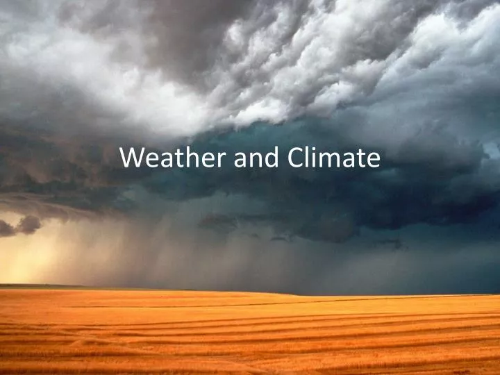
Weather and Climate. Climate vs. Weather. Weather: Short term state of the atmosphere. Temperature, humidity, cloud cover, precipitation, winds, visibility, air pressure, air pollution, etc… Climate: The average weather conditions in an area over a long period of time

E N D
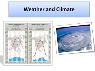
Climate vs. Weather • Weather: Short term state of the atmosphere. • Temperature, humidity, cloud cover, precipitation, winds, visibility, air pressure, air pollution, etc… • Climate: The average weather conditions in an area over a long period of time • Described by temperature and precipitation
Measurement Definition Instrument How hot or cold the air is The weight of the air How fast the wind is blowing Where the wind is blowing from Amount of water vapor in the air Amount of rain or snow that falls M E A S U R I N G W E A T H E R Thermometer Temperature Air Pressure Barometer Wind Speed Anemometer Weather Vane Wind Direction Humidity Hygrometer Rain Gauge Precipitation
Measuring Weather Instruments used in measuring weather in the upper atmosphere • Radiosonde: • a package of instruments that is carried aloft by balloons to measure upper atmospheric conditions, including temperature, dew point, and wind velocity • sends measurements as radio waves to a receiver that records the information. • When the balloon reaches a very high altitude, the balloon expands and bursts, and the radiosondeparachutes back to Earth. • Radar: radio detection and ranging • a system that uses reflected radio waves to determine the velocity and location of objects • The newest Doppler radar can indicate the precise location, movement, and extent of a storm. It can also indicate the intensity of precipitation and wind patterns within a storm. • Weather Satellites: • Satellite images provide weather information for regions where observations cannot be made from ground. • The direction and speed of the wind at the level of the clouds can also be measured by examining a continuous sequence of cloud images. • Satellite instruments can also measure marine conditions. • Computers • Solving very difficult mathematical equations • Store weather data • Can provide information that is useful in forecasting weather changes
Measuring Climate Continue • Long term weather measurements • Satellites • Geological Evidence • Evidence of glaciation • Rock layers
Solar Energy Indirect and Direct Sunlight are a result of the Earth’s tilt. In the Northern Hemisphere during winter Earth is titled away from the Sun and in the summer the Earth is titled towards the sun. • Cooler Temperatures = Cooler Climates • Higher latitudes • Sun’s rays hit Earth at a smaller angle • Solar energy is spread out over a larger area • Higher Temperatures = Warmer Climates • Lower latitudes • Sun’s rays hit Earth around 90 degrees • Solar energy is more direct, smaller areas
Atmosphere • Troposphere: • the lowest layer of the atmosphere • temperature drops at a constant rate as altitude increases • weather conditions exist • Tropopause: upper boundary of the troposhere. • Stratosphere: • between the troposphere and the mesosphere • temperature increases as altitude increases • contains the ozone layer • heated from above by absorption of solar radiation by ozone • Mesosphere • the coldest layer of the atmosphere • between the stratosphere and the thermosphere • temperature decreases as altitude increases • Mesopause: upper boundary of the mesosphere • Average temp. 90°C • Thermosphere: • the uppermost layer of the atmosphere • temperature increase as altitude increases • Ionosphere: • lower region of the thermosphere, at an altitude of 80 to 400 km • Interactions between solar radiation and the ionosphere cause auroras
Atmospheric Pressure(Air Pressure) • Gravity holds the gases of the atmosphere near Earth’s surface. As a result, the air molecules are compressed together and exert force on Earth’s surface. atmospheric pressure: • the force per unit area that is exerted on a surface by the weight of the atmosphere • decreases as altitude increases • changes as a result of differences in temperature and in the amount of water vapor in the air • Temperature increase pressure decreases • Water vapor increases pressure decreases • Measures with a barometer • Units: atmospheres (atm), millimeters or inches of mercury, and millibars (mb).
Coriolis Effect • The circulation of the atmosphere and of the ocean is affected by the rotation of Earth on its axis. Winds that blow from high pressure areas to lower-pressure areas curve as a result of the Coriolis effect. Coriolis effect the curving of the path of a moving object from an otherwise straight path due to Earth’s rotation
How Air Moves • Air moves from areas of high pressure to areas of low pressure. Therefore, there is a general, worldwide movement of surface air from the poles toward the equator. • Temperature and pressure differences on Earth’s surface create three wind belts in the Northern Hemisphere and three wind belts in the Southern Hemisphere. • The Coriolis effect, which occurs when winds are deflected by Earth’s rotation, also influences wind patterns.
Global Wind Patterns • Because Earth receives different amounts of solar energy at different latitudes, belts of cool, dense air form at latitudes near the poles, while belts of warm, less dense air form near the equator. • Winds affect many weather conditions, such as precipitation, temperature, and cloud cover. • Regions that have different global wind belts often have different climates. • As seasons change, the global wind belts shift in a north or south direction. • As the wind and pressure belts shift, the belts of precipitation associated with them also shift.
Global Wind Patterns • trade wind: • prevailing winds that blow from east to west from 30º latitude to the equator in both hemispheres • Westerlies: • prevailing winds that blow from west to east between 30º and 60º latitude in both hemispheres • descending air moving toward the poles is deflected by the Coriolis effect • Polar easterlies: • prevailing winds that blow from east to west between 60 and 90 latitude in both hemispheres • Surface winds created by the polar high pressure are deflected by the Coriolis effect
Jet Stream • a narrow band of strong winds that blow in the upper troposphere • These wind exist in the Northern and Southern Hemisphere. • Polar jet streams: • reach speeds of 500 km/h • can affect airline routes and the paths of storms. • Subtropical jet stream.
How Topography, ocean currents, and air currents effect weather patterns
How Topography Effects Weather Mountain and Valley Breezes • A valley breeze forms when warm air from the valleys moves upslope. • At night, the mountains cool more quickly than the valleys do. At that time, cool air descends from the mountain peaks to create a mountain breeze. • Areas near mountains may experience a warm afternoon that turns to a cold evening soon after sunset.
How Topography Effects Climate • Land heats faster than water and thus can reach higher temperatures in the same amount of time. • Waves, currents, and other movements continuously replace warm surface water with cooler water from the ocean depths. • In turn, the temperature of the land or ocean influences the amount of heat that the air above the land or ocean absorbs or releases. • The temperature of the air then affects the climate of the area.
Ocean effect Climate and Weather Ocean Currents • The temperature of ocean currents that come in contact with the air influences the amount of heat absorbed or released by the air. • If winds consistently blow toward shore, ocean currents have a strong effect on air masses over land. • For example, the combination of a warm Atlantic current and steady westerly winds gives northwestern Europe a high average temperature for its latitude.
Ocean effect Climate and Weather Seasonal Winds monsoon a seasonal wind that blows toward the land in the summer, bringing heavy rains, and that blows away from the land in the winter, bringing dry weather • Temperature differences between the land and the oceans sometimes cause winds to shift seasonally in some regions. • Monsoon climates, such as that in southern Asia, are caused by heating and cooling of the northern Indian peninsula.
El Nino El Niño Southern–Oscillation El Niño the warm-water phase of the El Niño Southern Oscillation; a periodic occurrence in the eastern Pacific Ocean in which the surface-water temperature becomes unusually warm (ENSO) • The event changes the interaction of the ocean and the atmosphere, which can change global weather patterns. • The ENSO also has a cool-water phase called La Niña, which also affects weather patterns.
Ocean effect weather hurricanea severe storm that develops over tropical oceans and whose strong winds of more than 120 km/h spiral in toward the intensely low-pressure storm center • A hurricane begins when warm, moist air over the ocean rises rapidly. • When moisture in the rising warm air condenses, a large amount of energy in the from of latent heat is released. This heat increase the force of the rising air. • A fully developed hurricane consists of a series of thick cumulonimbus cloud bands that spiral upward around the center of the storm. • The most dangerous aspect of a hurricane is a rising sea level and large waves, called a storm surge. • Every hurricane is categorized on the Safir-Simpson scale by using several factors. These factors include central pressure, wind speed, and storm surge.
How Elevation effects Climate Elevation • The surface features of the land, or topography, also influences climate. • The elevation, or height of landforms above sea level, produces distinct temperature changes. • Temperature generally decreases as elevation increases.
How Mountains effect weather Rain Shadows • When a moving air mass encounters a mountain range, the air mass rises, cools, and loses most of its moisture through precipitation. • As a result, the air that flows down the other side of the range is usually warm and dry. This effect is called a rain shadow. • One type of warm, dry wind that forms in this way is a the foehn (FAYN), a dry wind that flows down the slopes of the Alps.
How volcanic activity effects climate and weather patterns Volcanic Activity • Large volcanic eruptions can influence climates around the world. • Sulfur and ash from eruptions can decrease temperatures by reflecting sunlight back into space. • These changes last from a few weeks to several years and depend on the strength and duration of the eruption.