Download
1 / 44
440 likes | 577 Vues
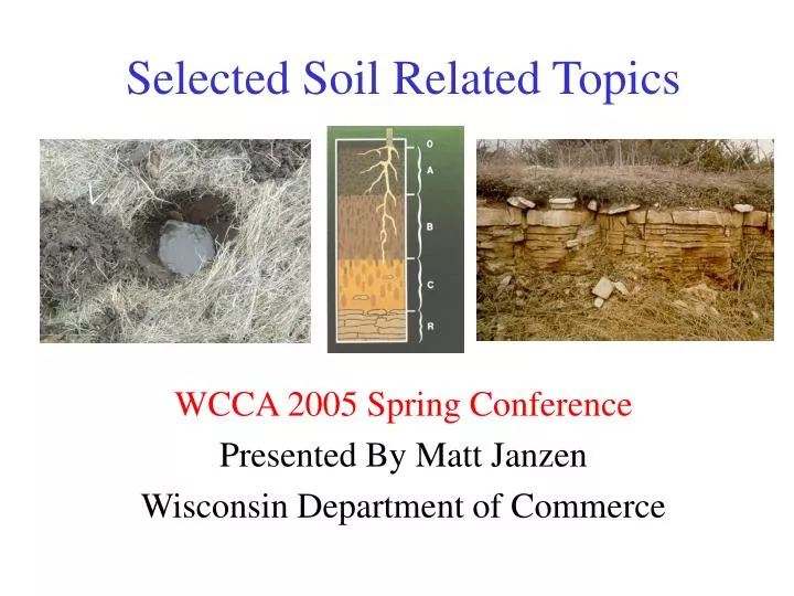
Selected Soil Related Topics. WCCA 2005 Spring Conference Presented By Matt Janzen Wisconsin Department of Commerce. Discussion Agenda. Minimum 6 Inch In Situ Soil Code Requirement Interpretative Determinations Siting Systems On A + 4 Soil Conditions.

E N D
Selected Soil Related Topics WCCA 2005 Spring Conference Presented By Matt Janzen Wisconsin Department of Commerce
Discussion Agenda • Minimum 6 Inch In Situ Soil Code Requirement • Interpretative Determinations • Siting Systems On A + 4 Soil Conditions
6 Inch Minimum Soil RequirementComm 83.44 (3)(a) Wis. Adm. Code • Comm 83.44(3)(a). The infiltrative surface of unsaturated soil to which influent is discharged shall be located at least 24 inches above the estimated highest groundwater elevation and bedrock. • A 24 inch separation is adequate for final treatment of wastewater containing less than or equal to 10,000 cfu/100 mL fecal coliform . • Greater separation (36-60 inches) is required for sandy soil with greater than 35 percent rock fragments.
6 Inch Minimum Soil RequirementComm 83.44 (3)(b) Wis. Adm. Code • Comm 83.44(3)(b)1. At least 6 inches of the soil separation required under par. (a) shall be anin situ soil type for which soil treatment capabilityhas been credited under Table 83.44-3. • The minimum soil depth (6”) must consist of naturally occurring (in situ) soil material, not fill. • Possible Petition for Variance for sites with < 6”in situ soil. • Except for material having more that 90 percent coarse fragments, all soil types are credited for treatment. • Note that POWTS designs shall reflect restrictive soil horizons that adversely affect treatment or dispersal.
6 Inch Minimum Soil RequirementComm 83.44 (3)(b) Wis. Adm. Code • Comm 83.44(3)(b)2. The purpose of the 6 inches of in situ soil under subd 1. shall be to assure that the influent will be assimilated into the original subsurface soils without ponding on the ground surface. • This requirement therefore addresses dispersal and not necessarily treatment. • Note that surface discharge of domestic wastewater is not allowed as per Comm 83.32(1)(f) Wis. Adm. Code. • Sewage is defined as having fecal coliform concentrations of > 200 cfu/100 mL.
Soil Saturation Sites must have a minimum 6 inches of unsaturated soil to assimilate the influent wastewater without ponding on the ground surface. A + 4 conditions or better usually meet the 6 inch min. requirement. Bedrock Must have a minimum 6 inches of non-bedrock material (i.e. soil material). Many bedrock controlled sites may not be affected by soil saturation, and simply need a soil cover of 6 inches to qualify as suitable. 6 Inch Minimum Soil RequirementSummary The 6-inch minimum in s. Comm 83.44(3)(b)1., applies to both limiting factors of soil saturation and bedrock and could be comprised of all A horizon material.
Soil Saturation Determinations s. Comm 85.60(1)(a). Optional Documentation. A property owner, or their agent, may submit documentation to the Department to prove that redoximorphic features, or other soil color patterns, at a particular site are not indicative of periodically saturated soil conditions or high groundwater elevation.
A + 4 Soil Conditions • “A + 4” is a Wisconsin POWTS trade term not found in any code or manual, but which generally refers to the soil interpretation limits of s. Comm 85.30(2)(b) which reads:
Fill Fill A A s. Comm 85.30(2)(b) • Unless otherwise determinedunder s. Comm 85.60, thehighest elevation of seasonal soil saturation shall be the ground surface where redoximorphic features are present within 4inches of any of the following: • An A-horizon that extends to the ground surface • The lower boundary of overlying fill where no buried A-horizon exists • An A-horizon buried by overlying fill B C
Some Conditions Are Black And White A+ 4 or More OK Wet to Surface 4 in+ Black Over Grey Walk Away
The statement “Unless otherwise determined under s. Comm 85.60...” found in Comm 85.30(2)(b) allows : The Interpretive Determination The Soil Saturation Determination The Hydrograph Procedure The Artificially Controlled NavigableWaters Determination This presentation is limited tointerpretative determinations unders. Comm 85.60(2) Wis. Adm. Code. Others Conditions Require Additional Information to Make a Determination
Alternative Determinations • Results from any of the Comm 85.60 procedures can overturn the default interpretation of saturation to the ground surface required with < A + 4 conditions. • The Interpretive Determination is often the preferred method for: • Evaluating somewhat poorly drainednatural (in situ) soil. • Some fill sites where there is sufficient evidence available to establish a reliabledepth of soil saturation.
Filled SitesSites With Existing Fill • Under the current code, there is no longer any prohibition placed on installation of any type of soil dispersal component in or on fill. However, • The commonly used POWTS Component Manual designs are all limited to natural (in situ) soils so plans must be submitted as an Individual Site Design. • In such cases, the Individual Site Design must show that the filled soil conditions will disperse and treat wastewater as well as natural soil. • In addition, to place a dispersal cell in, or on, existing fill, a petition for variance to s. Comm 83.44(3)(b)1 would need to be approved if between the lower boundary of the fill and bedrock or saturated soil there is < 6 inches of natural soil.
Putting An Interpretative Determination Together • A more intensive soil study and report, under Comm 85.60(2), may be used to overturn the assumption of saturation to the ground surface where any of the conditions enumerated in s. Comm 85.30(2)(b) exist (i.e. < A + 4). • Because of the 6 inch minimum limitation of s. Comm 83.44(3)(b)1, a Comm 85.60 study becomes necessary to explore the potential for onsite wastewater dispersal where such conditions exist.
Details And Information • Additional information is necessary such as: • Morphology of the A or Ap horizon and immediately below • Substratum morphology • Type of saturation - episaturationor endosaturation • Matrix color • Reduced (low chroma or gley) colors • Soil organic matter content • Root patterns • Redox feature - type and occurrence • Comparative landscape analysis • Up slope/down slope and off lot soils & landscape reviews • Surface and subsurface hydrology • Soil Survey information • Topographic maps • Literature citations and supporting documentation
Comparative Landform Analysis And Site Clues • Existing Vegetation • Slope Position • Slope Shape
Redoximorphic Features • Redox Concentrations • Nodules and Concretions • Masses (Fe) • Pore Linings • Redox Depletions • Iron • Reduced Matrices • Gley
Low Chroma Colors • Value of 4 or more and a chroma of 2 or less. • Redox depletions • Reducing conditions • Suspicious conditions with chromas of 3 or less.
Faint Redox Concentrations A Horizon Material
Gley Colors Low Chromas - of other hues
Hydric SoilConditions • Histic epipedon • Gleyed subsoil • Both above are indicators of severe wetness • A+ less than 0 conditions exist
Gleyed Matrix Colors Hydric Conditions
Relationships Between Saturation and Oxidation and Reduction • Redox feature formation requires: • Anaerobic conditions • Saturation • Near Saturation • Organic matter • Temperature • pH • Iron (Fe) and Manganese (Mn) Biogeochemical Process Iron Depletion and Concentration
Oxidation e-loss Reduction e-gain Chemical Oxidation-Reduction • Oxidation is the loss of electrons. • Reduction is the gain of electrons. • Fe+3 <----> Fe+2 • O2 <----> H2O • Mn+3 <----> Mn+2
Microbial Redox Sequence Oxygen Nitrate Manganese Iron Sulfur Invisible Invisible Visible Visible Odor Greater ReducingConditions
Interpretative Determination Objective • You are basically trying to prove that a pipe-in-the-ground soil saturation determination does not need to be performed because you can show the Department where the zone of soil saturation is, and where it is not. • “Conclusively Demonstrate” means that the interpretive determination can be made with a high level of confidence. • This usually means it is supported by information from more than one source
Required Information • Local Hydrology Such as: • Type of water table (perched or basal) and gradient • Elevations and location of streams, ponds, lakes or ditches. • Substratum Characteristics - Need one deep soil boring.
Required Information • Local Geomorphology Such as: • Describe the landform (summit, backslope, outwash plain, etc.) • Glacial deposit or bedrock as appropriate to the site. • This also could include natural changes in the water table in the distant past due to changes in lake or stream levels.
Required Information • Soil disturbance and hydraulic modification. Such as: • Include agricultural tillage along with any cut and fill as soil disturbance. • Hydraulic modifications would include drainage ditches, tile drain piping, as well as surface drainage from parking lots, roads, and roof tops. • REPORT CONTENTS: There may be some overlap with other information topics. Information reported under one topic does not need to be repeated in another.
Required Information • Landscape position and local topography Such as: • Relative position on the landform. • Local topography would include slope morphology both parallel and perpendicular (convex, concave, or smooth). • Other local land surface features as applicable.
Required Information • Soil Survey map unit for the tested area and adjacent units on the landscape. • If you are aware of a soil saturation determination previously performed for the same mapping unit, or on a nearby parcel, include the data. • If Department or County staff have been on the site, mention it in your report and include any written letters or reports.
APPROVED The Report: Conclusion • The conclusion is a statement of results addressing the specific objective. • Identifying depth and/or elevationof seasonal soil saturation. • State why you believe yourinterpretation of conditions isconclusive enough to predictthe depth to saturation. • Recommend other soil-related design parameters such as maximum linear loading rate and hydrologic modifications.
Basic Design Parameters For Sites With Shallow Depth To Limitations
Hydraulics and System Design • Three Parameters • Hydraulic Conductivity (Ksat) • Hydraulic Gradient • 2-Dimensional flux area perpendicular to hydraulic gradient • Design Variables • Dispersion perpendicular to the hydraulic gradient (linear loading) • Advection parallel to the hydraulic gradient (toe extension)
Linear Loading Rate 100 gpd /100 ft = 1gpd/ft Mound Toe Slope GWME Toe Extension System Design Variables 100 gpd /10 ft = 10 gpd/ft
Redoxomorphic FeaturesReference MaterialNorth Carolina State University Technical Bulletin 301(919) 513-3112rhonda_thrower@ncsu.edu$5.00
Redoxomorphic Features And Hydric SoilsReference MaterialVersion 5.01http://soils.usda.gov/use/hydric/
Questions? Thanks For Listening!