Download
1 / 5
140 likes | 499 Vues
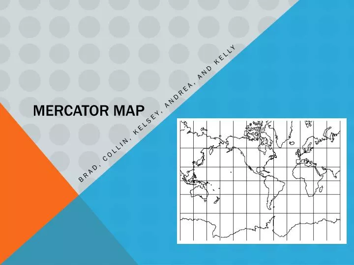
Mercator Map. Brad, Collin, Kelsey, Andrea, and Kelly. Who Created the Mercator map projection? When? .

E N D
Mercator Map Brad, Collin, Kelsey, Andrea, and Kelly
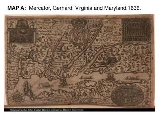
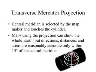
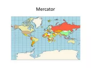
Who Created the Mercator map projection? When? • Geradus Mercator invented his famous projection in 1569.When he created the Mercator map projection, he never intended it to be used for anything besides navigation but it is now one of the most popular map projections. This type of map projection was the first map to be found in atlases. Areas that are farther away from the equator will appear larger than the areas that are closer and lines of latitude and longitude intersect at right angles. He created this map projection so that all shapes would appear almost exactly the way they would on a globe which made it easier for navigation in that time period.
What purpose does it serve? • This map serves the purpose of being the typical map projection for marine purposes because of its ability to show lines of continual course. The Mercator map projection has always been a poor map because of its rectangular grid shape. Geographically Illiterate publishers found this map useful for back of the book maps, maps that are posted on walls, and also some atlases.
Are there any issues/problems that come from itsuse? • Although the Mercator map is helpful for piloting a ship and makes it easy for understanding directions, it makes almost all of the countries proportions and sizes appear very distorted. The poles are a lot larger than they appear and the countries close to the equator are a lot smaller than they appear. The reason for this is because Mercator map’s latitude are the same length and do not curve throughout the whole map, whereas on a map that has accurate latitude lines, the poles and equators would be different widths which would make the sizes of the countries more accurately proportioned.
What are the benefits to using this type of projection? Some benefits to using the Mercator map projection are that the shapes and directions are accurate, latitude and longitude are parallel and it was found useful as a wall map, atlas map, and also maps in books and newspapers for non-geographers. The Mercator map projection is also easy to draw and it is perfect for true direction which made it useful on ships.