Download
1 / 17
170 likes | 391 Vues
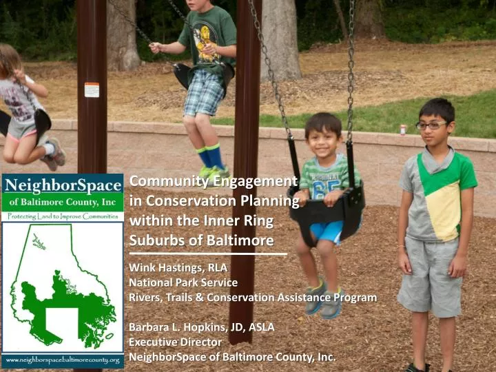
Community Engagement in Conservation Planning within the Inner Ring Suburbs of Baltimore. Wink Hastings, RLA National Park Service Rivers, Trails & Conservation Assistance Program Barbara L. Hopkins, JD, ASLA Executive Director NeighborSpace of Baltimore County, Inc. CONTEXT-

E N D
Community Engagement in Conservation Planning within the Inner Ring Suburbs of Baltimore Wink Hastings, RLA National Park Service Rivers, Trails & Conservation Assistance Program Barbara L. Hopkins, JD, ASLA Executive Director NeighborSpace of Baltimore County, Inc.
CONTEXT- Chesapeake Bay
CONTEXT- Mapping Valued Resources
CONTEXT- Community Conservation
Improving the health, welfare & cohesiveness of communities within the URDL Mission of promoting more livability communities by protecting and improving land within the URDL embraces 3 goals: 1. Social 3. Economic Improving environmental quality, protecting habitat, & reducing the effects of fragmentation Enhancing property values, reducing exposure to pollutants and environmental degradation, & improving efficiency of environmental services 2. Environmental
Criteria (GIS Layers) for Conservation Land That Will Achieve the Objectives Results Necessary to Achieve Goal Objective B Conserving land to protect habitat &/or reduce fragmentation • EXISTENCE OF CORE HABITAT • POTENTIAL FOR WETLAND CREATION OR EXPANSION • PROXIMITY TO NATURAL LANDS NETWORK • SUITABILITY FOR REFORESTATION Objective A Conserving land to improve air & water quality • BURIED STREAMS OR STORMWATER OUTFALLS • HARDENED SHORELINES SUITABLE FOR REMOVAL • PROXIMITY TO TRIBUTARIES & VEGETATED BUFFERS Environmental Goal Improving environmental quality, protecting habitat, & reducing the effects of fragmentation
Using Pairwise Comparisonto Rank the Criteria for Objective B, “Conserving land to protect habitat and reduce fragmentation” Rating Scale A,3 C,3 Resulting Criteria (Layer) Weights C,3
Actual Pairwise Comparison Questionnaire and Results for Objective B
From Pairwise Comparison to GIS Maps Via a Linear Weighted GIS Model The Model c1= GIS layer for criterion 1 GIS Map Results Where = {(c1) (w1) + (c2)(w2) +(c3)(w3) ….} w1= Weight for criterion 1 The Results GIS Map Results = {(existence of core habitat)(.3025) + (proximity to natural lands network) (.3868) ….}
Calibrating the Map Layers: Development of Metrics Development of Metrics High: Including & Adjacent to Moderate: Within 200 ft Low: Within 300 ft of wetland High: Within network Moderate: Adjacent Low: Within ¼ mile
For More Information: Barbara L. Hopkins, JD, ASLA Executive Director NeighborSpace of Baltimore County Barbara@neighborspacebaltimorecounty.org 443-377-3760 Wink Hastings, RLA National Park Service at the Chesapeake Bay Program Rivers, Trails & Conservation Assistance Program WHasting@chesapeakebay.net 410-260-2481 Web Page on the Conservation Planning Effort (and a copy of this presentation) http://www.neighborspacebaltimorecounty.org/openspaceplanning.html