Download
1 / 12
120 likes | 315 Vues
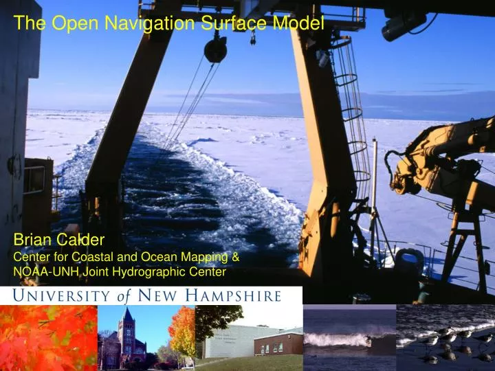
The Open Navigation Surface Model. Brian Calder Center for Coastal and Ocean Mapping & NOAA-UNH Joint Hydrographic Center. Open Navigation Surface. Community response to concerns for inter-operability of data products Intent:

E N D
The Open Navigation Surface Model Brian Calder Center for Coastal and Ocean Mapping & NOAA-UNH Joint Hydrographic Center Open Navigation Surface Working Group CHC2004 Uncertainty Workshop
Open Navigation Surface • Community response to concerns for inter-operability of data products • Intent: • Define a concrete representation of the Navigation Surface data model • Identify software technologies to support and implement the data model • Provide a free, open source code-base as a reference implementation • Hosted by CCOM as a vendor-neutral third party Open Navigation Surface Working Group CHC2004 Uncertainty Workshop
Open Navigation Surface Working Group • Started by e-mail solicitation of statements of interest • Technical: navsurf_dev@ccom.unh.edu • General: navsurf_general@ccom.unh.edu • Core group formed by responses from: • CCOM, NOAA, NAVOCEANO • IVS, CARIS, SAIC, 7Cs • First meeting held 21-23 January 2004 Open Navigation Surface Working Group CHC2004 Uncertainty Workshop
Goals of the ONSWG • Determine the requirements for an Open Navigation Surface data object, specifying all of the mandatory data elements. • Determine suitable software technologies to implement these requirements • Develop one or more source-code libraries that form a reference model for reading and writing data in this format, and provide support and guidance to potential users Open Navigation Surface Working Group CHC2004 Uncertainty Workshop
Format Requirements • A new name • “Navigation Surface” means different things to different people • Adopted “Bathymetric Attributed Grid” (BAG) for the data elements used to make navigational products • Reserved “Navigation Surface” to mean a BAG which has actually been made for a specific navigational purpose • Meta-Data • Meta-data to include everything of interest that has happened to the data (e.g., processing, certification for navigational use, etc.) • Meta-data to be in XML using ISO19139 encoding to ISO19115 content standards • Meta-data to be kept in the same file as the data to avoid loss in transit Open Navigation Surface Working Group CHC2004 Uncertainty Workshop
Format Requirements • Mandatory Data Components • Elevations on a regular grid at a single resolution (may be different in x,y) • Associated uncertainty on a co-located grid • Special exceptions (human over-rides) • Extension Data Components • Arbitrary ‘other’ data (grid or non-grid) as required by particular users • Must remain open (reviewed by ONS architecture board), non-proprietary • Procedures documented in Format Specification Document (BAG-FSD) [All grids are single-resolution node-based objects, but can be geographic or projected, and are reduced to one of a number of vertical datums; SI units are used throughout, with a right-handed coordinate system (z is positive up)] Open Navigation Surface Working Group CHC2004 Uncertainty Workshop
Format Requirements • Certificates and Digital Signatures • Every BAG will be hashed to the Secure Hash Standard (FIPS 180-2) • Every BAG will be digitally signed by the Digital Signature Standard (FIPS 186-2) to ensure taper-detection and authentication • Signing a BAG requires an entry in the XML meta-data indicating who did the signing, and what the certification implies for the data. • Documentation • Defined by Requirements, BAG-FSD and BAG-API • Intended to be living documents in CVS control • Advisory Board • Intended to review new modifications and requests • Co-opted by invitation, defined in BAG-FSD • Platform Independence Open Navigation Surface Working Group CHC2004 Uncertainty Workshop
BAG Format Outline Overall Metadata Meta- data Depth Mandatory Meta- data Uncertainty HDF-5 Data Object Meta- data Change-Tracking List Meta- data Extensions (Optional) Certification data Open Navigation Surface Working Group CHC2004 Uncertainty Workshop
Progress and Current Status • Technologies Identified: • HDF-5 (1.6.1), zlib 1.1.4, szip 1.1 • libgcrypt-1.1.44, libgpg-error-0.6 • Geotrans 2.2.3 (NGA) • XML parser TBD, possibly Apache Xerces • CVS Code/Documentation Repository Established • Open, but not public, access • Hosted at CCOM/JHC (brc@ccom.unh.edu) • Documentation at V1.0 for BAG-FSD, BAG-API • Test code built for sub-components and checked in; operation confirmed on Linux and Win32 Open Navigation Surface Working Group CHC2004 Uncertainty Workshop
Summary • The Open Navigation Surface is a file format specification known as BAG • Provides method for transfer of data • Provides enough flexibility for processing too • The project is supported by the community for the community • Provides for open-source code-base libraries • Based on ‘standards’ where possible • A BAG consists of: • Depth, Uncertainty and Change-tracking List for a single bathymetric entity • Meta-data describing the data, including processing • Certification for authentication, tamper-detection • Optional extension elements for specific purposes Open Navigation Surface Working Group CHC2004 Uncertainty Workshop
Taking Part! • Membership is open to all interested parties • Consists of willingness to be involved • Send e-mail to brc@ccom.unh.edu • Interact via the mailing lists: • navsurf_dev@ccom.unh.edu for technical details of development, API and format coding • navsurf_general@ccom.unh.edu for administrivia, policy and higher-level discussion • Send e-mail to brc@ccom.unh.edu to be added • Contribute code, time, enthusiasm (as available) Open Navigation Surface Working Group CHC2004 Uncertainty Workshop
Thank You To: CCOM/JHC: Brian Calder, Rick Brennan, Lee Alexander CARIS: Bill Lamey IVS: Mark Paton SAIC: Shannon Byrne, Jim Case NAVO: Dave Fabre, Wade Ladner, Jan Depner NOAA: Barry Gallagher, Jack Riley, Shep Smith, Rick Brennan SevenCs: Friedhelm Moggert … and the supporting institutions for time, travel & expenses. Open Navigation Surface Working Group CHC2004 Uncertainty Workshop