Download
1 / 22
220 likes | 322 Vues
Following the Lower Colorado River with the guidance of BASINS 3.0. Kristina Schneider CE 394K.2. My Quest and its Detours. Explore the use of the new BASINS 3.0 to model water quality in Lake Austin Decided to focus on the SWAT model Model entire Austin - Travis CU

E N D
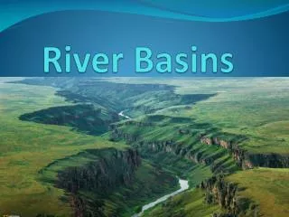
Following the Lower Colorado River with the guidance of BASINS 3.0 Kristina Schneider CE 394K.2
My Quest and its Detours • Explore the use of the new BASINS 3.0 to model water quality in Lake Austin • Decided to focus on the SWAT model • Model entire Austin - Travis CU • Have to cross some Mountains!
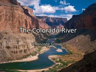
Destination: Austin – Travis CU TMDL Listed Waters for the CU Source: 303(d) Listed Waters Website maintained by the EPA
My Guide: BASINS 3.0 • Integrated framework using an ArcView Interface. • Models: • SWAT • WinHSPF • QUAL2E • PLOAD • Amazing Collection of National Environmental Data • Updated Data Formats • Automatic Watershed Delineator
My Planned Journey: The steps to using SWAT • Activate SWAT, Watershed Delineator, and Land Use, Soil Classification and Overlay Tool Ext. • Delineate the watershed • Define Land Use and Soils • Define HRUs • Define the weather data • Apply the default input files writer • Set up (requires specification of simulation period, PET calculation method, etc.) and run SWAT
My First Guide: BASINS 3.0 Beta from the Web • Available at:http://www.epa.gov/ost/ftp/basins/system/BASINS3/areadb3.htm • Use Assess and Target to get a general picture of water quality situation. • Watershed Delineator works!! • The Land Use and Soil Classification does not appear.
Burned-in Stream RF1 NHD Digitized Outlet My First Guide: BASINS 3.0 Beta from the Web
My second Guide: BASINS 3.0 Beta from BRC • Watershed Delineation • DEM from BASINS 2.0 polygon not exact enough when just convert to grid NHD used to burn-in stream Delineator created stream
My second Guide: Watershed Delineation • Tried to use the a NED DEM. • Possible Problem Projection
My second Guide: Watershed Delineation • Success! • Used BASINS DEM polygon but specified the correct grid size. • Tweeked the nhd_rch file Thanks to Vicki Samuels !
My second Guide: Subbasin Results Only one Subbasin has attributes?
My second Guide: Land Use and Soil Classification Reclassified Land Use Reclassified Soils
This input file is where our error in the subbasin delineation matters. My second Guide: SWAT Input Files The next step is to create the input files for SWAT.
What about the other Models? • HSPF • Also, requires correctly delineated watersheds. • QUAL2E • Needs Permit Compliance System Data • This dataset is being reformatted for version 3.0. • PLOAD • Manual has no documentation and not easily deciphered.
Travel Guide: Watershed Reports • Chlordane • Interesting to note the data is not available after 1980. It is possibly not longer an issue.
Future Travels • Use BASINS 3.0 when the final release with data is available this summer to complete my expedition. • Goal of the study with be to investigate the variation of DO with differing land uses. • If time permits study the nature of nutrient loading in the CU.