Download
1 / 17
180 likes | 296 Vues
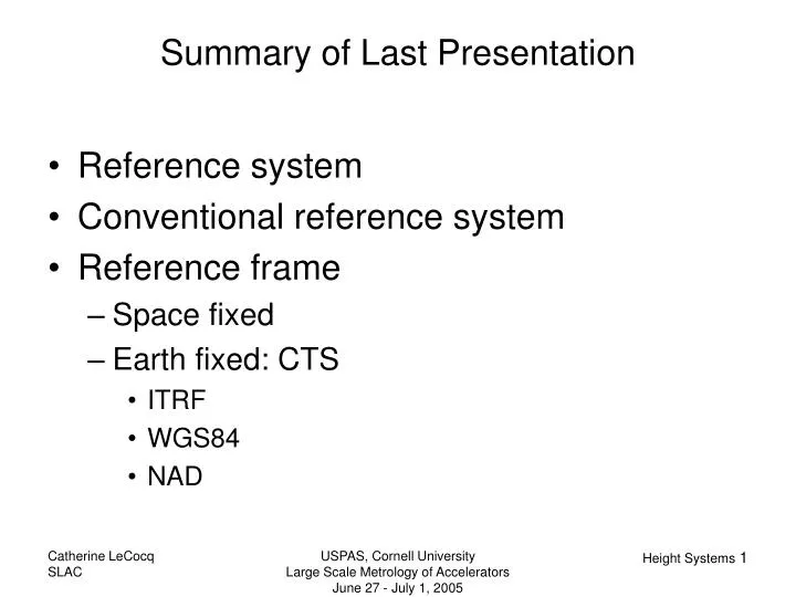
Reference system Conventional reference system Reference frame Space fixed Earth fixed: CTS ITRF WGS84 NAD. Summary of Last Presentation. They are new: easily obtained since the 80s with GPS, not accurate enough before. By comparison, triangulation exists since around 1500.

E N D
Reference system Conventional reference system Reference frame Space fixed Earth fixed: CTS ITRF WGS84 NAD Summary of Last Presentation USPAS, Cornell University Large Scale Metrology of Accelerators June 27 - July 1, 2005
They are new: easily obtained since the 80s with GPS, not accurate enough before. By comparison, triangulation exists since around 1500. They do not represent what most users want which is to see that “water flows downhill!” => need potential based height. Problem with Ellipsoid Heights USPAS, Cornell University Large Scale Metrology of Accelerators June 27 - July 1, 2005
Gravitational potential of the Earth=Newtonian potential generated by the mass distribution within the Earth: z Q P l O y • Gravity potential of the Earth: x • Gravity vector: Basic Definitions USPAS, Cornell University Large Scale Metrology of Accelerators June 27 - July 1, 2005
plumb line z P level surfaces W = const. g y Φ Λ x Gravity Vector-Astronomical Quantities USPAS, Cornell University Large Scale Metrology of Accelerators June 27 - July 1, 2005
The geoid is a particular level surface chosen to be close to the average surface of the oceans: P2 Earth surface ocean HP2 (>0) HP1 (<0) geoid oceanic floor P1 Geoid and orthometric Heights USPAS, Cornell University Large Scale Metrology of Accelerators June 27 - July 1, 2005
Zero level: First order: Leveled ellipsoid Approximations of V USPAS, Cornell University Large Scale Metrology of Accelerators June 27 - July 1, 2005
u P β F1 F2 Ellipsoidal Coordinates for Potential U U depends on 4 constants: - ω is known - U0 is computed by imposing: mass of the ellipsoid = mass of Earth - a and E are derived from satellite observations choosing Earth J2 USPAS, Cornell University Large Scale Metrology of Accelerators June 27 - July 1, 2005
Current NGS definition of geoid: The equipotential surface of the Earth's gravity field which best fits, in a least squares sense, global mean sea level The definition of the geoid is complicated by the permanent deformation of the Earth caused by the presence of the Sun and the Moon. Consideration of these permanent tidal effects has led to the definition of three types of geoids and three types of reference ellipsoids [Ekman, 1989, 1995; Rapp et al., 1991; Bursa, 1995a]. The three geoids are described as follows: Tide-free (or nontidal)—This geoid would exist for a tide-free Earth with all (direct and indirect) effects of the Sun and Moon removed. Mean—This geoid would exist in the presence of the Sun and the Moon (or, equivalently, if no permanent tidal effects are removed). Zero—This geoid would exist if the permanent direct effects of the Sun and Moon are removed, but the indirect effect component related to the elastic deformation of the Earth is retained. Different Types of Geoid USPAS, Cornell University Large Scale Metrology of Accelerators June 27 - July 1, 2005
z P B l r d O y x Tidal Effects • Gravitational Potential • Tidal effects: • permanent / periodic • direct / indirect • Nomenclature • no effect => free • only direct-permanent => zero-tide • all permanent =>mean USPAS, Cornell University Large Scale Metrology of Accelerators June 27 - July 1, 2005
NGS Definition: The equipotential surface of the Earth's gravity field which best fits, in a least squares sense, global mean sea level. NGS Warnings: Even though we adopt a definition, that does not mean we are perfect in the realization of that definition. For example, altimetry is often used to define "mean sea level" in the oceans, but altimetry is not global (missing the near polar regions). As such, the fit between "global" mean sea level and the geoid is not entirely confirmable. Also, there may be non-periodic changes in sea level (like a persistent rise in sea level, for example). If so, then "mean sea level" changes in time, and therefore the geoid should also change in time. These are just a few examples of the difficulty in defining "the geoid". Latest models: GEOID03, USGG2003, GEOID99, G99SSS Presentations:http://www.ngs.noaa.gov/GEOID/PRESENTATIONS/ Geoid in the US USPAS, Cornell University Large Scale Metrology of Accelerators June 27 - July 1, 2005
terrain geoid ellipsoid Leveling • The process of precise leveling is to measure height differences and to sum these to get the heights of other points. USPAS, Cornell University Large Scale Metrology of Accelerators June 27 - July 1, 2005
Different Height Systems USPAS, Cornell University Large Scale Metrology of Accelerators June 27 - July 1, 2005
How to compute gravity inside the Earth? Assume a simple terrain model: Bouguer plate (standard density 2.67g/cm3) Perform the following steps: Remove the Bouguer plate Do the free air anomaly Restore the Bouguer plate Final formula: Helmert heights: Orthometric Height USPAS, Cornell University Large Scale Metrology of Accelerators June 27 - July 1, 2005
P H earth’s surface h Po N geiod Q Qo ellipsoid Pizzetti Projection USPAS, Cornell University Large Scale Metrology of Accelerators June 27 - July 1, 2005
astronomic normal ellipsoidal surface normal α CTP P2 Ze Za ACTP φ T P1 ФCTP equipotential surface through P1 terrestrial equator CTP φ Deflections of the Vertical CTP α T ε Ze η ξ θ ACTP Za USPAS, Cornell University Large Scale Metrology of Accelerators June 27 - July 1, 2005
Methods for Geoid Computations USPAS, Cornell University Large Scale Metrology of Accelerators June 27 - July 1, 2005
Three Components of the GeoidNGM = long wavelength calculated from a geopotential modelNg = medium wavelengthcomputed with Stokes NT= terrain correction USPAS, Cornell University Large Scale Metrology of Accelerators June 27 - July 1, 2005