Download
1 / 29
290 likes | 293 Vues
This text discusses the formation of river valleys, including the differences in valleys between upper and lower reaches, the role of mass wasting and rock strength, and the development of alluvial and bedrock channels. It also explains the concept of stream long profiles and the processes of degradation and aggradation.

E N D
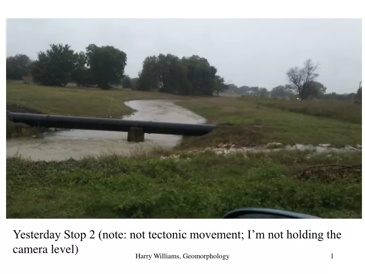
Yesterday Stop 2 (note: not tectonic movement; I’m not holding the camera level) Harry Williams, Geomorphology
Stop 2. Bank erosion? Harry Williams, Geomorphology
Stop 1. Saturation overland flow Harry Williams, Geomorphology
River Valleys and Floodplains Generally speaking, river valleys in upper reaches tend to be narrow and steep, while in lower reaches valleys are wider and have more gentle slopes. The higher elevations/steeper slopes in upper reaches promote vertical and headward erosion, rather than lateral erosion. Upper Lower Harry Williams, Geomorphology
The exact shape of the valley is also determined by mass wasting, which depends on hillslope processes and rock strength (see slide 9 for local examples) Harry Williams, Geomorphology
Upper reaches- bedrock channel, fairly straight streams, no/little deposition, steep slopes, maybe no floodplain. Harry Williams, Geomorphology
In middle reaches, 3 important changes usually occur – deposition begins and the river becomes an alluvial channel (flows through its own alluvium); the channel has a greater tendency to erode laterally, creating a wider, flat bottomed valley; floodplains form; the river meanders from side to side. deposition Alluvium Bedrock Harry Williams, Geomorphology
Lower reaches - floodplain wider, more meandering, gentler slopes. Harry Williams, Geomorphology
The width of the valley created is dependent on the resistance of the surrounding rock to lateral erosion and mass wasting - so different rock types undergo differential lateral erosion too (e.g. Austin Chalk, Eagle Ford Shale, Taylor Marl in Dallas). hills Harry Williams, Geomorphology
1 2 3 floodplain 1 2 floodplain floodplain 3 Harry Williams, Geomorphology
Channel Long ProfilesRecap: streams are steep in their upper reaches, more gently sloping in their lower reaches... Harry Williams, Geomorphology
So, streams naturally tend to develop concave-upward long profiles - this comes about because of the need to balance the transporting ability of the river and the input of sediment i.e.: 1. in the upper reaches of a network, discharge is low and sediment is coarse - therefore steep slopes are required to give the river sufficient energy to transport the sediment (if the slope was too low, sediment supplied by mass wasting would build up the bed of the channel and increase the slope: if the slope was too steep, the excess energy would erode the bed, lowering the slope and causing headward erosion). 2. in the lower reaches of a network, discharge is high and sediment is finer (because of abrasion) - therefore gentle slopes are sufficient to give the river enough energy to transport the sediment. Harry Williams, Geomorphology
The bottom of the profile is aligned to the stream's BASE LEVEL (the level to which the stream erodes down to, but no lower). Harry Williams, Geomorphology
For many large rivers, the ocean represents base level, but for smaller streams - lakes, larger streams, resistant rock outcrops can all act as LOCAL BASE LEVELS. In reality, of course, the smooth concave profile is rarely achieved: irregularities such as resistant rock outcrops result in a "step" in the profile, marked by waterfalls or rapids. Harry Williams, Geomorphology
Streams will try to adjust their long profile until the smooth concave shape is achieved. The bed of a stream can be lowered by erosion or raised up by deposition. These processes are known as DEGRADATION and AGGRADATION respectively. Degradation to lower profile Harry Williams, Geomorphology
Aggradation to raise profile Harry Williams, Geomorphology
These processes also operate over the short term in response to precipitation inputs (i.e. a large storm causes sediment to be eroded from the channel bed and then deposited again when the storm ends and flow decreases). Movement of sediment through a river system therefore tends to be discontinuous - the sediment is stored within the river system between storms that are big enough to cause the sediment to be re-entrained and moved further downstream - in many systems, it can take hundreds or thousands of years for sediment to move all the way through. Over the long term however, if as much sediment as is supplied can be moved through, the river is said to be graded (i.e. there is a balance between input and output of sediment to the river system), and the shape of the channel over the long-term may remain essentially unchanged (a graded long profile) (although wearing down is occurring). Harry Williams, Geomorphology
Because sediment is stored within river systems many channels flow through their own deposits - these are ALLUVIAL CHANNELS. These occur particularly in middle to lower reaches where deposition is more likely to occur; in the upper reaches channels may be cut directly into the underlying rock, forming BEDROCK CHANNELS. ALLUVIAL CHANNEL Harry Williams, Geomorphology
FLOODPLAINS Since flow is faster around the outside of a bend, meanders tend to shift sideways by eroding their outer bank (faster flow -> erosion) and at the same time depositing sediment on their inner bank (slower flow -> deposition). So when rivers start meandering, floodplains start to form. Harry Williams, Geomorphology Harry Williams, Geomorphology 19
The resulting plain is the FLOODPLAIN, because it is also the area that is flooded by the river when it overflows its banks. Harry Williams, Geomorphology Harry Williams, Geomorphology 20
(or bluff) Harry Williams, Geomorphology Harry Williams, Geomorphology 21
this also adds to the deposition of alluvium, because finer suspended sediment (silt and clay) is carried in over-bank flows and deposited on the floodplain. So floodplains are built from point bars and flood deposits. Floodplains are one of the major storages for sediment within the fluvial system. Harry Williams, Geomorphology Harry Williams, Geomorphology 22
River Terraces River terraces are steps on the valley side formed when a river cuts into a former floodplain. Most terraces result from AGGRADATION followed by INCISION of the river valley - i.e. deposition of sediment raising the valley floor (a “valley fill”), followed by downcutting (caused by environmental changes). Harry Williams, Geomorphology Harry Williams, Geomorphology 23
These terraces consist of alluvial deposits (sand, mud) and may contain relict floodplain features (e.g. filled-in oxbow lakes). Valley fills form when the input of sediment to the river system is too large to be transported - for example, a climate change that results in more weathering and erosion. Perdenales Terrace Modern point bar Harry Williams, Geomorphology Harry Williams, Geomorphology 24
In this area, large scale aggradation followed by incision and terrace formation occurred widely during the Pleistocene epoch (ice ages beginning ~3 million, ending 10,000 years ago). Thus, many Quaternary (= Pleistocene + Holocene epochs) fluvial deposits are in the form of terraces. As climates fluctuated during the Quaternary, the balance between sediment supply and river discharges changed: generally speaking, periglacial (marginal glacial areas) climates produced large amounts of sediment (by frost action, for example) - often more than could be transported, causing aggradation. During interglacials, sediment supplies were reduced and rivers incised their valley fills, forming terraces. Harry Williams, Geomorphology Harry Williams, Geomorphology 25
Qt = Quaternary Terrace Harry Williams, Geomorphology Harry Williams, Geomorphology 26
In this area the Hickory Creek Terrace is one of the best defined. Probably formed 76-30 thousand years ago, the Hickory Creek Terrace has a wide floodplain with a gradient less than that of the present-day floodplain. Harry Williams, Geomorphology Harry Williams, Geomorphology 27
Gradients of Hickory Creek terrace and modern Elm Fork floodplain. Harry Williams, Geomorphology Harry Williams, Geomorphology 28
The Hickory Creek terrace is responsible for discontinuous, relatively flat-topped steps, standing above the regular floodplain of local streams e.g. in the vicinity of Green Valley adjacent to the Elm Fork. Harry Williams, Geomorphology Harry Williams, Geomorphology 29