Download
1 / 9
90 likes | 167 Vues
The Grand Canyon Made by: Adriana Stender 5-11-12 Period:4. The south Rim of the Grand Canyon. What we did at Kaibab Trail.

E N D
The Grand Canyon Made by: Adriana Stender 5-11-12 Period:4
The south Rim of the Grand Canyon What we did at Kaibab Trail. When we got at Kaibab Trail our tour guide told us all about the hike. He would stop us at some place to talk about them. He also told us a story that happen a long time ago. He said there were two guys who would take a picture of people and try to sell them. But to get the picture you need to put it in water, and they did have water so they would have to run down Kaibab trail to the Colorado river get the water, and run all the way back up the trail and sell it. They had to do that each time just to sell one picture. Kaibab Trail. The Kaibab trail leads to the Colorado river. The trail is 6.5 miles. Kaibab is a part of the Arizona Trail. It also crossing 3 states, Arizona, Mexico, and Utah.
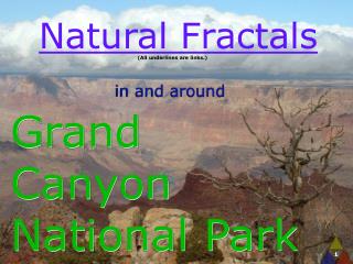
Facts About The South Rim The rims elevation is 7200`, and the elevation for the Colorado River is 2420`.The National Park Service gained control of the Grand Canyon in 1919. One of there first goal was to regulate all commercial interests. Ralph Cameron had controlled and trolled the Bright Angel Trail. The National park for five years had tried to control Bright angel trail, but Ralph Cameron would not let them so the National bullied there own trail to the Colorado river. The name of the trail was South Kaibab Trail, and they builed the first trans-canyon trail that had left the Grand Canyon village and that was called North Kaibab. This is the south rim of the grand canyon, on a hike on south Kaibab Trail. What I Thought About the Trail I though that the trail was a really beautiful place to walk. I learn so much, and something I notice when we were on the trail, is that we you begin the trail at top its cold like flagstaff weather and when 5 minutes in the trail and lower its warm like Tucson weather. I really enjoyed having a tore guide to tell us what everything is.
Colorado River Colorado river The depth average of the Colorado river is around 20 Feet, but its not all 20 feet. The are some deep holes That goes 90 feet deep. The Colorado river is in the Rocky Mountains in the Colorado. What We Did at the Colorado River When we got at the Colorado river we got on boats And a tore guild was there, and he told us all about The river and how high the water has been before. We also got to stop and hangout with ours friends and some people got in the water. The Colorado river is 1,450 miles long.
Facts about the Colorado River What I though about the river when we first started the river I just though it was so beautiful. The boat ride was so much fun because you with all your friends and our tore guild was really funny, he told us a lot about the river too. It was really cool when we saw a little waterfall on the side on the rock once. I also though that some of the rocks were really pretty. Some of the rocks even lock like a shape. When we were just begin it we could see glen Dam. I had a lot of fun of the Colorado river. The Colorado river is really important to the United States because of its water systems. This river has two major tributaries called, Green river and San Juan River. The Colorado River water was first developed by the Anasazi Indians in the early 600 A.D in the northwestern New Mexico. Glen Dam
Wupatki National Monument Wupatki National Monument Around this area a lot animals live here, such as lizards, snakes, Coyotes, Bobcats, and Mule Deer. Near the Amphitheater there is a blowhole. A blowhole is a opening in the Kaibab Limestone that inhales and exhales air that moves though underground cavities. What we did a Wupatki National Monument When we got at Wupatki National Monument we got into our groups and look around and saw, “Beautiful House”, the “Big House”, “Tall House”, and we got to see a blowhole. One place I though was really cool was the Amphitheater. When we were in there no one talk then I whispered “hey” and it sound really cool. “Tall House” is a Hopi word, it’s a multi-story that has more than 100 rooms.
What I though about the Wupatki National Monument When we got at this place I look around I though it was so cool. I think it really cool that 13-15 year olds made this that long ago, and they still have it. I liked walking around and seeing everything they had made. Facts about the Wupatki National Monument In 1924, Wupatki National Monument was established by President Calvin Coolidge because of Harold S. Colton and Samuel A. Barrett. There are a lot of different thing you can find like there is a blowhole, that inhales and exhales air that’s moving though interconnected underground cavities. There is also Spatter cones. Spatter cones formations rise like tiny pyramids throughout the San Francisco volcanic field. This is the blowhole. And sometime if you pure water in it some well float back up.
Sunset Crater National Monument Sunset Crater Sunset Crater is a volcanic cinder cone that’s north of Flagstaff. It has over 3,000 acres of lava fields. What we did at sunset crater When we got at sunset crater we didn’t really have a lot of time to hike or look around a lot. But the teachers talk a little about the place. The sunset crater has a blanket of lapilli and ash that is covering the are more than 2,100 square Kilometers.
Facts about Sunset Crater A rock called the Cinder Cone is a very old rock its age is 950 years. In 1064-1065 AD, a eruption had reached the surface though 6.2 miles long. They say that a initial eruptions probably had formed a curtain of fire. For magma about 25% of it was erupted as lava flows. And 75% of lava now is form Bonito lava flow. What I though about Sunset Crater I though that sunset crater looked really pretty when we first got there. I was kind of see we couldn’t hike or walk around for a little bite.