Download
1 / 21
210 likes | 342 Vues
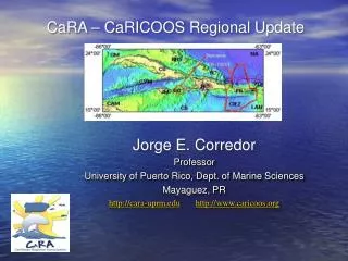
CariCOOS: a regional coastal observing system for the Northeastern Caribbean. J. Morell , J. Corredor, J. Capella R. Watlington, J. Gonzalez, M. Canals, C. Anselmi, A. Mercado, and L. Aponte. IOOS MISSION: IMPROVE SAFETY – ENHANCE ECONOMY-PROTECT OUR ENVIRONMENT.

E N D
CariCOOS: a regional coastal observing system for the Northeastern Caribbean • J. Morell, J. Corredor, J. Capella • R. Watlington, J. Gonzalez, M. Canals, • C. Anselmi, A. Mercado, and L. Aponte
IOOS MISSION: IMPROVE SAFETY – ENHANCE ECONOMY-PROTECT OUR ENVIRONMENT
CaRA domain is the United States Caribbean EEZ • densely populated (4 million) • tourism-marine recreation • 2 “States” PR & VI • artisanal fisheries • maritime activity • major shipping lanes • busy cruise ship ports • hurricanes & tsunamis • ocean energy potential • offshore wind,OTEC • steep, rugged bathymetry • multiple international boundaries • fragile marine ecosystems N.A. ● ● ● ● ● Caribbean
Caribbean Regional Association for Ocean Observing • Organizational structure : • Memorandum Of Agreement • (signed on Dec 4, 2007) • Membership: • 88 signatories • Affiliations: • Academics 18% • Government agencies 12% • Private Sector 40% • Federal Agencies 9% • Self Signatories 21% • ASSURES A STAKEHOLDER-DRIVEN CariCOOS
High-Priority Observational and Forecast Needs results from need assessments across all SH sectors • Coastal winds • Coastal waves • Coastal currents • Coastal inundation • Water quality (pathogens, visibility, sediments & pollutant plumes) • Bathymetry (navigation, inundation and wave models) • Temperature & salinity (climate change, riverine input) • Benthic habitats
Data and modeling products users • Coastal Weather (Wind / Waves) • Local NWS Weather Forecasting Office WRF and SWAN model setup, optimization/validation • Recreational and Tourism Industry (*) • 2010 XXI Central American and Caribbean Games • Rip Curl Search Pro 2010 • Support for safe maritime operations and decision making (Coast Guard, maritime interests) • Coastal Inundation/Sea Level • State Emergency Management Agencies at PR and USVI for shelter/storage site selection • Marine Transportation System Recovery (USCG) • Planning Offices (zoning regulations) • PR-DRNA Coastal Zone • Coastal Currents • State and Federal Search and Rescue • Fisheries and fishery management • Planning / Response to Pollutant dispersion • Recreational & Tourism sector • Water Quality • Watershed management- Natural Resources Conservation Services, DRNA, EQB • Park Service (beach monitoring) • Research Scientists • Recreational & tourism sector
CariCOOS Conceptual Design Operate an optimum number of observing assets coupled to a strong modeling components: GOMOOS type and Datawell wave buoys: Atlantic, off San Juan: semi diurnal tidal forcing, exposed to Atlantic winter swells. San Juan is the busiest port in the NEC region Caribbean, off Ponce: diurnal tidal forcing, Major transshipment port being implemented in Ponce Mona Passage – Caribbean-Atlantic interconnection South of Virgin and Anegada Passages Cruise ship approach to Charlotte Amalie, ● ● ● ● ●
Coastal weather: Observations: High quality coastal observation sites increased from 5 to 17 in the region, 2 buoys plus 12 mesonet stations by WeatheFlow Inc. Forecasting: Implementation of WRF @ 4 km resolution in collaboration with NWS San Juan Mesonet (WeatherFlow Inc.) , Distribution recommended by NWS San Juan reflecting the heterogeneity of wind distribution in insular tropical environments.
Coastal waves: • unprecedented coastal • wave data at CariCOOS Buoys: • (Triaxys sensors) • forecasts using SWAN (Simulating WAve Nearshore) • boundary conditions provided by NOAA WW 3 • 500 meter resolution 50 meter resolution • GFS wind forcing ● ● ● ● ● • outcome of validation experiments as criteria for adding observing assets
Coastal circulation: • In situ current profiles at CariCOOS buoys A & B • CODAR surface currents for the Mona Passage (CSR-Rutgers, C. Fuller, A&M) ADCIRC Forecasts for coastal zone Lagrangian & Eulerian validation of ADCIRC and CODAR products:
Coastal Inundation by Storm Surge • Initial efforts loosely coupling ADCIRC and SWAN (structured) • Implementation and validation of PADCSWAN • Cat 1,2 and 5 available (5 approach bearings, 10nm between tracks) San Felipe (aka Okeechobee) Cat 5 Hurricane 1928. 1836 deaths in Florida 312 in Puerto Rico.
Major water quality issues in the region • beach closures, eutrophication and sedimentation • frequently related to river and creeks discharge reef status: Warne, A.G., Webb, R.M.T., and Larsen, M.C., 2005, Water, Sediment, and Nutrient Discharge Characteristics of Rivers in Puerto Rico, and their Potential Influence on Coral Reefs: U.S. Geological Survey Scientific Investigations Report 2005-5206, 58 p. Development of WQ products based on remotely sensed optical properties for identifying watershed management deficiencies. In collaboration with:
Outreach and Education Data product dissemination and assessment : http://caricoos.org • EDUCATION PLAN • Informal education through web tutorials, • Inclusion into 7th- 8th grade curricula in collaboration with Editorial Norma and PR Dept. of Education Outreach and Education Committee
Where do we go from here? • INSHORE • Implementation of observing/modeling tools and products for close to shore processes driving: • runoff plume dispersal and • rip currents • beach erosion • port security and recuperation (NYHOPS) • spatial planning - MPA designation/validation • OFFSHORE • Observing Caribbean structure, processes and variability and its response to climate (incorporating serial glider observations @CaTS??) REGIONAL • Share expertise and practical experience with neighbors
Inshore waves at 30m resolution: nowcast - CarICOOS buoy data forecasts - regional SWAN Port of Las Americas, Ponce 2 m. Hs (significant wave height) 8s period, 7 m/s wind speed (June 2010) 4.5 m. Hs (significant wave height) 10s period, 9 m/s wind speed (Apr-08) San Juan Harbor
Marine Recreation • rip currents and nearshore • beach water quality • diver visibility (a) (a) Instantaneous surface elevation (m) at Jobos beach, one of the most dangerous beaches in PR. (b) Wave-induced currents from BOUSS2D depict, for the first time, the current patterns responsible for numerous drownings.
Coastalerosion: HurricaneEarle, Rincón, PR US Corp of Engineers ErosionfromHurricaneEarle at Rincón,
50 year projection for CaTS SST SSTprojected = climatological T + 0.0233 *50 (Hoegh-Guldberg O (1999) Marine and Freshwater Research 50: 839-866.) (Graham and Barnett, (1987 ) Science 238: 657-659)
KEY ELEMENTS AND PARTNERS IN CARICOOS IMPLEMENTATION • Intern Program (sustained development of regional expertise) • Visiting expert program (technology transfer) • Strategic Alliances and Leveraged resources • Essential Liaisons • NWS, • PR Sea Grant Program • USGS, USCG, DNRE • Buoy program – University of Maine • Modeling: • ADCIRC Circulation – PennState • ADCIRC/inundation – PR DNRE, Renaissance Institute & UNC • ROMS/HYCOM – RSMAS • SWAN (UniNorte) • UPRM Alliance for Coastal Modeling • Surface currents • CODAR program: DHS-funded “National Center for Secure and Resilient Maritime Commerce and Coastal Environments” (CSR), Rutgers COOL Lab • Water Quality • Partnerships with remote sensing specialists: • NOAA CoastWatch, European Space Agency, USF • NOAA Atlantic Test Bed for CO2 monitoring • Coastal Weather • ICON/CREWS-NOAA • PR Seismic Network • Coastal weather mesonet – WeatherFlow 20