Download
1 / 14
140 likes | 279 Vues
Virtual Reality Environment in C3I Systems Jan Hodick y, Petr Franti s Communication and Information Systems Departement University of Defense, Brno Czech Republic email: petr.frantis@unob.cz, jan.hodicky@unob.cz. AGENDA. Current state of presentation layer of C3I systems

E N D
Virtual Reality Environment in C3I Systems Jan Hodicky, Petr Frantis Communication and Information Systems Departement University of Defense, Brno Czech Republic email: petr.frantis@unob.cz, jan.hodicky@unob.cz
AGENDA • Current state of presentation layer of C3I systems • Czech C3I system • Questionnaire • VR operator station • Architecture overview • Visualization • Conclusion
CURRENT STATE OF PRESENTATION LAYER OF C3I • FBCB2 (USA) • CG2 - C3D • RT - area of interest
CZECH C3I SYSTEM • First design Ground Forces Tactical Command and Control System (GFTCCS) in 1996 • Presentation layer - desktop application • Limitations: • Speed of interaction operator-system • Display resolution • 2D visualization • Defense research project (2007-2008): VR devices in modernized conception of implementation of GFTCCSin the Czech Army Forces • New presentation layer with VR devices – 3D
QUESTIONNAIRE • Newpresentation layer - only supporting tool of the current GFTCCS • 3D solution with implemented VR devices is a key factor to increase situational awareness • The implementation of VR devices should be executed as a step-by-step process • Details must not endanger lucidity
VR OPERATOR STATION • Head Mounted Display (HMD) • 6DOF tracking devices • Data gloves
ARCHITECTURE OVERVIEW • New 3D presentation layer • VR devices used for user interaction • 3D terrain database generation on demand • Uses digital terrain data sources of GFTCCS • 3D representation of tactical symbols • Service Oriented Architecture
Input Layer APP6a data GFTCCS VR Presentation Layer Core Terrain database generator HW VR Input Layer Digital map resources HW VR ARCHITECTURE OVERVIEW
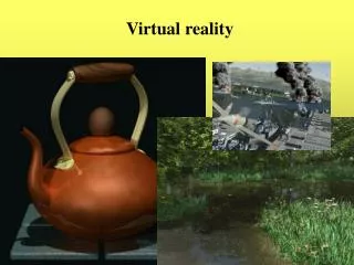
VISUALIZATION • 3D Terrain visualization including topographic objects and features • - Standard Army of the Czech Republic available (shared with the GFTCCS) • - digital elevation model • - digital vector map • - digital satellite or aero images • - digital topographic maps • WGS-84 coordinate system • Fast terrain and objects generation time
VISUALIZATION Topographic features and object reconstruction • Utilize low-resolution satellite images • Adds details and emphasizes important topographic features and objects • Combines vector and raster data • Matches the original by its dimensions and shapes • Uses pre-defined sets of textures
VISUALIZATION Military tactical symbol visualization • Represented as 3D objects • Tactical symbols mapped on semi-transparent square block • Tactical lines floating in 3D space • Compatible with APP6a standard
CONCLUSION • New presentation layer of GFTCCS • 3D visualization • Immersion • Utilization of VR devices for user input • Versatility • Issues • Quality of digital terrain data • Unit symbol placement