Download
1 / 17
170 likes | 303 Vues
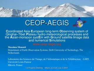
CEOP AEGIS An EU GEO project. Massimo Menenti – TU Delft NL Li Jia – WUR Alterra NL Jerome Colin – Univ. Strasbourg F. CEOP-AEGIS.

E N D
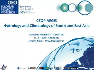
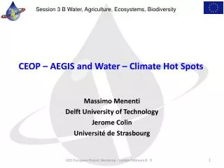
CEOP AEGISAn EU GEO project Massimo Menenti – TU Delft NL Li Jia – WUR Alterra NL Jerome Colin – Univ. Strasbourg F
CEOP-AEGIS Coordinated Asia-European long-term Observing system of Qinghai–Tibet Plateau hydro-metOeorological processes and the Asian-monsoon systEm with Ground satellite Image data and numerical Simulations An international cooperation project between Europe and Asia to improve knowledge on hydrology and meteorology of the Tibetan Plateau and its role in climate, monsoon and extreme meteorological events • To construct out of existing ground measurements and current / future satellites an observing system to determine and monitor the water yield of the Plateau, i.e. how much water is finally going into the seven major rivers of SE Asia • To monitor the evolution of snow, vegetation cover, surface wetness and surface fluxes and analyze the linkage with convective activity, (extreme) precipitation events and the Asian Monsoon. 18 beneficiaries from 8 european and asian countries
CEOP-AEGIS Vegetation phenology, transpiration and surface temperature Project partners GIS Service Data Server (openDAP) CEOP-AEGIS Web Portal GEOSS Portal Scientific community
CEOP-AEGIS Technical Elements
CEOP-AEGIS Partnership • 18 Research organizations and SME-s in 8 Countries • 6 Research organizations China • 1 Partner India, 1 Partner Japan • Coordinator: M.Menenti TU Delft • Permanent observatories Qinghai – Tibet Plateau: CAS, NSF-China • WATER Remote Sensing Experiment: CAS • ESA satellite data: ESA-NRSCC Dragon Program 2 and 3 two projects
CEOP-AEGIS Visibility GEO GEO VII Plenary and Ministerial Summit Beijing 2010: Asian regional showcase Stand EU Stand China Own stand GEO VIII Plenary Istanbul 2011: Stand EU Stand Capacity Building Committee GEO Portal: Compelling example http://www.geo-tasks.org/geoss_portfolio CEOP AEGIS data system is a registered component
CEOP-AEGIS Contribution to GEO • GEO Societal Benefit Area: Water • Task WA-01 Integrated Water Information (incl. Floods and Droughts) • Components: • C1 Integrated Water-cycle Products and Services • C2 Information Systems for Hydro-meteorological Extremes (incl. Floods and Droughts) • C5 Information System Development and Capacity Building
Precipitation (Porcu et al.) Composite reflectivity field from contiguous radars Cloud Dynamics and Radiation Database used to retrieve rainrate from microwave radiometers + merged into VIS-IR Six ground weather radars + microwave radiometers (SSMI/I, SSMIS, AMSR-E, TMI) + VIS-IR (MVIRI, MODIS, AVHRR) + radars (TRMM and CloudSat)
Terra Aqua Snow Cover Terra+Aqua Glaciers and Snow Meltwater Merge Terra + Aqua / MODIS FSCA: spectral mixture analysis algorithm (Wang et al.) Soil Frozen/Thaw Status Number of frozen days in China (Oct. 1, 2002 ~ Sep. 31, 2003) Sensor: SSM/I Method: Decision Tree Precision Evaluation Total classification precision: 91% ;Kappa coefficient: 80%
CEOP-AEGIS Achievements • Data system operational at Institute Tibetan Plateau Research, Beijing • New algorithms developed and applied for several hydrological observations • Most hydrological data sets 2008 – 2010 produced and available on data system • Distributed hydrological model Plateau and headwaters main rivers S and E Asia developed, evaluation in progress • Trans-boundary water transfers downstream of Plateau evaluated (Bangladesh, India, Pakistan..) • 125 team Members • 79 MSc and 93 PhD students active in the framework of the project
CEOP-AEGIS Outlook • Stakeholders Meetings and training sessions in China, India and Nepal • Consolidation / full fruition of results requires a follow-up phase of at least 3 years • Dual fruition: • Transfer of knowledge and methods to other parts of the world • Demonstration case-studies to include complete river basins around the Qinghai – Tibet Plateau
1st Stakeholders Meeting and Advanced Training Session CMA Beijing May 17th – 19th 2011 40 Participants: Regional Meteorological and Hydrological Services; PhD students, young scientists
2nd Stakeholders Meeting and Advanced Training Session NIT Rourkela, India April 16th 20th 2012 60 Participants: National and Local Government; Meteorological and Hydrological Services; PhD students, young scientists
Contribution to Water sector Asia CEOP-AEGIS Bangladesh, Vietnam, India, Pakistan..