Download
1 / 10
100 likes | 221 Vues
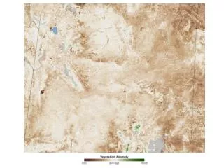
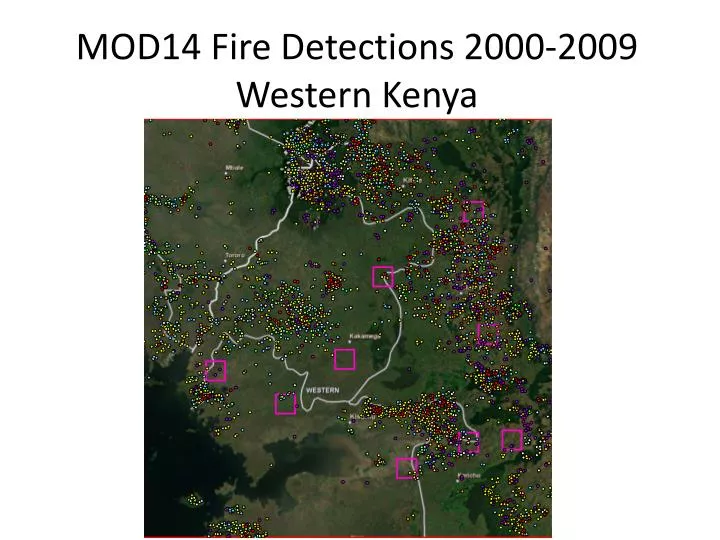
MOD14 Fire Detections 2000-2009 Western Kenya. Temporal Analysis. February and March are primary fire months Fires generally begin in January Some years show higher numbers of fire occurrences beginning in December Many fire occurrences (>800) in 2003, 2005, 2006, 2008, 2009

E N D
Temporal Analysis • February and March are primary fire months • Fires generally begin in January • Some years show higher numbers of fire occurrences beginning in December • Many fire occurrences (>800) in 2003, 2005, 2006, 2008, 2009 • Fewer fire occurrences (<500) in 2000-2001, 2002, 2004, 2007
Analysis by Land Cover Type • Using MERIS GLOBCOVER – Regional (Africa) Classes • 43% (2527) of total fires detected (5849) Mosaic Cropland (50-70%)/vegetation(grassland/shrubland/forest) (20-50%) • 28% (1620) of total fires detected Mosaic vegetation (grassland/shrubland/forest)(50-70%)/cropland(20-50%) • 7% (412) of total fires detected Closed to open (<15%) (broadleaved or needleleaved, evergreen or deciduous) shrubland (<5m) • 6.5% (380) of total fires detected Open (15-40%) broadleaved deciduous forest/woodland (>5m) • 4.5% (269) of total fires detected Closed to open (>15%) broadleaved evergreen or semi-deciduous forest (>5m) • 4% (217) of total fires detected Rainfed croplands