Download
1 / 43
430 likes | 549 Vues
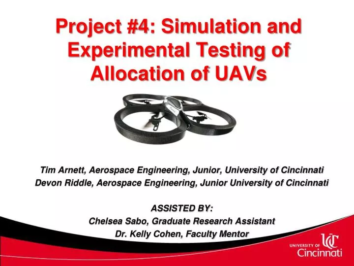
Project #4: Simulation and Experimental Testing of Allocation of UAVs. Tim Arnett, Aerospace Engineering, Junior, University of Cincinnati Devon Riddle, Aerospace Engineering, Junior University of Cincinnati ASSISTED BY: Chelsea Sabo, Graduate Research Assistant

E N D
Project #4: Simulation and Experimental Testing of Allocation of UAVs Tim Arnett, Aerospace Engineering, Junior, University of Cincinnati Devon Riddle, Aerospace Engineering, Junior University of Cincinnati ASSISTED BY: Chelsea Sabo, Graduate Research Assistant Dr. Kelly Cohen, Faculty Mentor
Applications of UAVs • Challenges • Project Goals and Objectives • Vehicle Routing Problems • Experimental Testing • Experimental Setup • Waypoint Navigation Algorithm • AMASE • Why use AMASE? • Overview • Features • Results & Analysis • Acknowledgements • Questions Outline
Missions that are “dull, dirty, and dangerous” • Cost and performance • Do not need pilot life support systems • Removal of human survivability constraints allows better performance Why UAVs?
Search and Rescue Weather Observation Forest Fire Monitoring Applications of Surveillance Missions with UAVs • Traffic Surveillance • Border Patrol • Military
Obtaining software and equipment suitable for tests • Systems difficult to obtain and usually expensive • Verifying solutions on proven systems • Systems not always well-documented or fully supported Challenges
Learn to interface equipment for UAV controller development Compare two routing solutions for common performance metrics Project Goals
Objective 1: Interface with cooperative control development systems • Interface and run algorithms on AR Drones • Interface and run algorithms on AMASE • Objective 2: Validate task allocation algorithm both in simulation and experimentally • Objective 3: Test and compare cooperative control strategies for UAVs • Distance travelled • Delivery time for time critical targets Objectives
Vehicle Routing Problems Targets Targets Depot Targets • Multiple routing solutions exist depending on desired operational goals • Which UAV services a target and in what order are the targets visited?
Vehicle Routing Problems:Minimum Distance Route Minimum distance solution is useful for minimizing total mission time, fuel consumption, etc.
Vehicle Routing Problems:Minimum Delivery Latency Route Often desirable to deliver data to a high-bandwidth connection or “depot” For this case, the delivery time is often of interest due to missions being time critical
3 different tests performed • Differing difficulty and number of targets • Both Minimum Distance and Minimum Delivery Latency solutions implemented for each test • Tests done both experimentally and in simulation • Experiments done in IMAGE Lab with AR Drone UAVs • Simulations created in AMASE – an Air Force flight simulation environment • Compared distance travelled and delivery time for each test Test Cases
Experimental Setup IMAGE Lab AR Drones
AR Drone • Inexpensive, commercially available quadrotor • “Black box” with limited support • Can be controlled by a device using wireless network adapter Experimental Setup
Experimental Setup IMAGE Lab AR Drones OptiTrack Cameras
Optitrack System • Cameras provide real time position data • Data can be imported into MatLab Experimental Setup
Experimental Setup IMAGE Lab AR Drones PC with MatLaband OptiTrack Tracking Tools OptiTrack Cameras Wireless Router
Software Interface • PC client with wireless capability, MatLab, and camera software • Wireless router to connect to multiple drones Experimental Setup
Needed to dictate flight path of UAV • Control Methods • Proportional-Derivative Control • Fuzzy Logic Control Waypoint Algorithm
Proportional-Derivative controller • Used for Yaw Rate, Ascent Rate • Provides good response and settling time • Simple implementation Waypoint Navigation Controller
Fuzzy Logic Controller • Used for Pitch, Roll • Does not require system model • Robust to stability issues Waypoint Navigation Controller
AMASE Automatic Test System Modeling and System Environment
AFRL • Air Force Research Laboratory (Wright Patterson) • Desktop simulation environment developed for UAV cooperative control studies • Used to develop and optimize multiple- UAV engagement approaches • Self contained simulation environment that accelerates iterative development/analysis History of AMASE
Control algorithms can be assessed and compared effectively Free for University research An environment that provides a formal simulation of the algorithm as a precursor to large scale flight tests. Proven as a legitimate way to set up realistic flight simulations. Provides good visual description of what’s happening Why AMASE? Challenge: No technical support… Learned through trial and error.
Toolbar AMASE Set Up Tool: This is where all of the scenarios are created and the progress is saved. The Map Event Editor Error Box
The Map Characteristics of the aircraft Path line Aircraft Simulation of test data on a world wide scale What runs the simulation
Experimental Results Minimum Delivery Latency Route Minimum Distance Route
Analysis Total Distance Travelled Total Time Cost D = Delivery Time
Simulation Results Simulation 1(a)
Simulation Results Simulation 1(b)
Analysis Total Time Cost D = Delivery Time
Comparison % Improvement of Total Time Cost for the Minimum Delivery Latency route compared to the Minimum Distance route % Improvement of Total Distance Travelled for the Minimum Distance route compared to the Minimum Delivery Latency route
Acknowledgements • NSF Grant # DUE-0756921 for Type 1 Science, Technology, Engineering, and Mathematics Talent Expansion Program (STEP) Project • Kelly Cohen, Ph.D, Faculty Mentor, University of Cincinnati, Cincinnati, OH • Chelsea Sabo, Ph.D, GRA, University of Cincinnati, Cincinnati, OH • Stephanie Lee, AFRL, Wright-Patterson Air Force Base, Dayton, OH • Manish Kumar, Ph.D, University of Toledo, Toledo, OH • Balaji Sharma, MS, University of Toledo, Toledo, OH • RuoyuTan, MS, University of Toledo, Toledo, OH • Task Allocation Algorithm sourced from work done by Dr. Chelsea Sabo
AR Drone requires commands in text strings with values formatted as a 32-bit signed integer • Command string example Command Value Conversion • CMD = sprintf('AT*PCMD=%d,%d,%d,%d,%d,%d\r',i,1,0,1036831949,0,0); • fprintf(ARc, CMD); Sequence
AR Drone requires commands in text strings with values formatted as a 32-bit signed integer • Command string example Command Value Conversion • CMD = sprintf('AT*PCMD=%d,%d,%d,%d,%d,%d\r',i,1,0,1036831949,0,0); • fprintf(ARc, CMD); Flag
AR Drone requires commands in text strings with values formatted as a 32-bit signed integer • Command string example Command Value Conversion • CMD = sprintf('AT*PCMD=%d,%d,%d,%d,%d,%d\r',i,1,0,1036831949,0,0); • fprintf(ARc, CMD); Roll
AR Drone requires commands in text strings with values formatted as a 32-bit signed integer • Command string example Command Value Conversion • CMD = sprintf('AT*PCMD=%d,%d,%d,%d,%d,%d\r',i,1,0,1036831949,0,0); • fprintf(ARc, CMD); Pitch • Value corresponds to a command value of 0.1 • Values are a ratio to the full value allowable by the drone
AR Drone requires commands in text strings with values formatted as a 32-bit signed integer • Command string example Command Value Conversion • CMD = sprintf('AT*PCMD=%d,%d,%d,%d,%d,%d\r',i,1,0,1036831949,0,0); • fprintf(ARc, CMD); Ascent Rate
AR Drone requires commands in text strings with values formatted as a 32-bit signed integer • Command string example Command Value Conversion • CMD = sprintf('AT*PCMD=%d,%d,%d,%d,%d,%d\r',i,1,0,1036831949,0,0); • fprintf(ARc, CMD); Yaw Rate
AirVehicleConfiguration • Characteristics of the UAV • Given • AirVehicleEntity • Characteristics of where the UAV starts in a scenario and where it will go first • MissionCommand • Tells the UAV where to go from homebase The Event Editor
Common Mission Automation Services Interface • A system of interactive objects that pertain to the command and control of a UAV system. • Where the MissionCommand is used. • Example of two scenarios to show why CMASI is important. CMASI