Download
1 / 16
160 likes | 303 Vues
Hydrologic storage in seasonal, mineral flat wetlands across native prairie, farmed, and restored prairie land cover: structural controls and hydrologic processes. Sarah Marshall. Overview. Context Research Questions Approach (3 parts) Status Obstacles Preliminary Findings

E N D
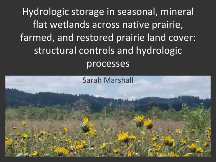
Hydrologic storage in seasonal, mineral flat wetlands across native prairie, farmed, and restored prairie land cover: structural controls and hydrologic processes Sarah Marshall
Overview • Context • Research Questions • Approach (3 parts) • Status • Obstacles • Preliminary Findings • Anticipated Outcomes
Context • Willamette Valley Lowlands Study Area • Native wetland prairie <1% of historic extent • Channelization, damming, incision of Willamette River and many tributaries • Drainage and simplification of floodplain, reduction in groundwater and surface water connectivity 1936 Aerial Photo, West Eugene Wetlands. Source: UO Map Library
Context: Wetland Policy and Assessment • 2006 Carabell and Rapanos Decisions • Isolated wetlands • “significant nexus”-downstream water quality and quantity • 2009 Oregon Rapid Wetland Assessment Protocol • Intended to be more broadly applicable • Pro: more comprehensive treatment of hydrologic functions and variability in wetlands • Con: limited quantitative assessment of factors influencing site-scale hydrologic variability (e.g. microtopography, soil disturbance) • Con: focuses primarily on surface water storage and connectivity
Research Questions • How has changing land use affected the water storage and delay functions of remnant and former wetland prairie flats in the Southern Willamette Valley lowlands? • At the plot scale • At the field scale • 2. What are the implications for downstream water quality and quantity?
Working Conceptual Model Precipitation Soil or Water Surface Evaporation Transpiration Ponding Root Zone Preferential Flow Path Infiltration Zone of Potential Soil Water Storage Capillary Fringe Perched Groundwater Infiltration Low-permeability Perching Soil Horizon Deeper Groundwater
Part I: Plot Scale Ecohydrological Associations • Objective: Quantify how different land management affects seasonal associations and interactions between soil structure, plant cover, microtopography, and soil hydraulic properties.
Part I: Variables of Interest Plant Cover, Structure Microtopography Soil Structure and composition Seasonal patterns in near-surface soil moisture and hydraulic properties
Part II: Water Storage and Delay at the Field Scale • Objective 1: Characterize field-scale hydraulic behavior to test why, and to what extent, valley bottom mineral flat wetland hydrology is affected by land use change and local hydraulic modifications (e.g. drainage ditches, stream channel incision). • Objective 2: Explore the effects of land management on wetland water storage and delay functions by relating fine-scale shallow water table patterns to saturation excess ponding (overland flow), groundwater-surface water interactions, and evapotranspiration throughout the year.
Methods • Spatially intensive sampling (9 sites) • Monitor surface and subsurface water elevations monthly to determine lateral and vertical hydraulic gradients, connectivity, perching • Temporally intensive sampling (minimum 3 sites) • Weekly monitoring during fall wet-up and spring drainage • Pressure transducers installed at Finley sites
Part III: Seasonal Groundwater and Surface Water Quality • Linking groundwater-surface water and wetland-surface water connections to water quality issues • Sample groundwater monitoring transect wells and piezometers and adjacent surface water (mobile water) for seasonal concentrations in the following chemical constituents: • Total dissolved organic nitrogen • Total dissolved organic phosphorus • Nitrate/nitrite • Phosphate • Ammonia • Dissolved organic carbon
Current Status • Coursework completed • Sites selected, access granted (City of Eugene, USFWS, TNC, USACE, private landowners) • 160+ wells and piezometers in the ground • Sampling plots established • Disturbed soil samples collected along piezometer transects • Preliminary infiltration tests
Preliminary Findings and Obstacles • Delayed formation of perched water table, rise of apparent water table • Distinct wet-up patterns evident across farmed, natural and restored sites (bottom-up vs. top-down?) • Challenges • Getting all necessary site permits in a timely manner (especially Finley NWR) • Double ring infiltrometer tests • Issues with cracks/structured soils • Difficulty getting equipment, water to more remote sites
Upcoming Tasks • Complete well installation • Develop wells once there is sufficient water • Continue well monitoring • Water quality sampling • Collection of minimally disturbed soil samples • Infiltration tests • Fall/winter plant functional group sampling • Soil sample processing • Survey all field sampling equipment
Anticipated Outcomes • Better understanding and quantification of: • How land use affects processes and factors influencing seasonal wetland hydrology at multiple spatial and temporal scales • Which hydrologic functions may be restored by limiting soil disturbance and re-establishing native plant cover • Functions provided along a spectrum from minimal to high soil and plant cover disturbance • The degree of subsurface and surface connectivity within non-riparian wetland flats and between these ecosystems and protected streams • Insight into how wetlands under different land management should be represented in conceptual and numerical catchment hydrologic models