Download
1 / 26
260 likes | 263 Vues
This meeting on April 1, 2014, provides an overview of the Copernicus Earth Observation Programme and its current status. The scope of the programme is to ensure operational and sustainable provision of space data and EO-based information to support environmental policies such as agriculture, climate, regional development, and more.

E N D
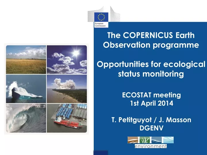
The COPERNICUS Earth Observation programme Opportunities for ecological status monitoring ECOSTAT meeting 1st April 2014 T. Petitguyot / J. Masson DGENV
Scope: ensuringoperational and sustainable provision of space data and EO based information, supportingenvironment and otherpolicies (agriculture, climate, regional, transports, energy, development, civil protection)+security 3 components: (i) Space, (ii) In-situ, (iii) 6 Services Data Policy: full, free and open accessfor space (Sentinels) data and Copernicus service information User-drivenapproach: important to ensurethatenvironmentpoliciesneeds are properlyaddressed Communication / awarenessraisingthrough expert groups COPERNICUS in a nutshell
COPERNICUS services Atmosphere Land Marine Security Climate Change Emergency Response
GMES (Global Monitoring of Environment and Security) startedin 1998 (Bavenomanifesto): joint initative ESA (European Space Agency) and EU Development phase: EU research + ESA budget Reg (EU) 911/2010: GMES Initial Operations 'GIO' – startedwith 2 services: Land & Emergency management 2013: GMES renamedCopernicus 2014-2020: New Copernicus programme CopernicusRegulation adoption plan April 2014 (overallbudget4.3 BnEUR in currentprices - 79% for the space component, 21% for the services and in situ component ) Copernicus WP 2014 in preparation incl. € 20.1 M for Land service COPERNICUS status
Characterisation / pressure assessment • Ecological status monitoring • Flood / WS&D management COPERNICUS potential interests for WFD implementation
Characterisation Pressure assesment • Land Monitoring service: http://land.copernicus.eu/ • Operationalactivities – productsalreadyavailable(or soon) • Pan-European Land Cover/Land Cover Change products: Corine LC (continuity of time series 1990,2000,2006,2012… +6 yrs), new 5 High Resolutionlayers (1ha MMU) on water, wetlands, forest, grassland, imperviousness(2012…+ 3 yrs) • European 'local' component zooming on areas of interest: Urban Atlas (0,25ha-1ha MMU), new Riparian Areas Mapping (Call for Tender launched by EEA) • Reference Data Access: EU-DEM (Digital Elevation Model) + EU-HYDRO (hydrological network – soonavailable) • Access to Pan-EU High Resolution (20m) and Very High Reoslution satellite images coverage, re-usable for public administrations
Land Pan-EU component - CLC series: 1990-2000-2006-2012 +6yrs • EEA flagship product for many years now integrated in Copernicus • 44 LC/LU classes, • MMU: 25 ha, • linear elements > 100m width • Updates every 6 years, incl. change layer • 39 countries, +/- 6 Mill. km2 • Production done by Eionet NRC/LCs through grant agreements • Coordination, training, QA/AC, integration by EEA. CLC2006
Land Pan-EU component High Resolution Layers (HRLs) Overview
High Resolution Layer: Degree of sealed soil (buildings, roads…) (Brno)
High Resolution Layers Permanent Wetlands + Water Bodies (Danube, RO) (Rhone, FR)
CLC + Imperviousness + Forests + Grasslands + Wetlands + Water
EU-hydro • Assessment of: • technical quality v.1.0 • access to IDs of river segments in national DBs • Organise call for tender to: • improve known issues (e.g. lakes in FI) • link with national IDs • Independent statistical validation – still ongoing • Dissemination (soon available) through: • EEA – Copernicus land • DG ESTAT - GISCO
Land 'Local' component Riparian zones in view of biodiversity monitoring and support to MAES • New productCopernicus (InitialOperations budget – WP2013) • Noticepublished in OJ on 12/02/2014 (deadline 22/04/2014) • documentsavailableon: • http://www.eea.europa.eu/about-us/tenders/eea-mdi-14-001-copernicus • 2 objectives: • Riparian areas delineationbased on Very High Resolution data • Land cover/use mapping
Flood / WS&D management • Alreadyavailable: Emergency Management Service in support to floodsmapping and forecasts: http://emergency.copernicus.eu/ • Possible services to bedevelopped on WS&D management • FP7 projects: SIRIUS Irrigation Water Abstraction Monitoring and Control, GLOWASIS Water Scarcity and Drought Monitoring and Forecasting, MyWaterInland Water QuantityMonitoring • DG ENV study on a Copernicusservice to support detection of illegalabstractions (cf. Blueprint)
Ecologicalstatus monitoring • Several FP7 Spaceprojectsendedin 2013 • White Papersdisseminated on possible services to bedeveloped to support WFD/MSFD: • Inland Water projects (FRESHMON Inland Water quality monitoring, SIRIUS Irrigation Water Abstraction Monitoring and Control, GLOWASIS Water Scarcity and Drought Monitoring and Forecasting, MyWaterInland Water Quantity Monitoring) • Coastal areas projects (AQUAMAR Oceancolour and Water quality, OSS2015 regionalbiogeochemicalsproducts, CoBIOSEcologicalmodels, Asimuth on HarmfulAlgae Blooms, HIGHROC for High Spatial and temporal resolutionOceanColour)
Freshmon products • Water quality measures • Turbidity / Suspended matter • Secchi depth / Transparency • Total Organic Absorption (proxy for organic load) • Colored Dissolved Organic Matter • Chlorophyll-a (measure of phytoplancton) • Ratio green / blue algae • + possibly: Submerged macrophyte coverage / sea floor composition
Freshmon products • Other • Water depth (0-25m in clear waters) • Water Surface Temperature • Proposed service: • EU wide • Lakes larger than 1ha • Rivers wider than 50m • Defined reporting interval e.g. 2 years
Coastal services • Projects Aqua Mar and MarCoast • Proposed services • Chlorophyll-a surface concentration • Turbidity / transparency • Harmful algal bloom (occurrence, likelihood of algae type) • Sea bed of shallow waters
Opportunities • Can't replace in-situ monitoring • but • Complement in time / spatial coverage • Improvereliablity • Reducecost of monitoring • Contribute to an harmonised EU-wideassessment • To bechecked • Consistencywith WFD requirements and monitoring systems in place • Conditions / specifications for these services
Copernicusnextsteps • Land Service - Evolution 2014+ • Deservesfurtherspecificationsand clear user requesttakingaccount of FP7 projectsoutcomes (White papersdisseminated to Copernicus User Forum and policyWorking Groups e.g. ECOSTAT) • DG ENV (D4 coordination + policyunits) and EEA (+ EIONET) facilitating the collection and prioritisation of user requirements (throughworking groups – considerspecificsubgroups for Copernicusspecifications?) • Additional Pan-EU and local Land components (focusing on land cover/use mapping)? Candidates identifiedso far: Natura 2000 sites monitoring (WP 2014), green linearelements, coastal areas, ice and snow monitoring… • Additional 'thematic' services e.g. on water monitoring (e.g. inlandwater quality, eutrophication…)? Supported by MS in Copernicus User Forum and GMES/Copernicuspotential support ismentioned in Water Blueprint communication: • (i) for Water illegal abstraction detection • (ii) for improvingourunderstanding of acquaticecosystems and knowledge base
Proposal to WG ECOSTAT • Assess opportunity of proposed Copernicus services for ecological status monitoring • Contribute to a possible inclusion of such services in Copernicus WP 2015 • Which services to be developed/prioritised • Key specifications • Practically: • Set up a small group of members with experience/interest on EO use in water monitoring • Review White papers and key FP7 outputs • Draft a short report to be shared in next EcoStat meeting (October 2014)