Download
1 / 47
470 likes | 472 Vues
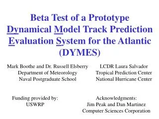
This research paper discusses the transition and evaluation of a revised dynamical model called DYMES for track prediction in tropical cyclones. It explores the factors influencing track prediction, such as synoptic patterns, environmental effects, and transitional mechanisms. The study also identifies error mechanisms in current models and proposes modifications for improvement.

E N D
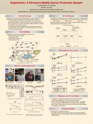
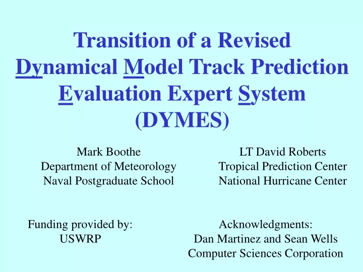
Transition of a Revised Dynamical Model Track Prediction Evaluation Expert System (DYMES) Mark Boothe Department of Meteorology Naval Postgraduate School LT David Roberts Tropical Prediction Center National Hurricane Center Funding provided by: USWRP Acknowledgments: Dan Martinez and Sean Wells Computer Sciences Corporation
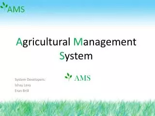
TC Motion Meteorology Knowledge Base Framework Environment Structure TC Structure Intensity Synoptic Pattern Determines best steering level Synoptic Region Size Determines the direction & speed of the steering flow that moves the TC Key factor in TC-Environment Transformations TC-Environment Transformations Environmental Effects TC-independent processes that change environment structure (steering) TC-dependent processes that change environmental structure (steering) and sometimes TC structure Transitional Mechanisms Inputs to TC-Environment Transformations Results of Transitional Mechanisms
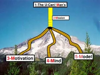
TC Motion Meteorology Knowledge Base Framework Environment Structure TC Structure Intensity Synoptic Pattern Standard (S) Upper-level Low (U) Poleward (P) Midlatitude (M) Exposed Low-level (XL) Tropical Depression (TD) Tropical Storm (TS) Hurricane (H) Synoptic Region Equatorial Westerlies (EW) Tropical Easterlies (TE) Poleward Flow (PF) / Equatorward Flow (EF) Midlatitude Westerlies (MW) / Easterlies (ME) Size Midget (M) Small (S) Average(A) Large (L) Environmental Effects TC-Environment Transformations Advection by Environment (ADV) Upper-level Low Evolutions: Upper-level Low Formation (ULF) Upper-level Low Dissipation (ULD) Midlatitude System Evolutions: Cyclogenesis (MCG) Cyclolysis (MCL) Anticyclogenesis (MAG) Anticyclolysis (MAL) Beta Effect-Related: Beta-Effect Propagation (BEP) Ridge Modification by TC (RMT) Reverse Trough Formation (RTF) Cyclone Interactions: Midlatitude-Related: Direct (DCI) Response to Vertical Semi-direct (SCI) Shear (RVS) Indirect (ICI) Baroclinic Cyclone Interaction (BCI) Transitional Mechanisms Inputs to TC-Environment Transformations Results of Transitional Mechanisms
Excessive Midlatitude Trough ------------- Insufficient Midlatitude Trough
Consensus Forecasts GFDL UK Met GUNs NOGAPS GUNA Aviation (GFS) NCON GFDN
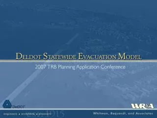
195 Cases 7 12 NCON can be improved Small Spread Large Error Large Spread Large Error Small Spread Small Error Large Spread Small Error 26 150 NCON OK NCON
Potential Improvementfor Large Spread/Large Error Cases (12 Cases in 2003) Average 72-h Forecast Track Error (n mi) NCON 342 OFCL 354 SCON 170
Prior to 2003NHC-Requested Code Modifications • Utilize NOGAPS four times a day • Use the ATCF’s simpler interpolated track • Add 12 and 36 h positions to NCON & SCON • Display model fields at 6-hourly interval
Quick Jump To Start Of Model Runs Flexible Fields Display Interval
Plan: Modifications Prior to 2004 • Slight changes to error mechanisms • Display height fields • Display difference fields • Comparison of current models • Intercomparison for trend analysis
Number of Large (> 250 n mi)72-hour ForecastsAtlantic 2003 20GFDL 36 UK Met 37 NOGAPS 23 Aviation (GFS) 27 GFDN
Excessive Midlatitude Trough ------------- Insufficient Midlatitude Trough
Plan: Modifications Prior to 2004 • Slight changes to error mechanisms • Display height fields • Display difference fields • Comparison of current models • Intercomparison for trend analysis
Difference Wind Wind Hght Hght
Difference Wind Wind Hght Hght
Difference Wind Wind Hght Hght