Download

1 / 10
100 likes | 287 Vues
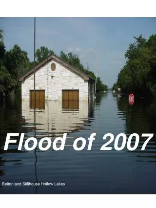
Marble Falls Flood of 2007. Alex Houston. Marble Falls Flood of 2007. Where were the most dangerous spots to be? What was the storm water quality and its affects?. Background. During the night of the 26 th and morning of the 27 th , 19 inches of rain fell on one community.

E N D
Marble Falls Flood of 2007 Alex Houston
Marble Falls Flood of 2007 • Where were the most dangerous spots to be? • What was the storm water quality and its affects?
Background During the night of the 26th and morning of the 27th, 19 inches of rain fell on one community
Repercussions • Washed out bridges, • Boat docks were immersed in water • At least 150 businesses were damaged • Left people stranded on rooftops and in trees • Water treatment plant damaged leaving water unusable even if boiled • Recreational band on lakes
Watersheds • Lake LBJ Basin • Lake Travis Basin
DEM The lower elevations occur around Marble Falls.
To-do list • Water quality data to see what the affects of the rain were on the lakes • Finish DEM processing to find where the most dangerous parts of Marble Falls were during the Flood